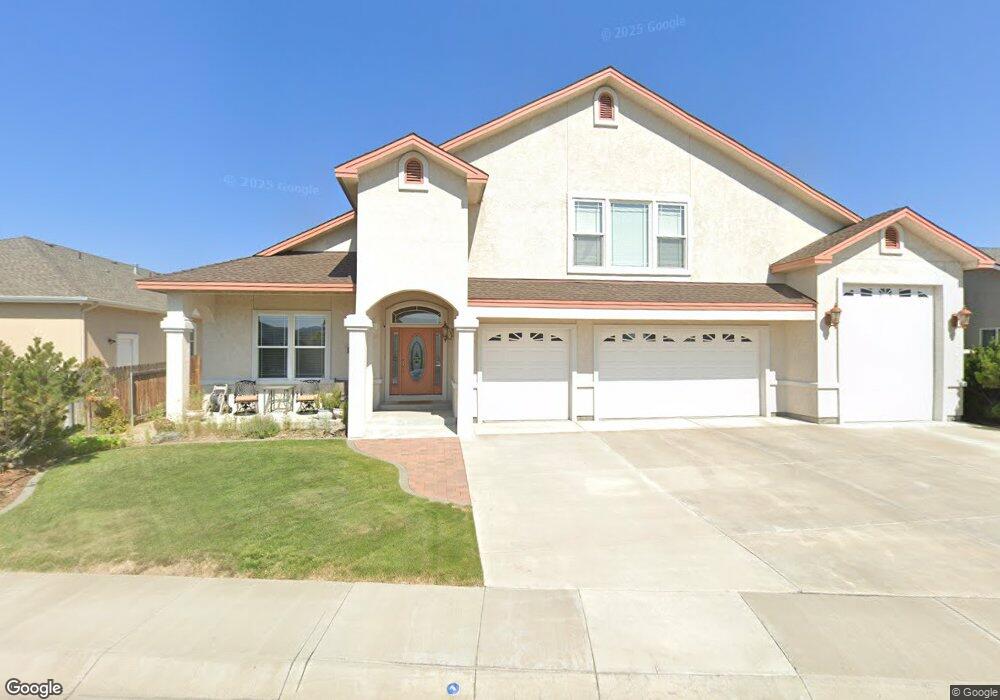
1890 Fair Way Carson City, NV 89701
Riverview NeighborhoodEstimated Value: $713,000 - $831,000
4
Beds
3
Baths
3,334
Sq Ft
$227/Sq Ft
Est. Value
About This Home
This home is located at 1890 Fair Way, Carson City, NV 89701 and is currently estimated at $756,799, approximately $226 per square foot. 1890 Fair Way is a home located in Carson City with nearby schools including Empire Elementary School, Eagle Valley Middle School, and Carson High School.
Ownership History
Date
Name
Owned For
Owner Type
Purchase Details
Closed on
Feb 3, 2009
Sold by
Cisga Frank and Csiga Linda M
Bought by
Csiga Frank and Csiga Linda M
Current Estimated Value
Purchase Details
Closed on
May 15, 2008
Sold by
Csiga Frank and Csiga Linda M
Bought by
Csiga Frank and Csiga Linda M
Home Financials for this Owner
Home Financials are based on the most recent Mortgage that was taken out on this home.
Original Mortgage
$40,000
Interest Rate
5.88%
Mortgage Type
Stand Alone Second
Purchase Details
Closed on
Apr 16, 2008
Sold by
Csiga Frank and Csiga Linda M
Bought by
Csiga Frank and Csiga Linda M
Home Financials for this Owner
Home Financials are based on the most recent Mortgage that was taken out on this home.
Original Mortgage
$40,000
Interest Rate
5.88%
Mortgage Type
Stand Alone Second
Create a Home Valuation Report for This Property
The Home Valuation Report is an in-depth analysis detailing your home's value as well as a comparison with similar homes in the area
Home Values in the Area
Average Home Value in this Area
Purchase History
| Date | Buyer | Sale Price | Title Company |
|---|---|---|---|
| Csiga Frank | -- | None Available | |
| Csiga Frank | -- | Accommodation | |
| Csiga Frank | -- | None Available |
Source: Public Records
Mortgage History
| Date | Status | Borrower | Loan Amount |
|---|---|---|---|
| Closed | Csiga Frank | $40,000 |
Source: Public Records
Tax History Compared to Growth
Tax History
| Year | Tax Paid | Tax Assessment Tax Assessment Total Assessment is a certain percentage of the fair market value that is determined by local assessors to be the total taxable value of land and additions on the property. | Land | Improvement |
|---|---|---|---|---|
| 2025 | $4,875 | $184,673 | $38,150 | $146,523 |
| 2024 | $4,733 | $186,680 | $38,150 | $148,530 |
| 2023 | $4,595 | $175,765 | $38,150 | $137,615 |
| 2022 | $4,462 | $156,011 | $31,850 | $124,161 |
| 2021 | $4,331 | $152,287 | $30,800 | $121,487 |
| 2020 | $4,331 | $147,596 | $26,600 | $120,996 |
| 2019 | $4,082 | $146,084 | $26,600 | $119,484 |
| 2018 | $3,963 | $140,547 | $25,550 | $114,997 |
| 2017 | $3,848 | $132,790 | $24,325 | $108,465 |
| 2016 | $3,750 | $122,183 | $23,153 | $99,030 |
| 2015 | $3,742 | $121,840 | $23,153 | $98,687 |
| 2014 | $3,633 | $108,422 | $22,050 | $86,372 |
Source: Public Records
Map
Nearby Homes
- 4349 Stampede Dr
- 4240 Sherman Ln
- 1808 Rock Ct
- 1856 Rock Ct
- 4070 Quinn Dr
- 61 Condor Cir
- 4001 Quinn Dr
- 0 Us Hwy 50 E - Apn#00837154
- 1628 Brown St
- 3954 Village Dr
- 3913 Pheasant Dr
- 855 Sundance Ct
- 3932 Village Dr
- 3905 Pheasant Dr
- 1329 Stanford Dr
- 0 Us Hwy 50 E - Apn#00837149
- 2999 Akron Way
- 6 Kit Sierra Loop
- 0 Akron Way
- 3523 Stanton Dr
- 4554 Clubhouse Way
- 1916 Fair Way
- 1961 Empire Ranch Rd
- 1975 Empire Ranch Rd
- 4571 Short Putt Rd
- 1933 Empire Ranch Rd
- 4559 Short Putt Rd
- 1868 Fair Way
- 1889 Fair Way
- 1921 Fair Way
- 4521 Clubhouse Way
- 1842 Fair Way
- 4574 Short Putt Rd
- 4568 Short Putt Rd
- 1965 Fair Way
- 1879 Empire Ranch Rd
- 2017 Empire Ranch Rd
- 4614 Short Putt Rd
- 1800 Fair Way
- 4622 Short Putt Rd