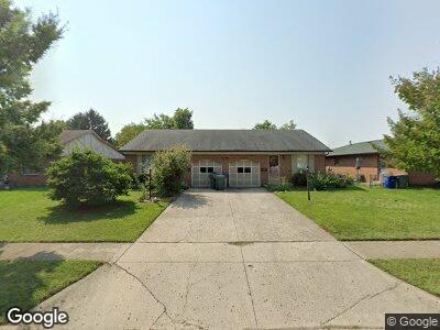
1893 Hampstead Dr Unit 895 Columbus, OH 43229
Northgate NeighborhoodEstimated Value: $302,539 - $382,000
4
Beds
2
Baths
2,220
Sq Ft
$151/Sq Ft
Est. Value
About This Home
This home is located at 1893 Hampstead Dr Unit 895, Columbus, OH 43229 and is currently estimated at $334,885, approximately $150 per square foot. 1893 Hampstead Dr Unit 895 is a home located in Franklin County with nearby schools including Alpine Elementary School, Northgate Intermediate, and Woodward Park Middle School.
Ownership History
Date
Name
Owned For
Owner Type
Purchase Details
Closed on
Nov 14, 2001
Sold by
Bishop Robert D
Bought by
Bishop Robert D and Bishop Gloria
Current Estimated Value
Home Financials for this Owner
Home Financials are based on the most recent Mortgage that was taken out on this home.
Original Mortgage
$108,000
Interest Rate
6.69%
Mortgage Type
Balloon
Purchase Details
Closed on
Jul 17, 2001
Sold by
Wygant Lois J
Bought by
Bishop Robert D
Purchase Details
Closed on
Apr 6, 1993
Create a Home Valuation Report for This Property
The Home Valuation Report is an in-depth analysis detailing your home's value as well as a comparison with similar homes in the area
Home Values in the Area
Average Home Value in this Area
Purchase History
| Date | Buyer | Sale Price | Title Company |
|---|---|---|---|
| Bishop Robert D | -- | Titlequest Agency Inc | |
| Bishop Robert D | $65,600 | -- | |
| -- | -- | -- |
Source: Public Records
Mortgage History
| Date | Status | Borrower | Loan Amount |
|---|---|---|---|
| Open | Bishop Robert D | $176,028 | |
| Closed | Bishop Robert D | $165,300 | |
| Closed | Bishop Robert D | $148,105 | |
| Closed | Bishop Robert D | $108,000 |
Source: Public Records
Tax History Compared to Growth
Tax History
| Year | Tax Paid | Tax Assessment Tax Assessment Total Assessment is a certain percentage of the fair market value that is determined by local assessors to be the total taxable value of land and additions on the property. | Land | Improvement |
|---|---|---|---|---|
| 2024 | $4,165 | $101,540 | $22,440 | $79,100 |
| 2023 | $4,141 | $101,540 | $22,440 | $79,100 |
| 2022 | $2,461 | $55,520 | $11,800 | $43,720 |
| 2021 | $2,543 | $55,520 | $11,800 | $43,720 |
| 2020 | $2,469 | $55,520 | $11,800 | $43,720 |
| 2019 | $2,198 | $44,420 | $9,450 | $34,970 |
| 2018 | $2,495 | $44,420 | $9,450 | $34,970 |
| 2017 | $2,636 | $44,420 | $9,450 | $34,970 |
| 2016 | $3,076 | $45,850 | $9,450 | $36,400 |
| 2015 | $2,797 | $45,850 | $9,450 | $36,400 |
| 2014 | $2,803 | $45,850 | $9,450 | $36,400 |
| 2013 | $1,536 | $50,925 | $10,465 | $40,460 |
Source: Public Records
Map
Nearby Homes
- 1883 Fairhaven Rd
- 1863-1865 Hampstead Dr Unit 1863
- 5970 Sharon Woods Blvd Unit 301
- 6019 Beechcroft Rd
- 5885 Beechcroft Rd Unit 110
- 5885 Beechcroft Rd Unit 315
- 5885 Beechcroft Rd Unit 311
- 1732 Lynnhurst Rd
- 6273 Bellmeadow Dr
- 5738 Beechcroft Rd Unit L
- 5732 Pine Tree St W Unit B
- 5972 Hampstead Ln
- 1881 Brimfield Rd
- 6407 Skywae Dr
- 0 Jewett Dr
- 6280 Chelmsford Square E
- 2249 Hampstead Dr
- 1833 Brookfield Rd
- 6416 Faircrest Rd
- 1410 Chelmsford Square S
- 1893 Hampstead Dr Unit 895
- 1885 Hampstead Dr
- 1885 Hampstead Dr Unit 1885
- 1883 Hampstead Dr Unit 885
- 1883 Hampstead Dr Unit 1885
- 1901 Hampstead Dr Unit 903
- 1901-1903 Hampstead Dr Unit 903
- 1873 Hampstead Dr Unit 875
- 1913 Hampstead Dr Unit 915
- 1915 Hampstead Dr
- 1913 Hampstead Dr
- 1892 Hampstead Dr Unit 894
- 1900-1902 Hampstead Dr
- 1900 Hampstead Dr Unit 902
- 1863 Hampstead Dr Unit 865
- 1863 Hampstead Dr Unit 65
- 1882 Hampstead Dr Unit 884
- 1921 Hampstead Dr Unit 923
- 1921 Hampstead Dr Unit 1923
- 1921-1923 Hampstead Dr