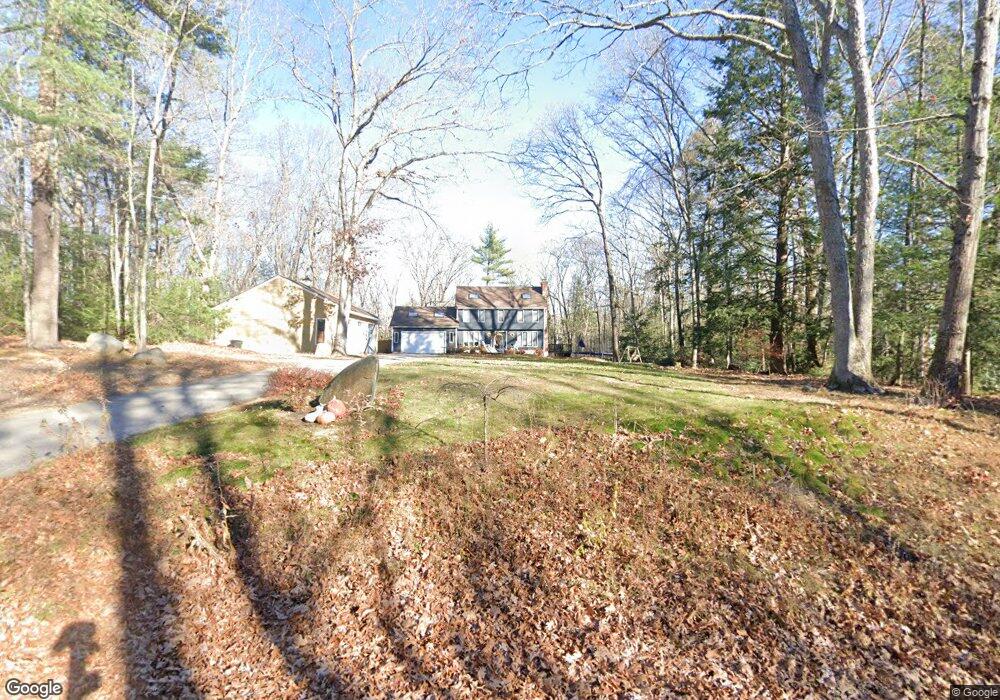
19 Rollins Farm Rd Stratham, NH 03885
Estimated Value: $866,000 - $961,000
4
Beds
3
Baths
2,739
Sq Ft
$339/Sq Ft
Est. Value
About This Home
This home is located at 19 Rollins Farm Rd, Stratham, NH 03885 and is currently estimated at $929,499, approximately $339 per square foot. 19 Rollins Farm Rd is a home located in Rockingham County with nearby schools including Stratham Memorial School, Cooperative Middle School, and Exeter High School.
Ownership History
Date
Name
Owned For
Owner Type
Purchase Details
Closed on
Dec 13, 2021
Sold by
Lawson Brent J and Lawson Laura M
Bought by
Lawson Ft and Lawson
Current Estimated Value
Purchase Details
Closed on
Dec 30, 2014
Sold by
Mcnall David and Mcnall Erin M
Bought by
Lawson Brent J and Lawson Laura M
Purchase Details
Closed on
Oct 15, 2012
Sold by
Banboshew Saran B
Bought by
Mcnall David and Mcnall Erin M
Create a Home Valuation Report for This Property
The Home Valuation Report is an in-depth analysis detailing your home's value as well as a comparison with similar homes in the area
Home Values in the Area
Average Home Value in this Area
Purchase History
| Date | Buyer | Sale Price | Title Company |
|---|---|---|---|
| Lawson Ft | -- | None Available | |
| Lawson Ft | -- | None Available | |
| Lawson Brent J | $440,000 | -- | |
| Lawson Brent J | $440,000 | -- | |
| Mcnall David | $298,700 | -- | |
| Mcnall David | $298,700 | -- |
Source: Public Records
Mortgage History
| Date | Status | Borrower | Loan Amount |
|---|---|---|---|
| Previous Owner | Mcnall David | $337,500 | |
| Previous Owner | Mcnall David | $50,000 | |
| Previous Owner | Mcnall David | $340,000 |
Source: Public Records
Tax History Compared to Growth
Tax History
| Year | Tax Paid | Tax Assessment Tax Assessment Total Assessment is a certain percentage of the fair market value that is determined by local assessors to be the total taxable value of land and additions on the property. | Land | Improvement |
|---|---|---|---|---|
| 2024 | $11,174 | $851,700 | $416,200 | $435,500 |
| 2023 | $10,877 | $520,200 | $213,600 | $306,600 |
| 2022 | $9,733 | $520,200 | $213,600 | $306,600 |
| 2021 | $9,634 | $520,200 | $213,600 | $306,600 |
| 2020 | $9,841 | $519,300 | $213,600 | $305,700 |
| 2019 | $9,675 | $519,300 | $213,600 | $305,700 |
| 2018 | $9,246 | $440,300 | $164,100 | $276,200 |
| 2017 | $8,938 | $440,300 | $164,100 | $276,200 |
| 2016 | $8,982 | $440,300 | $164,100 | $276,200 |
| 2015 | $8,760 | $440,200 | $164,100 | $276,100 |
| 2014 | $8,595 | $431,700 | $164,100 | $267,600 |
| 2013 | $8,123 | $413,400 | $164,100 | $249,300 |
Source: Public Records
Map
Nearby Homes
- 50 Thornhill Rd
- 133R Stratham Heights Rd
- Homesite 1 Windsong Place
- Homesite 4 Windsong Place
- 16 Parkman Brook Ln
- 2 Sterling Hill Ln Unit 211
- 91 Lovering Rd
- 135 Exeter Rd
- 1 Sterling Hill Ln Unit 116
- 3 Sterling Hill Ln Unit 324
- 5 Sterling Hill Ln Unit 531
- 5 Sterling Hill Ln Unit 514
- 5 Sterling Hill Ln Unit 545
- 131 Exeter Rd
- 8 Winterberry Ln
- 113 Exeter Rd
- 101 Robinhood Dr
- 43 Hampton Rd
- 752 Exeter Rd
- 19 1st St
- 19 Rollins Farm Rd
- 21 Rollins Farm Rd
- 17 Rollins Farm Rd
- 15 Rollins Farm Rd
- 18 Rollins Farm Rd
- 13 Rollins Farm Rd
- 11 Rollins Farm Rd
- 1 Haywick Dr
- 9 Rollins Farm Rd
- 10 Rollins Farm Rd
- 2 Haywick Dr Unit 1
- 3 Haywick Dr
- 3 Haywick Dr Unit Lot 33
- 7 Rollins Farm Rd
- 4 Haywick Dr Unit 4
- 4 Haywick Dr Unit 2
- 8 Rollins Farm Rd
- 5 Haywick Dr Unit Lot 32
- 6 Walters Way
- 6 Haywick Dr