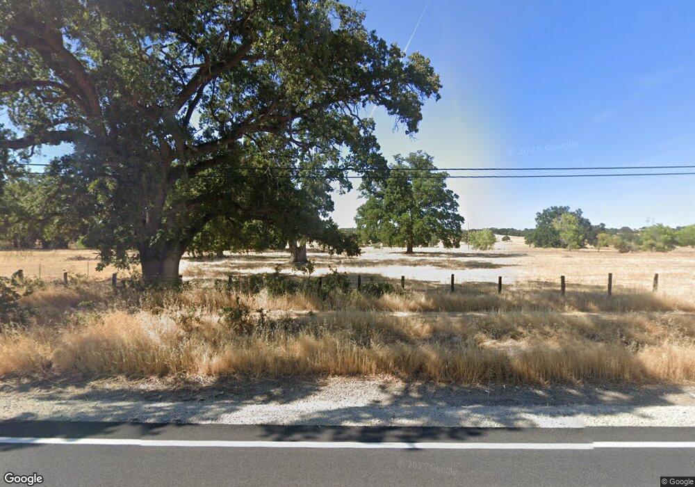
19020 State Highway 36 W Red Bluff, CA 96080
Estimated Value: $372,000 - $949,000
3
Beds
2
Baths
1,660
Sq Ft
$400/Sq Ft
Est. Value
About This Home
This home is located at 19020 State Highway 36 W, Red Bluff, CA 96080 and is currently estimated at $663,602, approximately $399 per square foot. 19020 State Highway 36 W is a home located in Tehama County with nearby schools including Jackson Heights Elementary School, Vista Preparatory Academy, and Red Bluff High School.
Ownership History
Date
Name
Owned For
Owner Type
Purchase Details
Closed on
Jan 24, 2013
Sold by
Chagnon Richard A and Chagnon Judith L
Bought by
Red Gate Ranch Llc
Current Estimated Value
Purchase Details
Closed on
Sep 10, 2011
Sold by
Lauder Susan H
Bought by
Chagnon Richard A and Chagnon Judith L
Purchase Details
Closed on
Apr 19, 2005
Sold by
Soncrant William A and Soncrant Nancy Janette
Bought by
Lauder Susan H and Susan H Lauder Trust
Create a Home Valuation Report for This Property
The Home Valuation Report is an in-depth analysis detailing your home's value as well as a comparison with similar homes in the area
Home Values in the Area
Average Home Value in this Area
Purchase History
| Date | Buyer | Sale Price | Title Company |
|---|---|---|---|
| Red Gate Ranch Llc | -- | None Available | |
| Chagnon Richard A | $389,000 | Placer Title Company | |
| Lauder Susan H | -- | Fidelity National Title | |
| Lauder Susan H | -- | Fidelity National Title | |
| Lauder Susanh | -- | Fidelty National Title | |
| Lauder Susan H | $700,000 | Fidelity National Title |
Source: Public Records
Tax History Compared to Growth
Tax History
| Year | Tax Paid | Tax Assessment Tax Assessment Total Assessment is a certain percentage of the fair market value that is determined by local assessors to be the total taxable value of land and additions on the property. | Land | Improvement |
|---|---|---|---|---|
| 2025 | $5,711 | $548,778 | $351,689 | $197,089 |
| 2023 | $5,568 | $528,886 | $338,034 | $190,852 |
| 2022 | $5,577 | $523,118 | $331,406 | $191,712 |
| 2021 | $5,300 | $510,768 | $324,908 | $185,860 |
| 2020 | $5,031 | $469,951 | $321,577 | $148,374 |
| 2019 | $4,935 | $449,002 | $315,272 | $133,730 |
| 2018 | $4,454 | $429,415 | $309,091 | $120,324 |
| 2017 | $4,492 | $420,996 | $303,031 | $117,965 |
| 2016 | $4,196 | $412,742 | $297,090 | $115,652 |
| 2015 | $4,130 | $406,543 | $292,628 | $113,915 |
| 2014 | $4,071 | $398,580 | $286,896 | $111,684 |
Source: Public Records
Map
Nearby Homes
- 14721 Nevis Rd
- 18771 Drake Rd
- 14610 Hanks Dr
- 14860 Oak Knoll Dr
- 18633 Stallion Dr
- 18574 Stallion Dr
- 14610 Shasta View Dr
- 14445 Green Valley Acres Dr
- 19911 State Highway 36 W
- 19600 Sunshine Dr
- 14575 Kinney Ave
- 17825 Clearwater Dr
- 14480 Warren Ave
- 15410 Autumn Oaks Ct
- 13905 Mendenhall Rd
- 0 Vintage Dr Unit 23007603
- 14485 Ryan Ln
- 20662 Saddlebrook Dr
- 00 Juaquin Ln
- 13185 Montecito Rd
- 19020 State Highway 36 W
- 14650 Saint Croy Rd
- 19035 State Highway 36 W
- 14865 Brian Rd
- 14770 Brian Rd
- 18980 State Highway 36 W
- 14670 Saint Croy Rd
- 18975 Hansen Dr
- 14630 Saint Croy Rd
- 14700 Brian Rd
- 14685 Chico Ct
- 19040 Hansen Dr
- 18945 Drake Rd
- 14748 Tyson Rd
- 18925 Drake Rd
- 18950 Drake Rd
- 14700 Chico Ct
- 14605 Tracy Ct
- 18940 Drake Rd
- 14650 Oak Hill Dr
