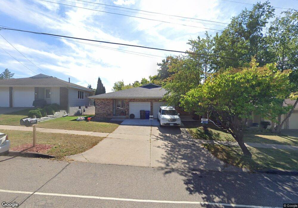
1908 Upper Afton Rd E Saint Paul, MN 55119
Battle Creek NeighborhoodEstimated Value: $372,234 - $447,000
4
Beds
2
Baths
2,464
Sq Ft
$166/Sq Ft
Est. Value
About This Home
This home is located at 1908 Upper Afton Rd E, Saint Paul, MN 55119 and is currently estimated at $409,559, approximately $166 per square foot. 1908 Upper Afton Rd E is a home located in Ramsey County with nearby schools including Battle Creek Elementary School, Battle Creek Middle School, and Harding Senior High School.
Ownership History
Date
Name
Owned For
Owner Type
Purchase Details
Closed on
Mar 7, 2023
Sold by
Hoagland Isaac
Bought by
1908 Upper Afton Road Llc
Current Estimated Value
Purchase Details
Closed on
Feb 23, 2022
Sold by
Sanxter John L & Bethany G
Bought by
Hoagland Isaac
Home Financials for this Owner
Home Financials are based on the most recent Mortgage that was taken out on this home.
Original Mortgage
$311,600
Interest Rate
3.69%
Mortgage Type
New Conventional
Purchase Details
Closed on
Feb 18, 2000
Sold by
Petersen Mark S
Bought by
Johnson Bethany Gloria
Purchase Details
Closed on
Sep 22, 1997
Sold by
Ringrose Wolsfeld Associates
Bought by
Aasen Steven M and Aasen Linda L
Create a Home Valuation Report for This Property
The Home Valuation Report is an in-depth analysis detailing your home's value as well as a comparison with similar homes in the area
Home Values in the Area
Average Home Value in this Area
Purchase History
| Date | Buyer | Sale Price | Title Company |
|---|---|---|---|
| 1908 Upper Afton Road Llc | $500 | -- | |
| Hoagland Isaac | $328,000 | Titlesmart | |
| Johnson Bethany Gloria | $160,000 | -- | |
| Aasen Steven M | $112,000 | -- | |
| Peterson Mark S | $120,000 | -- |
Source: Public Records
Mortgage History
| Date | Status | Borrower | Loan Amount |
|---|---|---|---|
| Previous Owner | Hoagland Isaac | $311,600 |
Source: Public Records
Tax History Compared to Growth
Tax History
| Year | Tax Paid | Tax Assessment Tax Assessment Total Assessment is a certain percentage of the fair market value that is determined by local assessors to be the total taxable value of land and additions on the property. | Land | Improvement |
|---|---|---|---|---|
| 2025 | $6,238 | $380,900 | $27,800 | $353,100 |
| 2023 | $6,238 | $320,700 | $27,800 | $292,900 |
| 2022 | $5,686 | $327,200 | $27,800 | $299,400 |
| 2021 | $5,416 | $271,900 | $27,800 | $244,100 |
| 2020 | $4,980 | $267,200 | $27,800 | $239,400 |
| 2019 | $4,276 | $226,600 | $27,800 | $198,800 |
| 2018 | $4,162 | $190,400 | $27,800 | $162,600 |
| 2017 | $4,034 | $190,400 | $27,800 | $162,600 |
| 2016 | $3,868 | $0 | $0 | $0 |
| 2015 | $3,892 | $167,000 | $27,800 | $139,200 |
| 2014 | $3,640 | $0 | $0 | $0 |
Source: Public Records
Map
Nearby Homes
- 49 Battle Creek Place
- 1989 N Park Dr
- 125 Battle Creek Place
- 2023 Parkside Dr
- 2063 N Park Dr Unit 6
- 2059 Parkside Dr Unit 29
- 138 Ruth St N Unit 9
- 1747 Louise Ave
- 38 Morningside Dr
- 2169 Glenridge Ave
- 2219 Cardinal Place
- 2243 Edgebrook Ave
- 125 Mcknight Rd N Unit K
- 1810 Wilson Ave
- 1526 Upper Afton Rd
- 267 Hazelwood St
- 371, 377, 381 Totem Rd
- 442 White Bear Ave N
- 408 Totem Rd
- 2226 Lower Afton Rd E
- 1912 Upper Afton Rd E
- 1904 Upper Afton Rd E
- 1914 Upper Afton Rd E
- 1918 Upper Afton Rd E
- 8 Battle Creek Rd
- 1955 Ebertz Ct
- 1898 Upper Afton Rd E
- 1926 Upper Afton Rd E
- 4 Battle Creek Rd
- 29 Darlene St
- 1949 Ebertz Ct
- 1925 Upper Afton Rd E
- 1930 1930 Upper Afton-Road-e
- 1905 Upper Afton Rd E
- 1930 Upper Afton Rd E
- 39 Darlene St
- 1948 Ebertz Ct
- 1911 Ebertz Ct
- 1911 1911 Ebertz-Court-
- 1929 Ebertz Ct