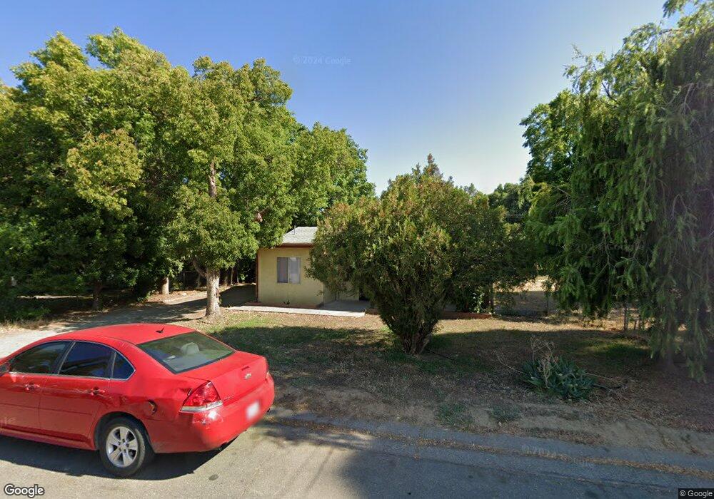
1909 Taft Ave Corning, CA 96021
Estimated Value: $95,000 - $228,000
About This Home
This home is located at 1909 Taft Ave, Corning, CA 96021 and is currently estimated at $183,017, approximately $182 per square foot. 1909 Taft Ave is a home with nearby schools including West Street Elementary School, Maywood Middle School, and Corning High School.
Ownership History
We collect this data history from publicly available records. To have your information removed, we recommend requesting removal directly through your county’s website.
Purchase Details
Purchase Details
Purchase Details
Purchase History
We collect this data history from publicly available records. To have your information removed, we recommend requesting removal directly through your county’s website.
| Date | Buyer | Sale Price | Title Company |
|---|---|---|---|
| -- | None Listed On Document | ||
| $45,000 | Northern California Title Co | ||
| -- | None Available |
Tax History
We collect this data history from publicly available records. To have your information removed, we recommend requesting removal directly through your county’s website.
| Year | Tax Paid | Tax Assessment Tax Assessment Total Assessment is a certain percentage of the fair market value that is determined by local assessors to be the total taxable value of land and additions on the property. | Land | Improvement |
|---|---|---|---|---|
| 2025 | $574 | $55,150 | $22,058 | $33,092 |
| 2023 | $564 | $53,010 | $21,202 | $31,808 |
| 2022 | $556 | $51,972 | $20,787 | $31,185 |
| 2021 | $535 | $50,954 | $20,380 | $30,574 |
| 2020 | $541 | $50,433 | $20,172 | $30,261 |
| 2019 | $519 | $49,445 | $19,777 | $29,668 |
| 2018 | $520 | $48,477 | $19,390 | $29,087 |
| 2017 | $516 | $47,527 | $19,010 | $28,517 |
| 2016 | $482 | $46,596 | $18,638 | $27,958 |
| 2015 | -- | $45,898 | $18,359 | $27,539 |
| 2014 | $316 | $29,952 | $8,377 | $21,575 |
Map
- 2018 Donnovan Ave
- 0 Toomes Ave Unit SN25272183
- 0 Toomes Ave Unit SN24222817
- 0 Toomes Ave Unit SN25176211
- 2059 Blossom Ave
- 2067 Blossom Ave
- 1414 Marin St
- 818 6th St
- 1162 5th Ave
- 1220 5th Ave
- 1209 Marin St
- 1121 Marin St
- 0 Houghton Ave Unit 324045531
- 0 Carona Ave
- 2008 North St
- 1075 99w
- 0 Hwy 99 W Unit SN26028885
- 0 Hwy 99 W Unit SN26134655
- 233 Rio Verde Ct
- 243 Edith Ave
- 1906 Scott Ave
- 1904 Scott Ave
- 1910 Scott Ave
- 1894 Scott Ave
- 1914 Scott Ave
- 1868 Scott Ave
- 1903 Taft Ave
- 1939 Scott Ave
- 1919 Scott Ave
- 1848 Scott Ave
- 1970 Scott Ave
- 1887 Scott Ave
- 1891 Scott Ave Unit 1899 scott ave
- 1951 Scott Ave
- 1877 Scott Ave
- 1828 Scott Ave
- 1961 Scott Ave
- 1972 Scott Ave
- 1827 Taft Ave
- 1973 Taft Ave
Ask me questions while you tour the home.