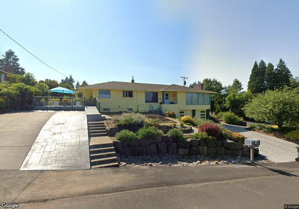
1910 Broadview St Eugene, OR 97405
Churchill NeighborhoodEstimated Value: $621,393 - $752,000
3
Beds
2
Baths
2,316
Sq Ft
$287/Sq Ft
Est. Value
About This Home
This home is located at 1910 Broadview St, Eugene, OR 97405 and is currently estimated at $664,598, approximately $286 per square foot. 1910 Broadview St is a home located in Lane County with nearby schools including McCornack Elementary School, Kennedy Middle School, and Churchill High School.
Ownership History
Date
Name
Owned For
Owner Type
Purchase Details
Closed on
Oct 18, 2007
Sold by
Koris George M and Love Pamela A
Bought by
Koris George Michael and Love Pamela Arden
Current Estimated Value
Purchase Details
Closed on
May 5, 1999
Sold by
Gressett Edward D
Bought by
Koris George M and Love Pamela A
Home Financials for this Owner
Home Financials are based on the most recent Mortgage that was taken out on this home.
Original Mortgage
$124,000
Interest Rate
6.53%
Create a Home Valuation Report for This Property
The Home Valuation Report is an in-depth analysis detailing your home's value as well as a comparison with similar homes in the area
Home Values in the Area
Average Home Value in this Area
Purchase History
| Date | Buyer | Sale Price | Title Company |
|---|---|---|---|
| Koris George Michael | -- | None Available | |
| Koris George M | $219,000 | Cascade Title Co |
Source: Public Records
Mortgage History
| Date | Status | Borrower | Loan Amount |
|---|---|---|---|
| Closed | Koris George M | $124,000 |
Source: Public Records
Tax History
| Year | Tax Paid | Tax Assessment Tax Assessment Total Assessment is a certain percentage of the fair market value that is determined by local assessors to be the total taxable value of land and additions on the property. | Land | Improvement |
|---|---|---|---|---|
| 2025 | $7,574 | $388,735 | -- | -- |
| 2024 | $7,480 | $377,413 | -- | -- |
| 2023 | $7,480 | $366,421 | $0 | $0 |
| 2022 | $7,007 | $355,749 | $0 | $0 |
| 2021 | $6,582 | $345,388 | $0 | $0 |
| 2020 | $6,605 | $335,329 | $0 | $0 |
| 2019 | $6,137 | $313,207 | $0 | $0 |
| 2018 | $5,723 | $295,228 | $0 | $0 |
| 2017 | $5,387 | $295,228 | $0 | $0 |
| 2016 | $5,154 | $286,629 | $0 | $0 |
| 2015 | $5,064 | $278,281 | $0 | $0 |
| 2014 | $4,682 | $257,644 | $0 | $0 |
Source: Public Records
Map
Nearby Homes
- 0 W 18th Ave Unit LOT 2
- 0 W 18th Ave Unit LOT 3
- 2085 Trillium St
- 2145 Hawkins Ln Unit 30
- 1432 Fetters Loop
- 3315 W 18th Ave
- 2953 W 15th Ave
- 2279 City View St
- 1509 Mckinley St
- 1365 Quaker St
- 2330 W 14th Ave
- 1438 Quaker St
- 1735 Cleveland Place
- 1326 Quaker St
- 2260 Orr Ln
- 3423 W 25th Ave
- 2161 W 16th Ave
- 2230 Cleveland St
- 2430 Wilson Dr
- 2490 Panorama Dr
- 2940 W 19th Ave
- 2915 Eldridge Ave
- 1909 Broadview St
- 2905 W 19th Ave
- 2897 W 19th Ave
- 2945 Eldridge Ave
- 2960 W 19th Ave
- 1925 Broadview St
- 2945 W 19th Ave
- 2891 W 19th Ave
- 1960 Broadview St
- 1920 Sunrise Blvd
- 1911 Lambert St
- 1965 Broadview St
- 1936 Sunrise Blvd
- 2989 Eldridge Ave
- 2930 W 18th Place
- 2954 Eldridge Ave
- 2950 W 18th Place
- 1950 Sunrise Blvd
Your Personal Tour Guide
Ask me questions while you tour the home.