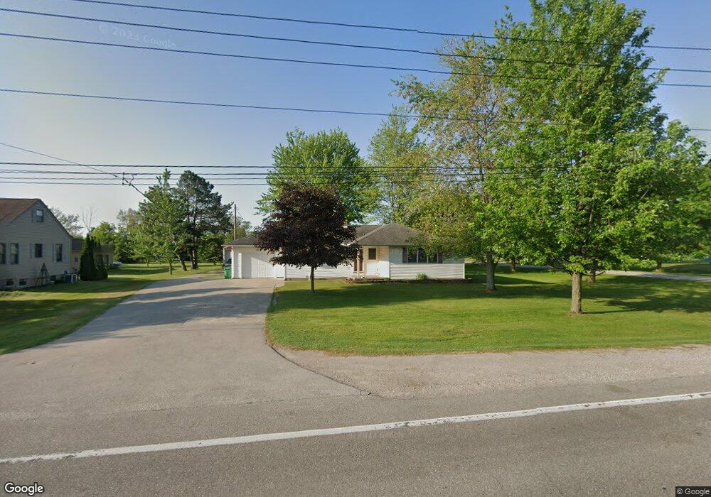
1910 Midland Rd Bay City, MI 48706
Estimated Value: $192,134 - $216,000
3
Beds
2
Baths
1,324
Sq Ft
$156/Sq Ft
Est. Value
About This Home
This home is located at 1910 Midland Rd, Bay City, MI 48706 and is currently estimated at $206,284, approximately $155 per square foot. 1910 Midland Rd is a home located in Bay County with nearby schools including McAlear-Sawden Elementary School, Western Middle School, and Bay City Western High School.
Ownership History
Date
Name
Owned For
Owner Type
Purchase Details
Closed on
Jan 13, 2014
Sold by
Stender Floyd T and Stender Linda M
Bought by
Stender Kimberly A
Current Estimated Value
Purchase Details
Closed on
Oct 20, 2004
Sold by
Chartier Purtell Betty A and Chartier Betty A
Bought by
Stender Floyd T and Stender Linda M
Home Financials for this Owner
Home Financials are based on the most recent Mortgage that was taken out on this home.
Original Mortgage
$20,000
Interest Rate
5.81%
Mortgage Type
Purchase Money Mortgage
Purchase Details
Closed on
Oct 12, 2004
Sold by
Chartier Thomas L and Chartier Brian A
Bought by
Chartier Purtell Betty A
Home Financials for this Owner
Home Financials are based on the most recent Mortgage that was taken out on this home.
Original Mortgage
$20,000
Interest Rate
5.81%
Mortgage Type
Purchase Money Mortgage
Create a Home Valuation Report for This Property
The Home Valuation Report is an in-depth analysis detailing your home's value as well as a comparison with similar homes in the area
Home Values in the Area
Average Home Value in this Area
Purchase History
| Date | Buyer | Sale Price | Title Company |
|---|---|---|---|
| Stender Kimberly A | -- | None Available | |
| Stender Floyd T | $120,900 | -- | |
| Chartier Purtell Betty A | -- | -- |
Source: Public Records
Mortgage History
| Date | Status | Borrower | Loan Amount |
|---|---|---|---|
| Closed | Stender Floyd T | $20,000 |
Source: Public Records
Tax History Compared to Growth
Tax History
| Year | Tax Paid | Tax Assessment Tax Assessment Total Assessment is a certain percentage of the fair market value that is determined by local assessors to be the total taxable value of land and additions on the property. | Land | Improvement |
|---|---|---|---|---|
| 2025 | $2,116 | $75,800 | $0 | $0 |
| 2024 | $819 | $70,800 | $0 | $0 |
| 2023 | $780 | $62,900 | $0 | $0 |
| 2022 | $1,942 | $62,400 | $0 | $0 |
| 2021 | $1,811 | $53,900 | $53,900 | $0 |
| 2020 | $1,797 | $48,300 | $48,300 | $0 |
| 2019 | $1,706 | $47,300 | $0 | $0 |
| 2018 | $1,732 | $53,800 | $0 | $0 |
| 2017 | $1,642 | $52,300 | $0 | $0 |
| 2016 | $1,647 | $51,000 | $0 | $51,000 |
| 2015 | $700 | $47,200 | $0 | $47,200 |
| 2014 | $700 | $47,100 | $0 | $47,100 |
Source: Public Records
Map
Nearby Homes
- 2251 Creekmore Ln
- 2284 Midland Rd
- 1280 E North Union Rd
- 4848 W Westgate Dr
- 0 Michigan Unit 50188067
- 0 Michigan Unit 50188064
- 4819 Cardinal Dr
- 1048 Pheasant Dr
- 1029 Raven Dr
- 2777 E Fisher Rd
- 5115 Baxman Rd
- 2948 E Fisher Rd
- 0 S Two Mile Rd Unit 50142051
- 0 2 Mile Rd Unit 50169642
- 4464 W Park Dr
- 3103 E Midland Rd
- 4700 Foxcroft Dr
- 3176 E Fisher Rd
- 0 Copper Creek Dr
- 2148 Wheeler Rd
- 1920 Midland Rd
- 1934 Midland Rd
- 1896 Midland Rd
- 1907 Midland Rd
- 1886 Midland Rd
- 1880 Midland Rd
- 1883 Midland Rd
- 1879 Midland Rd
- 1879 Midland Rd
- 1970 Midland Rd
- 1876 Midland Rd
- 1972 Midland Rd
- 1874 Midland Rd
- 1974 Midland Rd
- 1872 Midland Rd
- 1989 Midland Rd
- 1828 Midland Rd
- 1997 Midland Rd
- 1837 Midland Rd
- 1837 Midland Rd