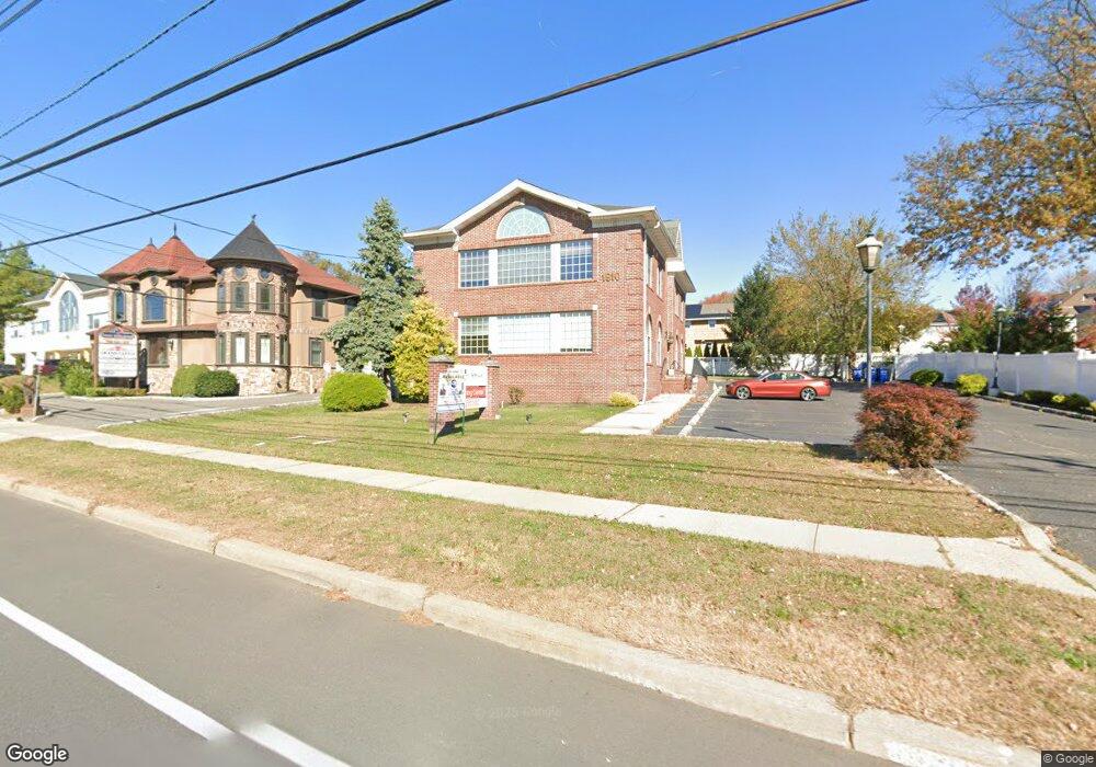
1910 Oak Tree Rd Unit 2B Edison, NJ 08820
Estimated Value: $1,571,633
Studio
--
Bath
810
Sq Ft
$1,940/Sq Ft
Est. Value
About This Home
This home is located at 1910 Oak Tree Rd Unit 2B, Edison, NJ 08820 and is currently estimated at $1,571,633, approximately $1,940 per square foot. 1910 Oak Tree Rd Unit 2B is a home located in Middlesex County with nearby schools including James Madison Primary School, James Madison Intermediate School, and John Adams Middle School.
Ownership History
Date
Name
Owned For
Owner Type
Purchase Details
Closed on
Apr 9, 1997
Sold by
Magnifico Michael
Bought by
Kravarik Martin and Kravarik Meiling
Current Estimated Value
Home Financials for this Owner
Home Financials are based on the most recent Mortgage that was taken out on this home.
Original Mortgage
$137,000
Outstanding Balance
$17,527
Interest Rate
7.77%
Mortgage Type
Commercial
Estimated Equity
$1,554,106
Create a Home Valuation Report for This Property
The Home Valuation Report is an in-depth analysis detailing your home's value as well as a comparison with similar homes in the area
Home Values in the Area
Average Home Value in this Area
Purchase History
| Date | Buyer | Sale Price | Title Company |
|---|---|---|---|
| Kravarik Martin | $103,000 | -- |
Source: Public Records
Mortgage History
| Date | Status | Borrower | Loan Amount |
|---|---|---|---|
| Open | Kravarik Martin | $137,000 |
Source: Public Records
Tax History
| Year | Tax Paid | Tax Assessment Tax Assessment Total Assessment is a certain percentage of the fair market value that is determined by local assessors to be the total taxable value of land and additions on the property. | Land | Improvement |
|---|---|---|---|---|
| 2025 | $23,812 | $400,000 | $198,000 | $202,000 |
| 2024 | $23,684 | $400,000 | $198,000 | $202,000 |
| 2023 | $23,684 | $400,000 | $198,000 | $202,000 |
| 2022 | $23,692 | $400,000 | $198,000 | $202,000 |
| 2021 | $28,753 | $511,600 | $198,000 | $313,600 |
| 2020 | $28,753 | $511,600 | $198,000 | $313,600 |
| 2019 | $26,580 | $511,600 | $198,000 | $313,600 |
| 2018 | $26,608 | $511,600 | $198,000 | $313,600 |
| 2017 | $26,353 | $511,600 | $198,000 | $313,600 |
| 2016 | $25,867 | $511,600 | $198,000 | $313,600 |
| 2015 | $24,884 | $511,600 | $198,000 | $313,600 |
| 2014 | $24,178 | $511,600 | $198,000 | $313,600 |
Source: Public Records
Map
Nearby Homes
- 1868 Oak Tree Rd
- 3 Hummingbird Ln
- 48 Lynnwood Rd
- 33 Nottingham Rd
- 1821 Oak Tree Rd
- 24 Norton St
- 454 Plainfield Rd
- 1123 New Dover Rd
- 1125 New Dover Rd
- 177 Mundy Ave
- 354 Plainfield Rd
- 3606 Springbrook Dr
- 5001 Stonehedge Rd Unit 5001
- 3606 Spring Brook Dr
- 304 Maplecrest Rd Unit 4
- 303 Maplecrest Rd
- 2805 Cricket Cir
- 64 Richard Rd
- 87 Ellmyer Rd
- 21 Williams Rd
- 1910 Oak Tree Rd Unit 1B
- 1912 Oak Tree Rd
- 1914 Oak Tree Rd Unit A
- 06 Oak Tree Rd Unit 1
- 0 Oak Tree Rd
- 3 Tamagnini Ct
- 1916 Oak Tree Rd
- 1908 Oak Tree Rd
- 23 Lombardi St
- 7 Tamagnini Ct
- 1915 Oak Tree Rd
- 1920 Oak Tree Rd
- 21 Lombardi St
- 9 Tamagnini Ct
- 5 Tamagnini Ct
- 19 Lombardi St
- 26 Lombardi St
- 6 Tamagnini Ct
- 1900 Oak Tree Rd
- 17 Lombardi St
Your Personal Tour Guide
Ask me questions while you tour the home.