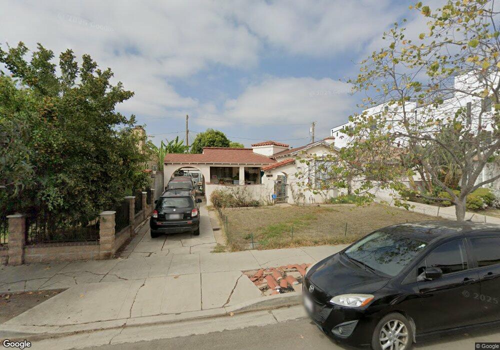
1917 S Corning St Los Angeles, CA 90034
Mid-City NeighborhoodEstimated Value: $1,062,000 - $1,533,000
3
Beds
2
Baths
1,450
Sq Ft
$948/Sq Ft
Est. Value
About This Home
This home is located at 1917 S Corning St, Los Angeles, CA 90034 and is currently estimated at $1,374,327, approximately $947 per square foot. 1917 S Corning St is a home located in Los Angeles County with nearby schools including Mark Twain Middle School, Alexander Hamilton Senior High School, and Cheder Menachem School.
Ownership History
Date
Name
Owned For
Owner Type
Purchase Details
Closed on
Jan 24, 1997
Sold by
Rodriguez Louis E and Rodriguez Nivia I
Bought by
Kaufman Larrow
Current Estimated Value
Home Financials for this Owner
Home Financials are based on the most recent Mortgage that was taken out on this home.
Original Mortgage
$163,400
Outstanding Balance
$18,773
Interest Rate
7.74%
Estimated Equity
$1,355,554
Purchase Details
Closed on
Apr 16, 1996
Sold by
Federal Home Mtg Corp
Bought by
Rodriguez Louis E and Rodriguez Nivia I
Home Financials for this Owner
Home Financials are based on the most recent Mortgage that was taken out on this home.
Original Mortgage
$95,625
Interest Rate
8.75%
Purchase Details
Closed on
Dec 28, 1995
Sold by
Terrell Wayne E and Alvarez James
Bought by
Federal Home Loan Mortgage Corporation
Create a Home Valuation Report for This Property
The Home Valuation Report is an in-depth analysis detailing your home's value as well as a comparison with similar homes in the area
Home Values in the Area
Average Home Value in this Area
Purchase History
| Date | Buyer | Sale Price | Title Company |
|---|---|---|---|
| Kaufman Larrow | $167,000 | Chicago Title Co | |
| Rodriguez Louis E | $127,500 | Old Republic Title Company | |
| Federal Home Loan Mortgage Corporation | $150,000 | -- |
Source: Public Records
Mortgage History
| Date | Status | Borrower | Loan Amount |
|---|---|---|---|
| Open | Kaufman Larrow | $163,400 | |
| Previous Owner | Rodriguez Louis E | $95,625 |
Source: Public Records
Tax History Compared to Growth
Tax History
| Year | Tax Paid | Tax Assessment Tax Assessment Total Assessment is a certain percentage of the fair market value that is determined by local assessors to be the total taxable value of land and additions on the property. | Land | Improvement |
|---|---|---|---|---|
| 2025 | $3,528 | $280,109 | $211,718 | $68,391 |
| 2024 | $3,528 | $274,617 | $207,567 | $67,050 |
| 2023 | $3,467 | $269,234 | $203,498 | $65,736 |
| 2022 | $3,316 | $263,956 | $199,508 | $64,448 |
| 2021 | $3,266 | $258,782 | $195,597 | $63,185 |
| 2019 | $3,171 | $251,109 | $189,797 | $61,312 |
| 2018 | $3,079 | $246,186 | $186,076 | $60,110 |
| 2016 | $2,933 | $236,628 | $178,851 | $57,777 |
| 2015 | $2,891 | $233,075 | $176,165 | $56,910 |
| 2014 | $2,909 | $228,511 | $172,715 | $55,796 |
Source: Public Records
Map
Nearby Homes
- 1942 S Sherbourne Dr
- 1810 S Sherbourne Dr
- 2006 S Corning St
- 1944 Chariton St
- 1960 Chariton St
- 2055 S Corning St
- 6082 W 18th St
- 1975 S Crescent Heights Blvd
- 8809 David Ave
- 1726 S Sherbourne Dr
- 1904 Preuss Rd
- 2011 S Shenandoah St
- 1901 S Point View St
- 2431 S Holt Ave
- 8953 W 24th St
- 1622 Alvira St
- 8767 Airdrome St
- 1915 Covington Ln
- 1856 Hi Point St
- 2614 S Garth Ave
- 1911 S Corning St
- 1921 S Corning St
- 1929 S Corning St Unit 5
- 1931 S Corning St
- 1907 S Corning St Unit 2/2
- 1907 S Corning St Unit 2
- 1907 S Corning St Unit 1
- 1907 S Corning St
- 1905 S Corning St Unit 1
- 1933 S Corning St
- 1901 S Corning St
- 1916 S Holt Ave
- 1910 S Holt Ave
- 1920 S Holt Ave
- 1924 S Holt Ave
- 1906 S Holt Ave
- 1916 S Corning St
- 1920 S Corning St
- 1910 S Corning St
- 1934 S Holt Ave