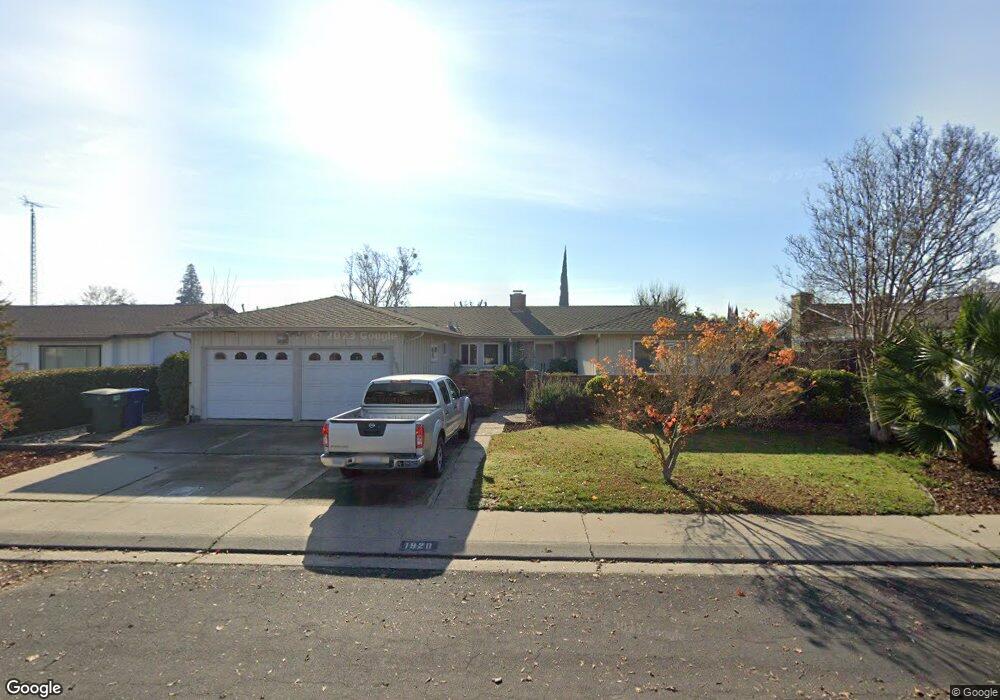
1920 Kendall Ave Modesto, CA 95355
Northeast Modesto NeighborhoodEstimated Value: $522,729 - $554,000
About This Home
This home is located at 1920 Kendall Ave, Modesto, CA 95355 and is currently estimated at $537,682, approximately $237 per square foot. 1920 Kendall Ave is a home located in Stanislaus County with nearby schools including Rose Avenue Elementary School, La Loma Jr High, and Thomas Downey High School.
Ownership History
We collect this data history from publicly available records. To have your information removed, we recommend requesting removal directly through your county’s website.
Purchase Details
Home Values in the Area
Average Home Value in this Area
Purchase History
We collect this data history from publicly available records. To have your information removed, we recommend requesting removal directly through your county’s website.
| Date | Buyer | Sale Price | Title Company |
|---|---|---|---|
| $136,000 | Fidelity National Title Co |
Mortgage History
We collect this data history from publicly available records. To have your information removed, we recommend requesting removal directly through your county’s website.
| Date | Status | Borrower | Loan Amount |
|---|---|---|---|
| Closed | $121,000 |
Tax History
We collect this data history from publicly available records. To have your information removed, we recommend requesting removal directly through your county’s website.
| Year | Tax Paid | Tax Assessment Tax Assessment Total Assessment is a certain percentage of the fair market value that is determined by local assessors to be the total taxable value of land and additions on the property. | Land | Improvement |
|---|---|---|---|---|
| 2025 | $2,457 | $217,143 | $55,879 | $161,264 |
| 2024 | $2,346 | $212,886 | $54,784 | $158,102 |
| 2023 | $2,310 | $208,712 | $53,710 | $155,002 |
| 2022 | $2,252 | $204,620 | $52,657 | $151,963 |
| 2021 | $2,117 | $200,609 | $51,625 | $148,984 |
| 2020 | $2,158 | $198,553 | $51,096 | $147,457 |
| 2019 | $2,106 | $194,661 | $50,095 | $144,566 |
| 2018 | $2,004 | $190,845 | $49,113 | $141,732 |
| 2017 | $1,954 | $187,103 | $48,150 | $138,953 |
| 2016 | $1,915 | $183,435 | $47,206 | $136,229 |
| 2015 | $1,888 | $180,680 | $46,497 | $134,183 |
| 2014 | $1,858 | $177,142 | $45,587 | $131,555 |
Map
- 1421 El Pueblo Dr
- 1813 Butternut Ct
- 1816 Manzanita Dr
- 1824 Ellison Dr
- 1820 Celeste Dr
- 1837 Celeste Dr
- 1608 Kruger Dr
- 1601 Carnation Ct
- 1924 Cota Way
- 2008 Presidio Ave
- 2307 Oakdale Rd Unit 75
- 2307 Oakdale Rd Unit 60
- 2307 Oakdale Rd Unit 36
- 1008 Gemini Ct
- 1908 Chelwood Way
- 1713 Wolverine Way
- 1717 Ensenada Dr
- 1841 Giardino Way
- 1437 Entrada Way
- 2504 Crosswood Way
- 1921 Rockford Ave
- 1917 Rockford Ave
- 1925 Rockford Ave
- 1916 Kendall Ave
- 1924 Kendall Ave
- 1913 Rockford Ave
- 1920 Rockford Ave
- 1916 Rockford Ave
- 1924 Rockford Ave
- 1513 Duportail Ave
- 1908 Rockford Ave
- 1501 Duportail Ave
- 1908 Kendall Ave
- 1917 Lafayette Ave
- 1904 Rockford Ave
- 1913 Lafayette Ave
- 1921 Lafayette Ave
- 1921 Kendall Ave
- 1917 Kendall Ave
- 1925 Kendall Ave
Ask me questions while you tour the home.