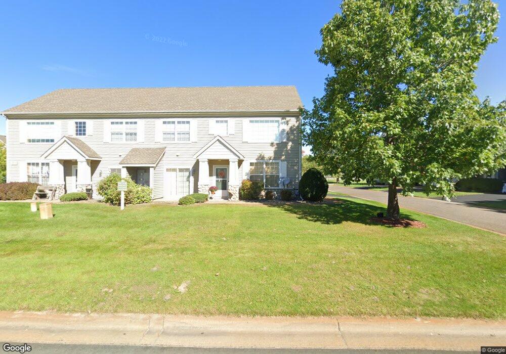
1921 Bluestem Ln Unit 23 Saint Paul, MN 55126
Estimated Value: $227,190 - $253,000
2
Beds
2
Baths
1,216
Sq Ft
$198/Sq Ft
Est. Value
About This Home
This home is located at 1921 Bluestem Ln Unit 23, Saint Paul, MN 55126 and is currently estimated at $240,298, approximately $197 per square foot. 1921 Bluestem Ln Unit 23 is a home located in Ramsey County with nearby schools including Pinewood Elementary School, Edgewood Middle School, and Hopkinton High School.
Ownership History
Date
Name
Owned For
Owner Type
Purchase Details
Closed on
Apr 28, 2017
Sold by
Januszewski Michael and Januszewski Amy
Bought by
Lillemo Kris and Lillemo Amy
Current Estimated Value
Home Financials for this Owner
Home Financials are based on the most recent Mortgage that was taken out on this home.
Original Mortgage
$124,720
Outstanding Balance
$103,348
Interest Rate
3.97%
Estimated Equity
$136,950
Purchase Details
Closed on
Apr 28, 2000
Sold by
The Rottlund Company Inc
Bought by
Overman Lynn
Create a Home Valuation Report for This Property
The Home Valuation Report is an in-depth analysis detailing your home's value as well as a comparison with similar homes in the area
Home Values in the Area
Average Home Value in this Area
Purchase History
| Date | Buyer | Sale Price | Title Company |
|---|---|---|---|
| Lillemo Kris | $160,624 | Burnet Title | |
| Overman Lynn | $117,600 | -- |
Source: Public Records
Mortgage History
| Date | Status | Borrower | Loan Amount |
|---|---|---|---|
| Open | Lillemo Kris | $124,720 |
Source: Public Records
Tax History Compared to Growth
Tax History
| Year | Tax Paid | Tax Assessment Tax Assessment Total Assessment is a certain percentage of the fair market value that is determined by local assessors to be the total taxable value of land and additions on the property. | Land | Improvement |
|---|---|---|---|---|
| 2025 | $2,762 | $225,700 | $50,000 | $175,700 |
| 2023 | $2,762 | $208,800 | $50,000 | $158,800 |
| 2022 | $2,540 | $217,000 | $50,000 | $167,000 |
| 2021 | $2,354 | $175,500 | $50,000 | $125,500 |
| 2020 | $2,526 | $165,800 | $50,000 | $115,800 |
| 2019 | $2,070 | $165,800 | $25,000 | $140,800 |
| 2018 | $2,036 | $144,600 | $25,000 | $119,600 |
| 2017 | $1,784 | $137,700 | $25,000 | $112,700 |
| 2016 | $1,868 | $0 | $0 | $0 |
| 2015 | $1,872 | $119,700 | $18,000 | $101,700 |
| 2014 | $1,748 | $0 | $0 | $0 |
Source: Public Records
Map
Nearby Homes
- 5713 Cabot Dr
- 5762 Schutta Rd
- 5601 Schutta Rd
- 1715 Hillview Rd
- 8504 Edison St NE
- 1588 Hall St
- 8798 Dunkirk Ct NE
- 2243 Lambert Ave
- 5591 Albert St
- 2956 Rice Creek Pkwy NE
- 3667 91st Dr NE
- 2557 County Road I
- 8718 Ghia St NE
- 8823 Fraizer St
- 2560 County Road I
- 3811 Restwood Rd
- 7767 Eastwood Rd
- 2550 Moundsview Dr Unit 49
- 2639 Lake Court Cir Unit 81
- 2466 Clearview Ave
- 1933 Bluestem Ln
- 1923 Bluestem Ln
- 1931 Bluestem Ln
- 1925 Bluestem Ln Unit 21
- 1929 Bluestem Ln Unit 18
- 1919 Bluestem Ln
- 1933 1933 Bluestem Ln
- 1929 1929 Bluestem Ln
- 1931 1931 Bluestem Ln
- 1927 1927 Bluestem Ln
- 1919 Bluestem Ln
- 1869 1869 Bluestem-Lane-
- 1917 Bluestem Ln Unit 28
- 1937 Bluestem Ln
- 1949 Bluestem Ln
- 1943 Bluestem Ln
- 1941 Bluestem Ln Unit 13
- 1939 Bluestem Ln
- 1935 Bluestem Ln Unit 16
- 1947 Bluestem Ln Unit 11