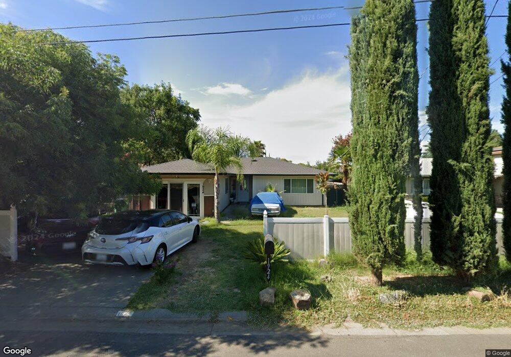
1924 Elizabeth Ave Corning, CA 96021
Estimated Value: $231,659 - $255,000
2
Beds
1
Bath
949
Sq Ft
$253/Sq Ft
Est. Value
About This Home
This home is located at 1924 Elizabeth Ave, Corning, CA 96021 and is currently estimated at $240,165, approximately $253 per square foot. 1924 Elizabeth Ave is a home located in Tehama County with nearby schools including West Street Elementary School, Maywood Middle School, and Corning High School.
Ownership History
Date
Name
Owned For
Owner Type
Purchase Details
Closed on
Jul 5, 2001
Sold by
Cole Richard and Cole Jimmie
Bought by
Romo Martin G and Romo Sara M
Current Estimated Value
Home Financials for this Owner
Home Financials are based on the most recent Mortgage that was taken out on this home.
Original Mortgage
$78,795
Outstanding Balance
$30,630
Interest Rate
7.26%
Mortgage Type
FHA
Estimated Equity
$209,535
Create a Home Valuation Report for This Property
The Home Valuation Report is an in-depth analysis detailing your home's value as well as a comparison with similar homes in the area
Home Values in the Area
Average Home Value in this Area
Purchase History
| Date | Buyer | Sale Price | Title Company |
|---|---|---|---|
| Romo Martin G | $79,500 | Northern California Title Co |
Source: Public Records
Mortgage History
| Date | Status | Borrower | Loan Amount |
|---|---|---|---|
| Open | Romo Martin G | $78,795 | |
| Closed | Romo Martin G | $4,770 |
Source: Public Records
Tax History Compared to Growth
Tax History
| Year | Tax Paid | Tax Assessment Tax Assessment Total Assessment is a certain percentage of the fair market value that is determined by local assessors to be the total taxable value of land and additions on the property. | Land | Improvement |
|---|---|---|---|---|
| 2025 | $1,186 | $121,777 | $26,151 | $95,626 |
| 2023 | $1,162 | $117,050 | $25,137 | $91,913 |
| 2022 | $1,144 | $114,756 | $24,645 | $90,111 |
| 2021 | $1,100 | $112,507 | $24,162 | $88,345 |
| 2020 | $1,111 | $111,355 | $23,915 | $87,440 |
| 2019 | $1,064 | $109,173 | $23,447 | $85,726 |
| 2018 | $1,065 | $107,034 | $22,988 | $84,046 |
| 2017 | $1,006 | $100,223 | $21,735 | $78,488 |
| 2016 | $908 | $95,450 | $20,700 | $74,750 |
| 2015 | $916 | $95,450 | $20,700 | $74,750 |
| 2014 | $790 | $83,000 | $18,000 | $65,000 |
Source: Public Records
Map
Nearby Homes
- 2018 Donnovan Ave
- 1013 Toomes Ave
- 0 Toomes Ave Unit SN24222817
- 2480 Houghton Ave
- 1195 West St
- 1495 South St
- 1586 Link St
- 1560 Highway 99 W
- 1414 Marin St
- 818 6th St
- 1162 5th Ave
- 1419 Yolo St
- 1938 Colusa St
- 0 Houghton Ave Unit 324045531
- 1980 Colusa St
- 330 Houghton Ave
- 1212 Fig Ln
- 1537 4th Ave
- 342 Rio Vista Ct
- 2098 North St
- 1914 Elizabeth Ave
- 1944 Elizabeth Ave
- 1894 Elizabeth Ave
- 1919 Scott Ave
- 1939 Scott Ave
- 1874 Elizabeth Ave
- 1887 Scott Ave
- 1891 Scott Ave Unit 1899 scott ave
- 1954 Elizabeth Ave
- 1913 Elizabeth Ave
- 1891 Elizabeth Ave
- 1927 Elizabeth Ave
- 1951 Scott Ave
- 1877 Scott Ave
- 1964 Elizabeth Ave
- 1939 Elizabeth Ave
- 1961 Scott Ave
- 1857 Scott Ave
- 1842 Elizabeth Ave
- 1951 Elizabeth Ave