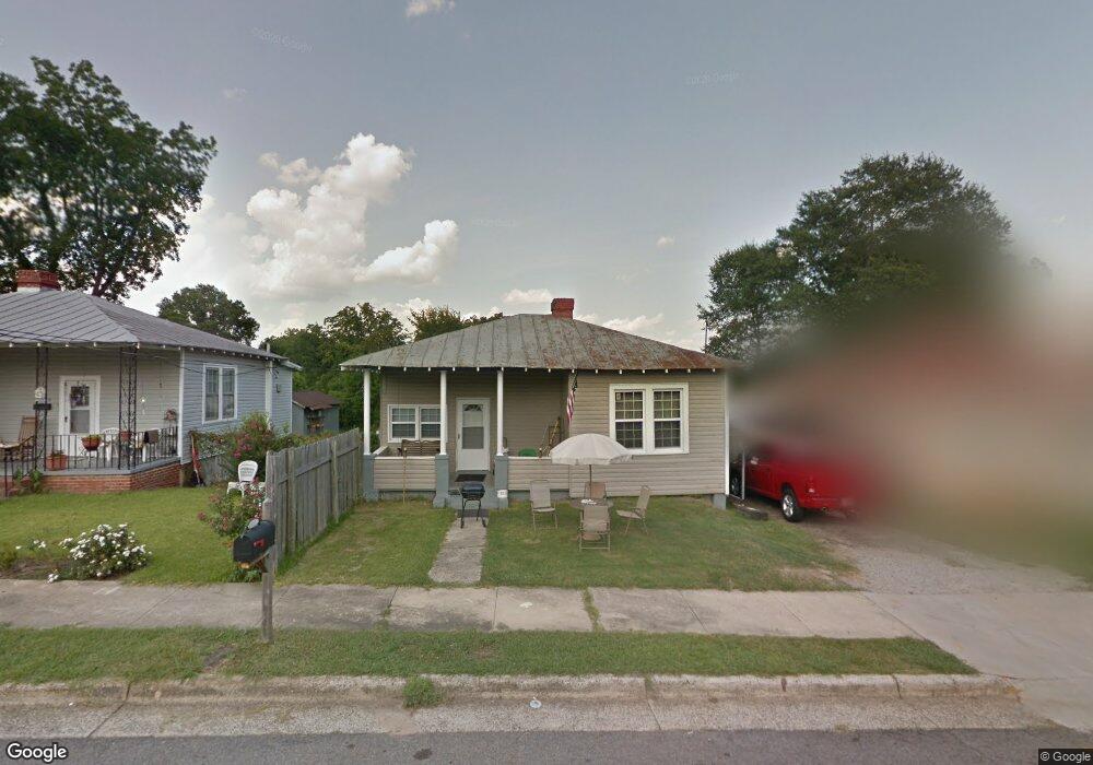
1925 Division St Augusta, GA 30904
West End NeighborhoodEstimated Value: $101,000 - $110,000
3
Beds
2
Baths
1,467
Sq Ft
$71/Sq Ft
Est. Value
About This Home
This home is located at 1925 Division St, Augusta, GA 30904 and is currently estimated at $104,388, approximately $71 per square foot. 1925 Division St is a home located in Richmond County with nearby schools including Lamar Elementary School, W.S. Hornsby Elementary School, and Johnson Magnet.
Ownership History
Date
Name
Owned For
Owner Type
Purchase Details
Closed on
Jul 21, 2008
Sold by
Thompson Craig and Warner Robin
Bought by
Thompson Tonya M
Current Estimated Value
Home Financials for this Owner
Home Financials are based on the most recent Mortgage that was taken out on this home.
Original Mortgage
$54,962
Outstanding Balance
$35,642
Interest Rate
6.43%
Mortgage Type
FHA
Estimated Equity
$68,746
Purchase Details
Closed on
Nov 10, 2003
Sold by
Woodridge Properties Llp
Bought by
Thompson Craig and Thompson Tonya
Home Financials for this Owner
Home Financials are based on the most recent Mortgage that was taken out on this home.
Original Mortgage
$21,388
Interest Rate
5.98%
Mortgage Type
Seller Take Back
Purchase Details
Closed on
Apr 20, 1999
Sold by
Nationscredit Financial Services Corp
Bought by
Woodridge Properties Llp
Purchase Details
Closed on
Feb 3, 1998
Sold by
Hobbs William C
Bought by
Nationscredit
Create a Home Valuation Report for This Property
The Home Valuation Report is an in-depth analysis detailing your home's value as well as a comparison with similar homes in the area
Home Values in the Area
Average Home Value in this Area
Purchase History
| Date | Buyer | Sale Price | Title Company |
|---|---|---|---|
| Thompson Tonya M | -- | None Available | |
| Thompson Craig | $21,400 | -- | |
| Thompson Craig | $21,400 | -- | |
| Woodridge Properties Llp | $14,650 | -- | |
| Woodridge Propertie | $14,600 | -- | |
| Nationscredit | $35,000 | -- | |
| .Nationscredit Finan | $29,900 | -- |
Source: Public Records
Mortgage History
| Date | Status | Borrower | Loan Amount |
|---|---|---|---|
| Open | Thompson Tonya M | $54,962 | |
| Previous Owner | Thompson Craig | $21,388 |
Source: Public Records
Tax History
| Year | Tax Paid | Tax Assessment Tax Assessment Total Assessment is a certain percentage of the fair market value that is determined by local assessors to be the total taxable value of land and additions on the property. | Land | Improvement |
|---|---|---|---|---|
| 2025 | $1,339 | $37,992 | $2,232 | $35,760 |
| 2024 | $1,339 | $26,348 | $2,232 | $24,116 |
| 2023 | $624 | $34,104 | $2,232 | $31,872 |
| 2022 | $952 | $25,986 | $2,232 | $23,754 |
| 2021 | $564 | $12,542 | $2,234 | $10,308 |
| 2020 | $618 | $14,308 | $4,000 | $10,308 |
| 2019 | $640 | $14,308 | $4,000 | $10,308 |
| 2018 | $643 | $14,308 | $4,000 | $10,308 |
| 2017 | $641 | $14,308 | $4,000 | $10,308 |
| 2016 | $641 | $14,308 | $4,000 | $10,308 |
| 2015 | $644 | $14,308 | $4,000 | $10,308 |
| 2014 | $671 | $15,043 | $4,000 | $11,043 |
Source: Public Records
Map
Nearby Homes
- 1923 Division St
- 1927 Division St
- 1921 Division St
- 1929 Division St
- 1931 Division St
- 0 Curry St Unit 5437983-9558951
- 0 Curry St Unit 5437983-8094865
- 0 Curry St Unit 5437983-11313877
- 102 Curry St
- 1919 Division St
- 2001 Division St
- 106 Curry St
- 1917 Division St
- 2003 Division St
- 2010 Division St
- 105 Curry St
- 108 Curry St
- 2003 Clark St
- 2005 Division St
- 1920 Division St
Your Personal Tour Guide
Ask me questions while you tour the home.