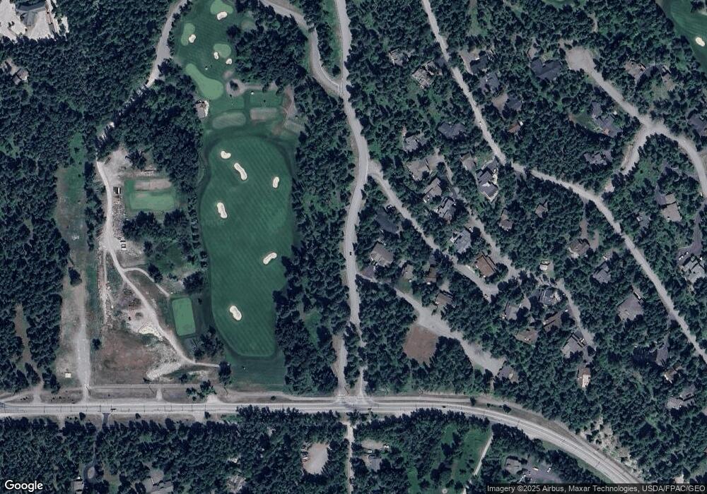
1925 Murdock Ln Whitefish, MT 59937
Estimated Value: $1,454,000 - $1,843,000
3
Beds
3
Baths
2,488
Sq Ft
$646/Sq Ft
Est. Value
About This Home
This home is located at 1925 Murdock Ln, Whitefish, MT 59937 and is currently estimated at $1,606,905, approximately $645 per square foot. 1925 Murdock Ln is a home located in Flathead County with nearby schools including L.A. Muldown School, Whitefish Middle School, and Whitefish High School.
Ownership History
Date
Name
Owned For
Owner Type
Purchase Details
Closed on
Aug 10, 2020
Sold by
Davis Bradford and Davis Dana
Bought by
Davis Bradford and Davis Dana
Current Estimated Value
Home Financials for this Owner
Home Financials are based on the most recent Mortgage that was taken out on this home.
Original Mortgage
$430,800
Outstanding Balance
$305,894
Interest Rate
3%
Mortgage Type
New Conventional
Estimated Equity
$1,301,011
Purchase Details
Closed on
May 6, 2019
Sold by
Davis Bradford C
Bought by
Davis Bradford and Davis Dana
Purchase Details
Closed on
Oct 16, 2015
Sold by
Thomas Richard R and Waugh Janelle M
Bought by
Davis Bradford C
Home Financials for this Owner
Home Financials are based on the most recent Mortgage that was taken out on this home.
Original Mortgage
$472,000
Interest Rate
3.75%
Mortgage Type
Adjustable Rate Mortgage/ARM
Create a Home Valuation Report for This Property
The Home Valuation Report is an in-depth analysis detailing your home's value as well as a comparison with similar homes in the area
Home Values in the Area
Average Home Value in this Area
Purchase History
| Date | Buyer | Sale Price | Title Company |
|---|---|---|---|
| Davis Bradford | -- | None Available | |
| Davis Bradford | -- | None Available | |
| Davis Bradford C | -- | First American Title Company |
Source: Public Records
Mortgage History
| Date | Status | Borrower | Loan Amount |
|---|---|---|---|
| Open | Davis Bradford | $430,800 | |
| Closed | Davis Bradford C | $472,000 |
Source: Public Records
Tax History Compared to Growth
Tax History
| Year | Tax Paid | Tax Assessment Tax Assessment Total Assessment is a certain percentage of the fair market value that is determined by local assessors to be the total taxable value of land and additions on the property. | Land | Improvement |
|---|---|---|---|---|
| 2025 | $5,784 | $1,505,700 | $0 | $0 |
| 2024 | $5,420 | $1,083,200 | $0 | $0 |
| 2023 | $5,625 | $1,083,200 | $0 | $0 |
| 2022 | $5,305 | $706,000 | $0 | $0 |
| 2021 | $5,831 | $706,000 | $0 | $0 |
| 2020 | $5,515 | $662,600 | $0 | $0 |
| 2019 | $5,933 | $662,600 | $0 | $0 |
| 2018 | $5,605 | $613,500 | $0 | $0 |
| 2017 | $5,235 | $613,500 | $0 | $0 |
| 2016 | $4,419 | $509,800 | $0 | $0 |
| 2015 | $4,469 | $509,800 | $0 | $0 |
| 2014 | $4,161 | $282,967 | $0 | $0 |
Source: Public Records
Map
Nearby Homes
- 1922 Sun Crest Dr Unit 1
- 1992 Ridge Crest Dr
- 1963 Ridge Crest Dr
- 1939 Sun Crest Dr
- 122 Kinnikinnik Cir
- NHN E Lakeshore Dr
- 2120 Iron Horse Dr Unit 11
- 176 S Shooting Star Cir
- 2316 Houston Point Dr
- 156 Duff Ln
- 231 Arrowhead Dr
- 174 Reservoir Rd
- 2130 Houston Dr
- 1400 Wisconsin Ave Unit 108
- 1400 Wisconsin Ave Unit 308
- 113 S Prairiesmoke Cir
- 1380 Wisconsin Ave Unit Room 341
- 292 Reservoir Rd
- 105 Huckleberry Ln
- 3023 Iron Horse Dr
- 1910 Sun Crest Dr
- 1914 Sun Crest Dr
- 1916 Sun Crest Dr
- 1987 Ridge Crest Dr
- 1987 Ridge Crest Dr
- 1987 Ridge Crest Dr Unit 1
- 1987 Ridge Crest #1 Dr
- 1920 Sun Crest Dr
- 1918 Sun Crest Dr
- 1991 Ridge Crest Dr
- 1919 Sun Crest Dr
- 1922 Sun Crest Dr Unit 1
- 1924 Sun Crest Dr
- 1922 Sun Crest Dr
- 1922 Sun Crest Dr Unit 1
- 1979 Ridge Crest Dr
- 1979 Ridge Crest Dr Unit B
- 1979 Ridge Crest Dr Unit A
- 1979 Ridge Crest Dr Unit A
- 1975 Ridge Crest Dr
