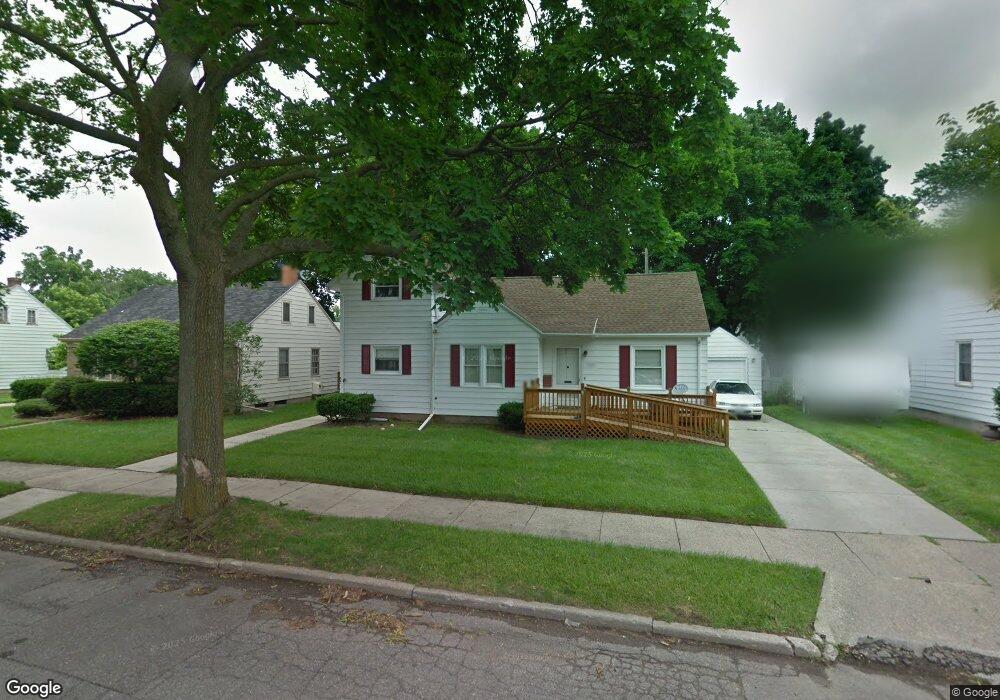
1927 Devonshire Ave Lansing, MI 48910
Clifford Park NeighborhoodEstimated Value: $189,000 - $209,000
--
Bed
--
Bath
1,310
Sq Ft
$150/Sq Ft
Est. Value
About This Home
This home is located at 1927 Devonshire Ave, Lansing, MI 48910 and is currently estimated at $195,917, approximately $149 per square foot. 1927 Devonshire Ave is a home located in Ingham County with nearby schools including Lyons Elementary School, Pattengill Academy, and Eastern High School.
Ownership History
Date
Name
Owned For
Owner Type
Purchase Details
Closed on
May 1, 2025
Sold by
Metevier Thomas Charles
Bought by
Metevier Thomas Charles and Sherwood Management Ventures
Current Estimated Value
Purchase Details
Closed on
Jul 6, 2006
Sold by
Miner Frances T and Hand Leta M
Bought by
Metevier Tom
Home Financials for this Owner
Home Financials are based on the most recent Mortgage that was taken out on this home.
Original Mortgage
$65,000
Interest Rate
6.72%
Mortgage Type
Purchase Money Mortgage
Create a Home Valuation Report for This Property
The Home Valuation Report is an in-depth analysis detailing your home's value as well as a comparison with similar homes in the area
Home Values in the Area
Average Home Value in this Area
Purchase History
| Date | Buyer | Sale Price | Title Company |
|---|---|---|---|
| Metevier Thomas Charles | -- | None Listed On Document | |
| Metevier Tom | $120,000 | None Available |
Source: Public Records
Mortgage History
| Date | Status | Borrower | Loan Amount |
|---|---|---|---|
| Previous Owner | Metevier Tom | $65,000 |
Source: Public Records
Tax History Compared to Growth
Tax History
| Year | Tax Paid | Tax Assessment Tax Assessment Total Assessment is a certain percentage of the fair market value that is determined by local assessors to be the total taxable value of land and additions on the property. | Land | Improvement |
|---|---|---|---|---|
| 2025 | $3,900 | $102,900 | $10,000 | $92,900 |
| 2024 | $31 | $93,700 | $10,000 | $83,700 |
| 2023 | $3,655 | $82,800 | $10,000 | $72,800 |
| 2022 | $3,293 | $71,700 | $10,100 | $61,600 |
| 2021 | $3,224 | $66,700 | $8,100 | $58,600 |
| 2020 | $3,205 | $66,400 | $8,100 | $58,300 |
| 2019 | $3,074 | $61,600 | $8,100 | $53,500 |
| 2018 | $2,878 | $54,900 | $8,100 | $46,800 |
| 2017 | $2,756 | $54,900 | $8,100 | $46,800 |
| 2016 | $2,636 | $51,500 | $8,100 | $43,400 |
| 2015 | $2,636 | $49,100 | $16,181 | $32,919 |
| 2014 | $2,636 | $47,200 | $18,878 | $28,322 |
Source: Public Records
Map
Nearby Homes
- 2011 Clifton Ave
- 2215 Alpha St
- 2201 S Pennsylvania Ave
- 1221 Pershing Dr
- 918 Mckim Ave
- 1620 Clifton Ave
- 2300 Sunnyside Ave
- 2237 Sunnyside Ave
- 2309 S Pennsylvania Ave
- 2338 Harding Ave
- 0 E Mount Hope Ave
- 904 Pacific Ave
- 2340 S Pennsylvania Ave
- 1529 S Pennsylvania Ave
- 704 Mckim Ave
- 2208 Lyons Ave
- 707 Isbell St
- 701 Tisdale Ave
- 1423 Pontiac St
- 1437 Ada St
- 1921 Devonshire Ave
- 1931 Devonshire Ave
- 1926 Harding Ave
- 1930 Harding Ave
- 1920 Harding Ave
- 1915 Devonshire Ave
- 1932 Harding Ave
- 1924 Devonshire Ave
- 1930 Devonshire Ave
- 1916 Harding Ave
- 1920 Devonshire Ave
- 1912 Harding Ave
- 2001 Devonshire Ave
- 2001 - 2003 Devonshire Ave
- 1909 Devonshire Ave
- 1914 Devonshire Ave
- 2000 Devonshire Ave
- 2000 Harding Ave
- 1220 E Mount Hope Ave
- 2004 Harding Ave