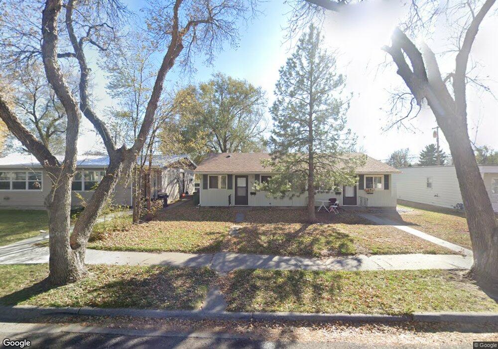
1930 Alderson Ave Billings, MT 59102
West End NeighborhoodEstimated Value: $243,429 - $394,000
8
Beds
4
Baths
1,584
Sq Ft
$200/Sq Ft
Est. Value
About This Home
This home is located at 1930 Alderson Ave, Billings, MT 59102 and is currently estimated at $316,357, approximately $199 per square foot. 1930 Alderson Ave is a home located in Yellowstone County with nearby schools including Burlington School, Will James Junior High School, and Billings West High School.
Ownership History
Date
Name
Owned For
Owner Type
Purchase Details
Closed on
Dec 22, 2006
Sold by
Amen Michael A and Amen Cheryll K
Bought by
Blue Scott A
Current Estimated Value
Home Financials for this Owner
Home Financials are based on the most recent Mortgage that was taken out on this home.
Original Mortgage
$130,400
Outstanding Balance
$83,993
Interest Rate
7.75%
Mortgage Type
New Conventional
Estimated Equity
$232,364
Purchase Details
Closed on
Aug 19, 2005
Sold by
Pence Cathleen A
Bought by
Amen Michael A and Amen Cheryl K
Home Financials for this Owner
Home Financials are based on the most recent Mortgage that was taken out on this home.
Original Mortgage
$95,920
Interest Rate
5.61%
Mortgage Type
New Conventional
Create a Home Valuation Report for This Property
The Home Valuation Report is an in-depth analysis detailing your home's value as well as a comparison with similar homes in the area
Home Values in the Area
Average Home Value in this Area
Purchase History
| Date | Buyer | Sale Price | Title Company |
|---|---|---|---|
| Blue Scott A | -- | None Available | |
| Amen Michael A | -- | None Available |
Source: Public Records
Mortgage History
| Date | Status | Borrower | Loan Amount |
|---|---|---|---|
| Open | Blue Scott A | $130,400 | |
| Previous Owner | Amen Michael A | $95,920 |
Source: Public Records
Tax History Compared to Growth
Tax History
| Year | Tax Paid | Tax Assessment Tax Assessment Total Assessment is a certain percentage of the fair market value that is determined by local assessors to be the total taxable value of land and additions on the property. | Land | Improvement |
|---|---|---|---|---|
| 2025 | $2,131 | $239,500 | $36,366 | $203,134 |
| 2024 | $2,131 | $216,200 | $35,655 | $180,545 |
| 2023 | $2,126 | $216,200 | $35,655 | $180,545 |
| 2022 | $1,639 | $173,600 | $0 | $0 |
| 2021 | $1,808 | $173,600 | $0 | $0 |
| 2020 | $1,743 | $155,900 | $0 | $0 |
| 2019 | $1,664 | $155,900 | $0 | $0 |
| 2018 | $1,584 | $145,200 | $0 | $0 |
| 2017 | $1,538 | $145,200 | $0 | $0 |
| 2016 | $1,357 | $128,400 | $0 | $0 |
| 2015 | $1,327 | $128,400 | $0 | $0 |
| 2014 | $1,285 | $66,250 | $0 | $0 |
Source: Public Records
Map
Nearby Homes
- 1834 Belvedere Dr
- 1116 Lendel Ln
- 2013 Clark Ave
- 2043 Lewis Ave
- 1815 Clark Ave
- 1607 21st St W
- 2124 Lewis Ave
- 2204 Alderson Ave Unit C
- 1720 Lewis Ave
- 1704 Burlington Ave
- 2035 Avenue D
- 2230 Avenue C
- 2219 Avenue B
- 1640 Lewis Ave
- 2260 Avenue C
- 2300 Clark Ave
- 2332 Alderson Ave
- 1539 Burlington Ave
- 621 Nelson Dr
- 1540 Clark Ave
- 1926 Alderson Ave
- 1936 Alderson Ave
- 1922 Alderson Ave
- 1929 Belvedere Dr
- 1925 Belvedere Dr
- 1933 Belvedere Dr
- 1946 Alderson Ave
- 1921 Belvedere Dr
- 1937 Belvedere Dr
- 1916 Alderson Ave
- 1925 Alderson Ave
- 1935 Alderson Ave
- 1941 Belvedere Dr
- 1915 Belvedere Dr
- 1919 Alderson Ave
- 1914 Alderson Ave
- 1943 Alderson Ave
- 1911 Belvedere Dr
- 1913 Alderson Ave
- 1947 Alderson Ave