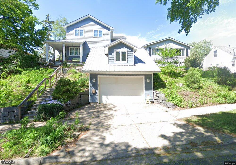
1937 Rome Ave Saint Paul, MN 55116
Highland Park NeighborhoodEstimated Value: $647,000 - $759,000
4
Beds
3
Baths
2,209
Sq Ft
$322/Sq Ft
Est. Value
About This Home
This home is located at 1937 Rome Ave, Saint Paul, MN 55116 and is currently estimated at $711,547, approximately $322 per square foot. 1937 Rome Ave is a home located in Ramsey County with nearby schools including Horace Mann School, Highland Park Middle School, and Highland Park Senior High.
Ownership History
Date
Name
Owned For
Owner Type
Purchase Details
Closed on
Jun 14, 2002
Sold by
Banning Linda J
Bought by
Rydbeck Joel A and Rydbeck Rachael J
Current Estimated Value
Purchase Details
Closed on
Apr 27, 2001
Sold by
Woodard Jason
Bought by
Banning Linda J
Purchase Details
Closed on
Aug 26, 1999
Sold by
Steininger Elizabeth
Bought by
Woodard Jason E and Woodard James E
Create a Home Valuation Report for This Property
The Home Valuation Report is an in-depth analysis detailing your home's value as well as a comparison with similar homes in the area
Home Values in the Area
Average Home Value in this Area
Purchase History
| Date | Buyer | Sale Price | Title Company |
|---|---|---|---|
| Rydbeck Joel A | $206,000 | -- | |
| Banning Linda J | $175,000 | -- | |
| Woodard Jason E | $140,500 | -- |
Source: Public Records
Tax History Compared to Growth
Tax History
| Year | Tax Paid | Tax Assessment Tax Assessment Total Assessment is a certain percentage of the fair market value that is determined by local assessors to be the total taxable value of land and additions on the property. | Land | Improvement |
|---|---|---|---|---|
| 2025 | $10,388 | $677,700 | $201,400 | $476,300 |
| 2023 | $10,388 | $639,800 | $201,400 | $438,400 |
| 2022 | $10,082 | $602,100 | $201,400 | $400,700 |
| 2021 | $8,804 | $593,000 | $201,400 | $391,600 |
| 2020 | $9,128 | $554,200 | $201,400 | $352,800 |
| 2019 | $8,936 | $532,100 | $201,400 | $330,700 |
| 2018 | $8,578 | $521,900 | $201,400 | $320,500 |
| 2017 | $8,252 | $509,300 | $201,400 | $307,900 |
| 2016 | $7,904 | $0 | $0 | $0 |
| 2015 | $7,844 | $477,000 | $173,600 | $303,400 |
| 2014 | $3,932 | $0 | $0 | $0 |
Source: Public Records
Map
Nearby Homes
- 1841 W Saunders Ave
- 2046 Montreal Ave
- 1941 Ford Pkwy Unit 102
- 1075 Saint Paul Ave
- 1759 Montreal Ave
- 1752 Bohland Ave
- 1778 Ford Pkwy
- 1776 Ford Pkwy
- 1065 Colby St
- 896 Mississippi River Blvd S
- 878 Mississippi River Blvd S
- 1640 Bohland Ave
- 1913 Morgan Ave
- 875 Falls Passage W Unit C
- 1626 Bohland Ave
- 870 Mount Curve Blvd Unit L
- 909 Mount Curve Blvd Unit F
- 909 Mount Curve Blvd Unit I
- 906 S Woodlawn Ave Unit H
- 906 S Woodlawn Ave Unit E
- 1941 W Rome Ave
- 1931 Rome Ave
- 1945 Rome Ave
- 1945 Rome (Lot 7) Ave
- 1945 Rome (Lot 7) Camp
- 1941 Rome (Lot 8) Ave
- 1925 Rome Ave
- 1949 Rome Ave
- 1919 Rome Ave
- 1930 Saunders Ave
- 1926 Saunders Ave
- 1934 Saunders Ave
- 1922 Saunders Ave
- 1953 Rome Ave
- 1917 Rome Ave
- 1940 Rome Ave
- 1934 Rome Ave
- 1942 Saunders Ave
- 1918 Saunders Ave
- 1946 Rome Ave