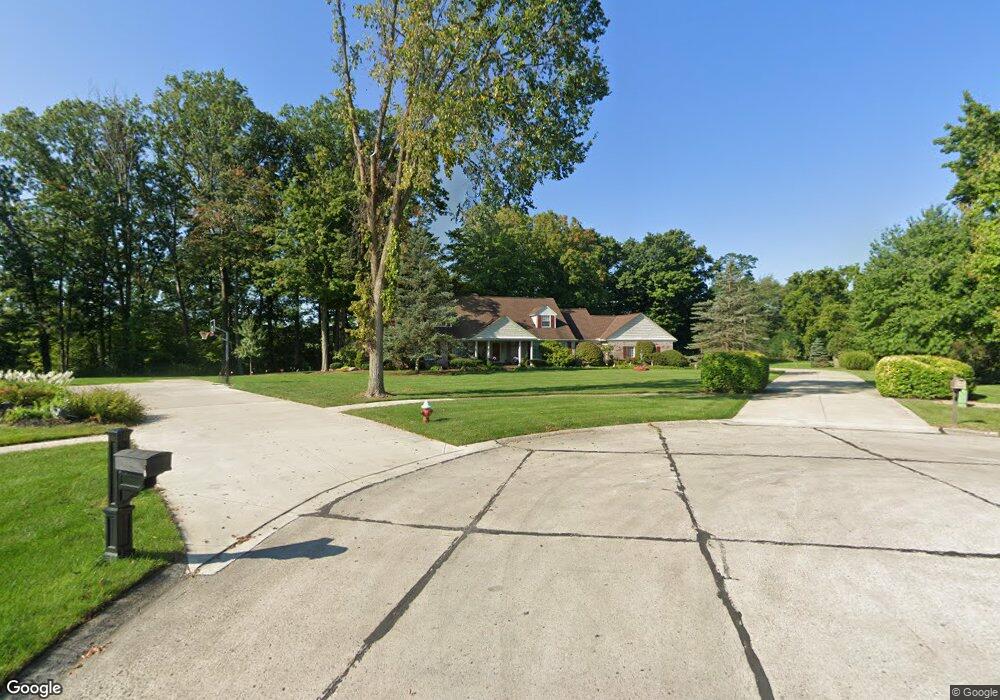
194 Windbrook Ct Elyria, OH 44035
Estimated Value: $394,000 - $582,000
4
Beds
4
Baths
8,836
Sq Ft
$55/Sq Ft
Est. Value
About This Home
This home is located at 194 Windbrook Ct, Elyria, OH 44035 and is currently estimated at $489,040, approximately $55 per square foot. 194 Windbrook Ct is a home located in Lorain County with nearby schools including Windsor Elementary School, Westwood Middle School, and Elyria High School.
Ownership History
Date
Name
Owned For
Owner Type
Purchase Details
Closed on
Jan 9, 2006
Sold by
Russert John and Russert Marie
Bought by
Russert John W and Russert Marie E
Current Estimated Value
Purchase Details
Closed on
Jun 22, 2000
Sold by
Yost Dale P and Yost Catherine
Bought by
Yost Dale P and Yost Catherine
Purchase Details
Closed on
Aug 3, 1999
Sold by
Yost Family Partnership
Bought by
Yost Dale P and Yost Catherine A
Create a Home Valuation Report for This Property
The Home Valuation Report is an in-depth analysis detailing your home's value as well as a comparison with similar homes in the area
Home Values in the Area
Average Home Value in this Area
Purchase History
| Date | Buyer | Sale Price | Title Company |
|---|---|---|---|
| Russert John W | -- | None Available | |
| Russert Marie E | -- | None Available | |
| Yost Dale P | -- | Lorain County Title Co Inc | |
| Yost Dale P | -- | Lorain County Title Co Inc |
Source: Public Records
Tax History
| Year | Tax Paid | Tax Assessment Tax Assessment Total Assessment is a certain percentage of the fair market value that is determined by local assessors to be the total taxable value of land and additions on the property. | Land | Improvement |
|---|---|---|---|---|
| 2024 | $7,346 | $165,029 | $19,765 | $145,264 |
| 2023 | $6,907 | $135,905 | $30,527 | $105,378 |
| 2022 | $6,904 | $135,905 | $30,527 | $105,378 |
| 2021 | $6,921 | $135,905 | $30,527 | $105,378 |
| 2020 | $6,831 | $120,380 | $27,040 | $93,340 |
| 2019 | $6,788 | $120,380 | $27,040 | $93,340 |
| 2018 | $6,708 | $120,380 | $27,040 | $93,340 |
| 2017 | $6,615 | $112,830 | $25,860 | $86,970 |
| 2016 | $6,528 | $112,830 | $25,860 | $86,970 |
| 2015 | $6,114 | $112,830 | $25,860 | $86,970 |
| 2014 | $6,140 | $114,540 | $26,250 | $88,290 |
| 2013 | $6,082 | $114,540 | $26,250 | $88,290 |
Source: Public Records
Map
Nearby Homes
- 122 Haydens Arbor
- 114 Timberlane Dr
- 223 Naples Dr
- 308 Loyola Dr
- 257 Windward Dr
- 172 Loyola Dr
- 145 Crestview Dr
- 2430 W River Rd N
- 117 Woodview Dr
- 372 Briar Lake Dr
- 5193 Liberty Ave
- 416 Deer Crossing
- 236 Northfield Dr
- 110 Edgefield Dr
- 165 Meadow Dr
- 4510 Riverside Dr
- 4429 Norfolk Ave
- V/L Rear Land Unit 1
- V/L Rear Land Unit 2
- 4617 Andover Ave
- 187 Windbrook Ct
- 184 Windbrook Ct
- 193 Windbrook Ct
- 178 Windbrook Ct
- 179 Windbrook Ct
- 166 Windbrook Ct
- 173 Windbrook Ct
- 167 Windbrook Ct
- 161 Windbrook Ct
- 154 Windbrook Ct
- 155 Windbrook Ct
- 148 Windbrook Ct
- 112 Deerfield Ct
- 4660 Lucas Ct
- 6099 Ford Rd
- 6095 Ford Rd
- 140 Windbrook Ct
- 6067 Ford Rd
- 118 Deerfield Ct
- 6041 Ford Rd
Your Personal Tour Guide
Ask me questions while you tour the home.