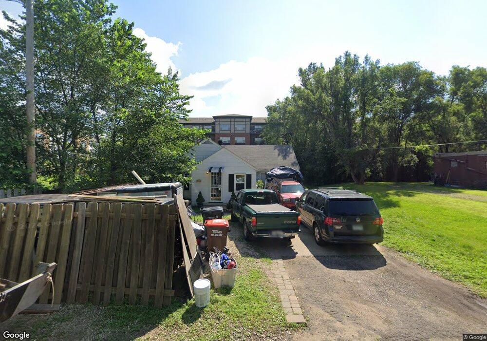
1940 Atlantic St Saint Paul, MN 55109
Gladstone NeighborhoodEstimated Value: $214,000 - $281,000
2
Beds
1
Bath
760
Sq Ft
$307/Sq Ft
Est. Value
About This Home
This home is located at 1940 Atlantic St, Saint Paul, MN 55109 and is currently estimated at $233,640, approximately $307 per square foot. 1940 Atlantic St is a home located in Ramsey County with nearby schools including Weaver Elementary School, John Glenn Middle School, and St Jerome Elementary School.
Ownership History
Date
Name
Owned For
Owner Type
Purchase Details
Closed on
Aug 8, 2016
Sold by
Kessenich Jeslie Jeslie
Bought by
Strutz Dana Dana
Current Estimated Value
Home Financials for this Owner
Home Financials are based on the most recent Mortgage that was taken out on this home.
Original Mortgage
$111,000
Outstanding Balance
$88,422
Interest Rate
3.43%
Estimated Equity
$145,218
Purchase Details
Closed on
Aug 14, 2000
Sold by
Thompson Charles D
Bought by
Kunde William Neil and Stickland Geoffrey
Purchase Details
Closed on
Nov 4, 1999
Sold by
Roehling Wayne G
Bought by
Thompson Charles David
Create a Home Valuation Report for This Property
The Home Valuation Report is an in-depth analysis detailing your home's value as well as a comparison with similar homes in the area
Home Values in the Area
Average Home Value in this Area
Purchase History
| Date | Buyer | Sale Price | Title Company |
|---|---|---|---|
| Strutz Dana Dana | $112,000 | -- | |
| Kunde William Neil | $79,900 | -- | |
| Thompson Charles David | $70,000 | -- |
Source: Public Records
Mortgage History
| Date | Status | Borrower | Loan Amount |
|---|---|---|---|
| Open | Strutz Dana Dana | $111,000 |
Source: Public Records
Tax History Compared to Growth
Tax History
| Year | Tax Paid | Tax Assessment Tax Assessment Total Assessment is a certain percentage of the fair market value that is determined by local assessors to be the total taxable value of land and additions on the property. | Land | Improvement |
|---|---|---|---|---|
| 2025 | $2,908 | $228,000 | $36,300 | $191,700 |
| 2023 | $2,908 | $219,400 | $36,300 | $183,100 |
| 2022 | $2,350 | $202,600 | $36,300 | $166,300 |
| 2021 | $2,132 | $175,400 | $36,300 | $139,100 |
| 2020 | $2,170 | $164,600 | $36,300 | $128,300 |
| 2019 | $1,652 | $157,500 | $36,300 | $121,200 |
| 2018 | $1,498 | $128,600 | $36,300 | $92,300 |
| 2017 | $1,024 | $116,700 | $36,300 | $80,400 |
| 2016 | $836 | $0 | $0 | $0 |
| 2015 | $688 | $77,200 | $33,300 | $43,900 |
| 2014 | $694 | $0 | $0 | $0 |
Source: Public Records
Map
Nearby Homes
- 1201 Frost Ave
- 1869 Birmingham St
- 1779 Frank St
- 1730 Atlantic St
- 1740 English St
- 1940 Barclay St
- 1854 Barclay St
- 1875 E Shore Dr Unit 302
- 1435 Price Ave
- 1639 Clarence St
- 1467 County Road B E
- 1672 Manton St
- 1984 Prosperity Rd
- 1567 Atlantic St
- 1509 Sandhurst Ave E
- 1562 Chamber St
- 2020 Arcade St
- 1849 Kennard St
- 1627 Christie Place
- 1937 Flandrau St
- XXX Frost Ave
- 1247 Frost Ave
- 1949 Atlantic St
- 1221 Frost Ave
- 1955 English St
- 1957 English St
- 1957 English St
- 1236 Ryan Ave E
- 1244 Ryan Ave E
- 1230 Ryan Ave E
- 1250 Ryan Ave E
- 1224 Ryan Ave E
- 1258 Ryan Ave E
- 1216 Ryan Ave E
- 1264 Ryan Ave E
- 1210 Ryan Ave E
- 1270 Ryan Ave E
- 1202 Ryan Ave E
- 1187 Frost Ave
- 1233 Ryan Ave E