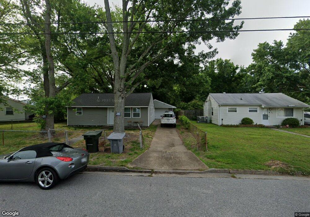
1942 Kensington Dr Hampton, VA 23663
Buckroe Beach NeighborhoodEstimated Value: $174,000 - $204,000
3
Beds
1
Bath
768
Sq Ft
$252/Sq Ft
Est. Value
About This Home
This home is located at 1942 Kensington Dr, Hampton, VA 23663 and is currently estimated at $193,493, approximately $251 per square foot. 1942 Kensington Dr is a home located in Hampton City with nearby schools including Benjamin Syms Middle School, Phoebus High School, and Gloria Dei Lutheran School.
Ownership History
Date
Name
Owned For
Owner Type
Purchase Details
Closed on
Dec 28, 2017
Sold by
Prolific Properties Llc A Virginia Limit
Bought by
Wee Three Rentals Llc A Virginia Limited
Current Estimated Value
Purchase Details
Closed on
Oct 1, 2015
Sold by
Deutsche Bank National Trust Company As
Bought by
Prolific Properties Llc
Home Financials for this Owner
Home Financials are based on the most recent Mortgage that was taken out on this home.
Original Mortgage
$20,000
Interest Rate
3.92%
Mortgage Type
New Conventional
Purchase Details
Closed on
Feb 3, 2015
Sold by
Atlantic Trustee Services Llc and Clements Robert L
Bought by
Deutsche Bank National Trust C
Create a Home Valuation Report for This Property
The Home Valuation Report is an in-depth analysis detailing your home's value as well as a comparison with similar homes in the area
Home Values in the Area
Average Home Value in this Area
Purchase History
| Date | Buyer | Sale Price | Title Company |
|---|---|---|---|
| Wee Three Rentals Llc A Virginia Limited | $64,000 | Attorney | |
| Prolific Properties Llc | $20,000 | None Available | |
| Deutsche Bank National Trust C | $124,599 | -- |
Source: Public Records
Mortgage History
| Date | Status | Borrower | Loan Amount |
|---|---|---|---|
| Previous Owner | Prolific Properties Llc | $20,000 |
Source: Public Records
Tax History
| Year | Tax Paid | Tax Assessment Tax Assessment Total Assessment is a certain percentage of the fair market value that is determined by local assessors to be the total taxable value of land and additions on the property. | Land | Improvement |
|---|---|---|---|---|
| 2025 | $2,147 | $185,000 | $55,000 | $130,000 |
| 2024 | $1,889 | $164,300 | $55,000 | $109,300 |
| 2023 | $1,870 | $161,200 | $55,000 | $106,200 |
| 2022 | $1,559 | $132,100 | $50,000 | $82,100 |
| 2021 | $1,658 | $123,200 | $42,000 | $81,200 |
| 2020 | $1,302 | $105,000 | $38,300 | $66,700 |
| 2019 | $1,241 | $100,100 | $38,300 | $61,800 |
| 2018 | $1,295 | $95,700 | $38,300 | $57,400 |
| 2017 | $1,281 | $0 | $0 | $0 |
| 2016 | $1,281 | $95,700 | $0 | $0 |
| 2015 | $1,281 | $0 | $0 | $0 |
| 2014 | $84 | $95,700 | $38,300 | $57,400 |
Source: Public Records
Map
Nearby Homes
- 1926 Somerville Dr
- 1923 Rawood Dr
- 2013 Whitman Place
- 1915 Long Green Ln
- 1909 Long Green Ln
- 706 Grimes Rd
- 2101 Andrews Blvd
- 1912 Beall Dr
- 1814 Somerville Dr
- 1845 Kensington Dr
- 2007 Egger Cir
- 2013 Egger Cir
- 1527 Grove St
- 1530 Morgan Dr
- 733 Burgess Ave
- 731 Burgess Ave
- 604 Old Buckroe Rd
- 531 Price St
- 438 Shelton Rd
- 213 Ireland St
- 1940 Kensington Dr
- 1944 Kensington Dr
- 707 Redford Rd
- 1938 Kensington Dr
- 705 Redford Rd
- 1943 Kensington Dr
- 1941 Kensington Dr
- 1939 Kensington Dr
- 1936 Kensington Dr
- 1937 Kensington Dr
- 703 Redford Rd
- 2000 Kensington Dr
- 710 Redford Rd
- 803 Redford Rd
- 708 Redford Rd
- 1934 Kensington Dr
- 1935 Kensington Dr
- 2001 Kensington Dr
- 1938 Rawood Dr
- 1936 Rawood Dr