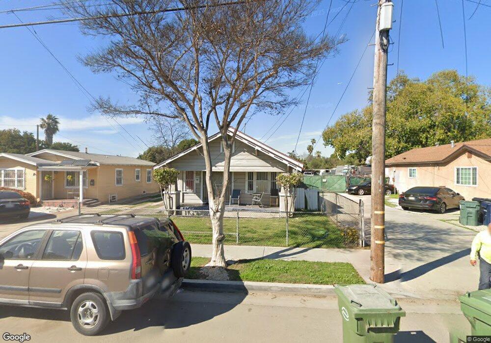
1943 E 126th St Compton, CA 90222
Estimated Value: $553,488 - $644,000
2
Beds
1
Bath
992
Sq Ft
$612/Sq Ft
Est. Value
About This Home
This home is located at 1943 E 126th St, Compton, CA 90222 and is currently estimated at $606,622, approximately $611 per square foot. 1943 E 126th St is a home located in Los Angeles County with nearby schools including Martin Luther King Elementary School, Bunche Middle School, and Centennial High School.
Ownership History
Date
Name
Owned For
Owner Type
Purchase Details
Closed on
Jul 20, 2011
Sold by
Kimbell Charlotte B and Alvin N Butler Living Trust
Bought by
Butler Louie
Current Estimated Value
Purchase Details
Closed on
Oct 9, 2008
Sold by
Weaver Winfred and The Lucille M Weaver Living Tr
Bought by
Kimbell Charlotte and The Alvin N Butler Living Trust
Purchase Details
Closed on
Jun 14, 2001
Sold by
Butler Alvin N and Weaver Lucille M
Bought by
Butler Alvin N and Alvin N Butler Living Trust
Create a Home Valuation Report for This Property
The Home Valuation Report is an in-depth analysis detailing your home's value as well as a comparison with similar homes in the area
Home Values in the Area
Average Home Value in this Area
Purchase History
| Date | Buyer | Sale Price | Title Company |
|---|---|---|---|
| Butler Louie | -- | None Available | |
| Kimbell Charlotte | -- | First American Title Company | |
| Butler Alvin N | -- | -- |
Source: Public Records
Tax History
| Year | Tax Paid | Tax Assessment Tax Assessment Total Assessment is a certain percentage of the fair market value that is determined by local assessors to be the total taxable value of land and additions on the property. | Land | Improvement |
|---|---|---|---|---|
| 2025 | $2,872 | $185,613 | $138,243 | $47,370 |
| 2024 | $2,872 | $181,975 | $135,533 | $46,442 |
| 2023 | $2,838 | $178,408 | $132,876 | $45,532 |
| 2022 | $2,661 | $174,911 | $130,271 | $44,640 |
| 2021 | $2,700 | $171,482 | $127,717 | $43,765 |
| 2019 | $2,627 | $166,398 | $123,930 | $42,468 |
| 2018 | $2,547 | $163,136 | $121,500 | $41,636 |
| 2016 | $2,415 | $156,803 | $116,783 | $40,020 |
| 2015 | $2,299 | $154,448 | $115,029 | $39,419 |
| 2014 | $2,265 | $151,423 | $112,776 | $38,647 |
Source: Public Records
Map
Nearby Homes
- 2143 E 126th St
- 2010 E 122nd St
- 2222 E 124th St
- 1726 E 122nd St
- 12120 S Willowbrook Ave
- 12116 S Willowbrook Ave
- 12106 S Willowbrook Ave
- 2207 N Anzac Ave
- 2402 E 126th St
- 850 W 132nd St
- 1644 E 122nd St
- 1950 N Bloom Dr
- 2102 E Lucien St
- 2443 E 124th St
- 1808 N Grape Ave
- 2107 E Stockwell St
- 13115 S Largo Ave
- 12624 S Mona Blvd
- 0 W 134th Place
- 2531 E 124th St
- 1941 E 126th St
- 1953 E 126th St
- 1933 E 126th St
- 2001 E 126th St
- 1935 E 126th St
- 1929 E 126th St
- 1931 E 126th St
- 1950 E 126th St
- 1940 E 126th St
- 2009 E 126th St
- 1936 E 126th St
- 1923 E 126th St
- 2000 E 126th St
- 1926 E 126th St
- 2015 E 126th St
- 2010 E 126th St
- 12424 S Anzac Ave
- 1920 E 126th St
- 1915 E 126th St
- 1948 E 126th St
Your Personal Tour Guide
Ask me questions while you tour the home.