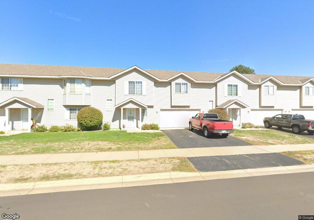
1945 Downing Ave Shakopee, MN 55379
Estimated Value: $242,365 - $260,000
3
Beds
2
Baths
1,256
Sq Ft
$199/Sq Ft
Est. Value
About This Home
This home is located at 1945 Downing Ave, Shakopee, MN 55379 and is currently estimated at $249,591, approximately $198 per square foot. 1945 Downing Ave is a home located in Scott County with nearby schools including Sun Path Elementary School, Shakopee West Middle School, and Shakopee Senior High School.
Ownership History
Date
Name
Owned For
Owner Type
Purchase Details
Closed on
Sep 13, 2018
Sold by
Berhow Jacob and Berhow Jenna
Bought by
Nibbe Jonathon K and Nibbe Linda K
Current Estimated Value
Home Financials for this Owner
Home Financials are based on the most recent Mortgage that was taken out on this home.
Original Mortgage
$168,884
Outstanding Balance
$146,557
Interest Rate
4.37%
Mortgage Type
FHA
Estimated Equity
$103,034
Purchase Details
Closed on
Aug 10, 2015
Sold by
Iesh Deanna L
Bought by
Berhow Jacob
Home Financials for this Owner
Home Financials are based on the most recent Mortgage that was taken out on this home.
Original Mortgage
$139,428
Interest Rate
3.75%
Mortgage Type
FHA
Purchase Details
Closed on
Oct 6, 2000
Sold by
Mw Johnson Construction
Bought by
Iesh Deanna L
Create a Home Valuation Report for This Property
The Home Valuation Report is an in-depth analysis detailing your home's value as well as a comparison with similar homes in the area
Home Values in the Area
Average Home Value in this Area
Purchase History
| Date | Buyer | Sale Price | Title Company |
|---|---|---|---|
| Nibbe Jonathon K | $173,000 | Trademark Title Services Inc | |
| Berhow Jacob | $142,000 | Trademark Title Services Inc | |
| Iesh Deanna L | $116,926 | -- |
Source: Public Records
Mortgage History
| Date | Status | Borrower | Loan Amount |
|---|---|---|---|
| Open | Nibbe Jonathon K | $168,884 | |
| Previous Owner | Berhow Jacob | $139,428 |
Source: Public Records
Tax History
| Year | Tax Paid | Tax Assessment Tax Assessment Total Assessment is a certain percentage of the fair market value that is determined by local assessors to be the total taxable value of land and additions on the property. | Land | Improvement |
|---|---|---|---|---|
| 2025 | $2,152 | $235,600 | $76,100 | $159,500 |
| 2024 | $2,232 | $225,000 | $72,400 | $152,600 |
| 2023 | $2,284 | $221,600 | $71,000 | $150,600 |
| 2022 | $2,178 | $223,300 | $72,700 | $150,600 |
| 2021 | $1,918 | $187,100 | $57,000 | $130,100 |
| 2020 | $1,980 | $183,300 | $52,500 | $130,800 |
| 2019 | $1,822 | $169,400 | $44,400 | $125,000 |
| 2018 | $1,804 | $0 | $0 | $0 |
| 2016 | $1,670 | $0 | $0 | $0 |
| 2014 | -- | $0 | $0 | $0 |
Source: Public Records
Map
Nearby Homes
- 2066 Mockingbird Ave
- 1928 Vierling Dr E
- 1596 Chartreux Ave
- 2350 Downing Ave
- 2423 Tyrone Dr
- 2399 Tyrone Dr
- 2351 Tyrone Dr
- 1227 Elmwood Ave Unit 85
- 2574 Vierling Dr E
- 2006 Tyrone Dr
- 2655 King Ave
- 2795 Downing Ave
- 1667 Countryside Dr
- 2817 Downing Ave
- 1624 Philipp Way
- 1542 Philipp Way
- 1777 Countryside Dr
- 1035 Providence Dr
- 2542 Mathias Rd
- 2868 Trinity Dr
- 1961 Downing Ave
- 1929 Downing Ave
- 1977 Downing Ave
- 1993 Downing Ave
- 1948 Downing Ave
- 1964 Downing Ave
- 1932 Downing Ave
- 1995 Brittany Ct
- 1999 Brittany Ct
- 1897 Downing Ave
- 1916 Downing Ave
- 2003 Brittany Ct
- 1881 Downing Ave
- 1900 Downing Ave
- 1884 Downing Ave
- 1865 Downing Ave
- 2007 Brittany Ct
- 1994 Brittany Ct
- 1999 Downing Ave
- 1930 Pintail Ave
Your Personal Tour Guide
Ask me questions while you tour the home.