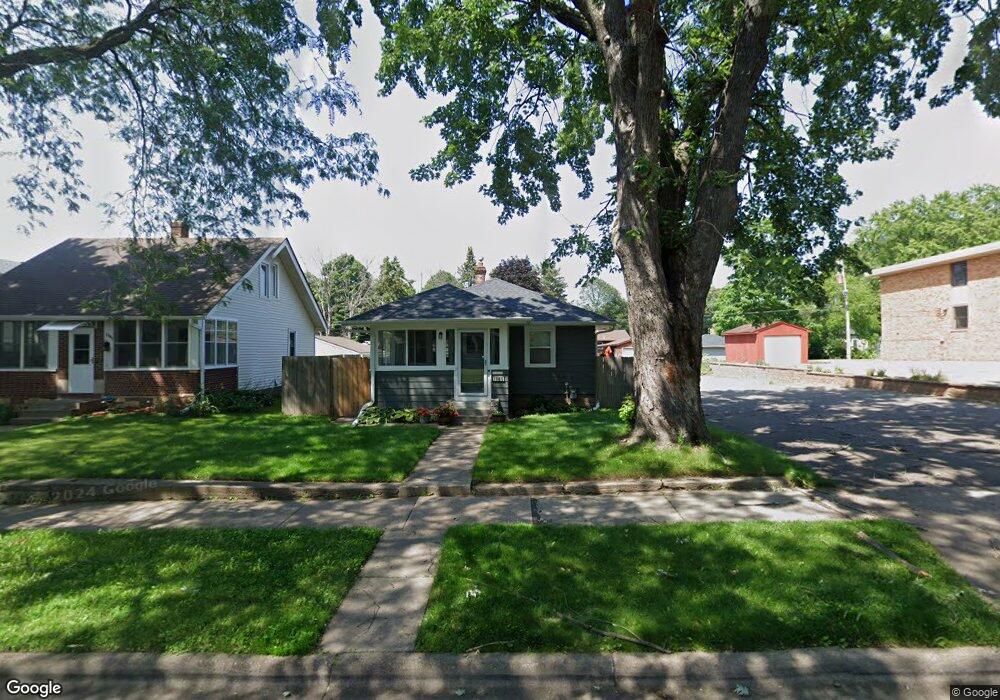
1945 Sherwood Ave Saint Paul, MN 55119
Southern Hayden Heights NeighborhoodEstimated Value: $187,919 - $278,000
2
Beds
1
Bath
672
Sq Ft
$323/Sq Ft
Est. Value
About This Home
This home is located at 1945 Sherwood Ave, Saint Paul, MN 55119 and is currently estimated at $216,980, approximately $322 per square foot. 1945 Sherwood Ave is a home located in Ramsey County with nearby schools including The Heights Community School, Txuj Ci HMong Language and Culture Upper Campus, and Johnson Senior High School.
Ownership History
Date
Name
Owned For
Owner Type
Purchase Details
Closed on
Mar 31, 2017
Sold by
Rpci Llc
Bought by
Moore Leeann
Current Estimated Value
Home Financials for this Owner
Home Financials are based on the most recent Mortgage that was taken out on this home.
Original Mortgage
$126,663
Outstanding Balance
$105,258
Interest Rate
4.16%
Mortgage Type
FHA
Estimated Equity
$111,722
Create a Home Valuation Report for This Property
The Home Valuation Report is an in-depth analysis detailing your home's value as well as a comparison with similar homes in the area
Home Values in the Area
Average Home Value in this Area
Purchase History
| Date | Buyer | Sale Price | Title Company |
|---|---|---|---|
| Moore Leeann | $132,909 | Home Title Inc |
Source: Public Records
Mortgage History
| Date | Status | Borrower | Loan Amount |
|---|---|---|---|
| Open | Moore Leeann | $126,663 |
Source: Public Records
Tax History Compared to Growth
Tax History
| Year | Tax Paid | Tax Assessment Tax Assessment Total Assessment is a certain percentage of the fair market value that is determined by local assessors to be the total taxable value of land and additions on the property. | Land | Improvement |
|---|---|---|---|---|
| 2025 | $4,152 | $190,600 | $30,000 | $160,600 |
| 2023 | $4,152 | $190,100 | $25,000 | $165,100 |
| 2022 | $3,700 | $204,900 | $25,000 | $179,900 |
| 2021 | $3,046 | $156,700 | $25,000 | $131,700 |
| 2020 | $2,390 | $154,500 | $19,400 | $135,100 |
| 2019 | $2,248 | $142,200 | $19,400 | $122,800 |
| 2018 | $1,610 | $138,200 | $19,400 | $118,800 |
| 2017 | $1,660 | $110,600 | $19,400 | $91,200 |
| 2016 | $1,560 | $0 | $0 | $0 |
| 2015 | $1,508 | $90,300 | $19,400 | $70,900 |
| 2014 | $1,320 | $0 | $0 | $0 |
Source: Public Records
Map
Nearby Homes
- 1964 Arlington Ave E
- 1406 Furness Pkwy
- 1828 Arlington Ave E
- 1905 Montana Ave E
- 1868 Ivy Ave E
- 1806 Sherwood Ave
- 2102 Sherwood Ave
- 1874 Hoyt Ave E
- 2032 Hyacinth Ave E
- 2112 Cottage Ave E
- 1840 Hoyt Ave E
- 1976 Orange Ave E
- 1931 Hawthorne Ave E
- 1840 Iowa Ave E
- 1729 Sherwood Ave
- 1734 Cottage Ave E
- 1891 Maryland Ave E
- 1698 Arlington Ave E
- 1685 Arlington Ave E
- 1755 Maryland Ave E
- 1945 1945 Sherwood-Avenue-
- 1941 Sherwood Ave
- 1937 Sherwood Ave
- 1935 Sherwood Ave
- 1935 1935 Sherwood-Avenue-
- 1948 Arlington Ave E
- 1948 1948 Arlington-Avenue-e
- 1954 Arlington Ave E
- 1931 Sherwood Ave
- 1956 Arlington Ave E
- 1936 Arlington Ave E
- 1946 Sherwood Ave
- 1950 Sherwood Ave
- 1942 Sherwood Ave
- 1927 Sherwood Ave
- 1954 Sherwood Ave
- 1938 Sherwood Ave
- 1930 Arlington Ave E
- 1936 Sherwood Ave
- 1405 Furness Pkwy