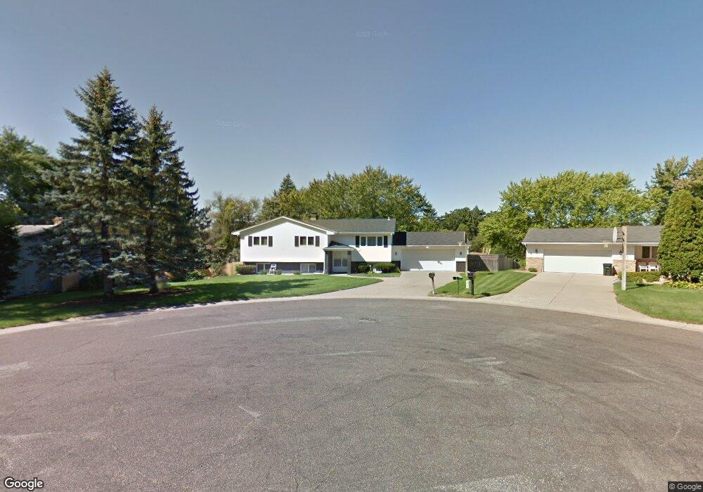
1949 Ebertz Ct Saint Paul, MN 55119
Battle Creek NeighborhoodEstimated Value: $340,000 - $468,727
5
Beds
3
Baths
1,388
Sq Ft
$293/Sq Ft
Est. Value
About This Home
This home is located at 1949 Ebertz Ct, Saint Paul, MN 55119 and is currently estimated at $406,682, approximately $292 per square foot. 1949 Ebertz Ct is a home located in Ramsey County with nearby schools including Battle Creek Elementary School, Battle Creek Middle School, and Harding Senior High School.
Ownership History
Date
Name
Owned For
Owner Type
Purchase Details
Closed on
Jan 9, 2022
Sold by
Schwab Joseph L and Schwab Gayle A
Bought by
Schwab Aaron M
Current Estimated Value
Purchase Details
Closed on
Jul 17, 2013
Sold by
Jackson Ezekiel J and Fowler Vernis R
Bought by
Jackson Ezekiel J and Fowler Vernis R
Home Financials for this Owner
Home Financials are based on the most recent Mortgage that was taken out on this home.
Original Mortgage
$200,134
Outstanding Balance
$146,140
Interest Rate
4.02%
Mortgage Type
New Conventional
Estimated Equity
$260,542
Purchase Details
Closed on
Aug 27, 1999
Sold by
Jansen Gerald D and Jansen Jacqueline L
Bought by
Jackson Ezekiel J and Jackson Carrie B
Create a Home Valuation Report for This Property
The Home Valuation Report is an in-depth analysis detailing your home's value as well as a comparison with similar homes in the area
Home Values in the Area
Average Home Value in this Area
Purchase History
| Date | Buyer | Sale Price | Title Company |
|---|---|---|---|
| Schwab Aaron M | -- | None Available | |
| Jackson Ezekiel J | $515 | None Available | |
| Jackson Ezekiel J | $169,900 | -- |
Source: Public Records
Mortgage History
| Date | Status | Borrower | Loan Amount |
|---|---|---|---|
| Open | Jackson Ezekiel J | $200,134 |
Source: Public Records
Tax History Compared to Growth
Tax History
| Year | Tax Paid | Tax Assessment Tax Assessment Total Assessment is a certain percentage of the fair market value that is determined by local assessors to be the total taxable value of land and additions on the property. | Land | Improvement |
|---|---|---|---|---|
| 2025 | $6,432 | $414,700 | $41,800 | $372,900 |
| 2023 | $6,432 | $416,300 | $41,800 | $374,500 |
| 2022 | $5,116 | $355,700 | $41,800 | $313,900 |
| 2021 | $4,770 | $322,000 | $36,200 | $285,800 |
| 2020 | $4,942 | $311,800 | $36,200 | $275,600 |
| 2019 | $4,924 | $301,400 | $36,200 | $265,200 |
| 2018 | $4,310 | $296,100 | $36,200 | $259,900 |
| 2017 | $3,662 | $269,200 | $31,900 | $237,300 |
| 2016 | $4,358 | $0 | $0 | $0 |
| 2015 | $3,946 | $248,200 | $31,900 | $216,300 |
| 2014 | $3,576 | $0 | $0 | $0 |
Source: Public Records
Map
Nearby Homes
- 49 Battle Creek Place
- 1989 N Park Dr
- 125 Battle Creek Place
- 2023 Parkside Dr
- 2063 N Park Dr Unit 6
- 2059 Parkside Dr Unit 29
- 138 Ruth St N Unit 9
- 1747 Louise Ave
- 38 Morningside Dr
- 2169 Glenridge Ave
- 2219 Cardinal Place
- 2243 Edgebrook Ave
- 125 Mcknight Rd N Unit K
- 1883 Garden Way
- 371, 377, 381 Totem Rd
- 1526 Upper Afton Rd
- 1810 Wilson Ave
- 408 Totem Rd
- 2226 Lower Afton Rd E
- 267 Hazelwood St
- 1955 Ebertz Ct
- 4 Battle Creek Rd
- 1911 Ebertz Ct
- 1911 1911 Ebertz-Court-
- 1929 Ebertz Ct
- 8 Battle Creek Rd
- 1914 Upper Afton Rd E
- 1912 Upper Afton Rd E
- 1908 Upper Afton Rd E
- 1948 Ebertz Ct
- 1926 Upper Afton Rd E
- 1918 Upper Afton Rd E
- 1942 Ebertz Ct
- 1930 Upper Afton Rd E
- 1904 Upper Afton Rd E
- 1930 1930 Upper Afton-Road-e
- 1936 Ebertz Ct
- 1914 Ebertz Ct
- 1898 Upper Afton Rd E
- 1924 Ebertz Ct