195 Joe R McCrary Rd Fall Branch, TN 37656
Fall Branch NeighborhoodEstimated Value: $557,000
--
Bed
--
Bath
15,678
Sq Ft
$36/Sq Ft
Est. Value
About This Home
This home is located at 195 Joe R McCrary Rd, Fall Branch, TN 37656 and is currently priced at $557,000, approximately $35 per square foot. 195 Joe R McCrary Rd is a home located in Washington County with nearby schools including Fall Branch Elementary School and Daniel Boone High School.
Ownership History
Date
Name
Owned For
Owner Type
Purchase Details
Closed on
Jul 24, 2018
Sold by
Caudle Scott O
Bought by
Tennessee
Current Estimated Value
Home Financials for this Owner
Home Financials are based on the most recent Mortgage that was taken out on this home.
Interest Rate
4.52%
Purchase Details
Closed on
Oct 14, 2002
Sold by
East Tenn Auto Auction
Bought by
Scott Caudle
Purchase Details
Closed on
Apr 3, 2001
Sold by
Dishner Billy C
Bought by
Dishner Billy C
Home Financials for this Owner
Home Financials are based on the most recent Mortgage that was taken out on this home.
Original Mortgage
$100,000
Interest Rate
7.01%
Purchase Details
Closed on
Aug 14, 1997
Sold by
Fall Branch Llc
Bought by
Kirk J P
Purchase Details
Closed on
Jan 5, 1996
Bought by
East Tenn Auto Auction Inc
Purchase Details
Closed on
Jun 22, 1990
Bought by
Humphries Bill
Create a Home Valuation Report for This Property
The Home Valuation Report is an in-depth analysis detailing your home's value as well as a comparison with similar homes in the area
Home Values in the Area
Average Home Value in this Area
Purchase History
| Date | Buyer | Sale Price | Title Company |
|---|---|---|---|
| Tennessee | -- | -- | |
| Scott Caudle | $36,000 | -- | |
| Dishner Billy C | $100,000 | -- | |
| Kirk J P | $45,000 | -- | |
| Billy Dishner | $75,000 | -- | |
| East Tenn Auto Auction Inc | $400,000 | -- | |
| Humphries Bill | $360,000 | -- |
Source: Public Records
Mortgage History
| Date | Status | Borrower | Loan Amount |
|---|---|---|---|
| Closed | Humphries Bill | -- | |
| Previous Owner | Humphries Bill | $100,000 |
Source: Public Records
Tax History Compared to Growth
Tax History
| Year | Tax Paid | Tax Assessment Tax Assessment Total Assessment is a certain percentage of the fair market value that is determined by local assessors to be the total taxable value of land and additions on the property. | Land | Improvement |
|---|---|---|---|---|
| 2024 | $2,225 | $130,100 | $130,100 | -- |
| 2022 | $2,035 | $94,650 | $94,650 | $0 |
| 2021 | $2,035 | $94,650 | $94,650 | $0 |
| 2020 | $2,035 | $94,650 | $94,650 | $0 |
| 2019 | $2,312 | $94,650 | $94,650 | $0 |
| 2018 | $2,312 | $97,150 | $97,150 | $0 |
| 2017 | $2,322 | $97,575 | $97,575 | $0 |
| 2016 | $2,322 | $97,575 | $97,575 | $0 |
| 2015 | $1,932 | $97,575 | $97,575 | $0 |
| 2014 | $1,932 | $97,575 | $97,575 | $0 |
Source: Public Records
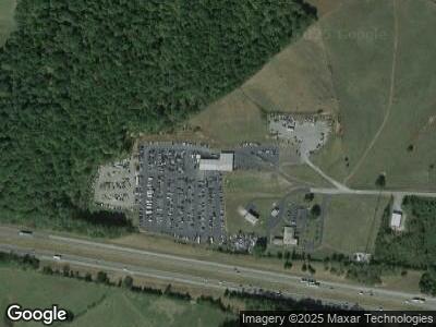
Map
Nearby Homes
- TBD Interstate 81 Unit 1
- 90 N Carr Ln
- 150 Carr Ln N
- 330 Lovelace Mountain View Loop
- 480 Fordtown Rd
- 145 Linda Heights
- 545 Fordtown Rd
- 19530 Horton Hwy
- 240 Moulton Rd
- 380 Moulton Greene Rd
- 257 Logan Chapel Rd
- Tbd Oak Glen Cir
- 88/Ac Tbd Hwy 93
- 176 Moulton Rd
- Lot 5 Jackson Rd
- 00 Jackson Rd
- 186 Kincheloe Rd
- 18280 Horton Hwy
- 18325 Horton Hwy
- Tbd Pitt Loop