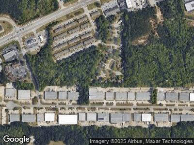
195 N Main Dr Stockbridge, GA 30281
Estimated Value: $194,000 - $238,000
2
Beds
1
Bath
958
Sq Ft
$222/Sq Ft
Est. Value
About This Home
This home is located at 195 N Main Dr, Stockbridge, GA 30281 and is currently estimated at $212,539, approximately $221 per square foot. 195 N Main Dr is a home located in Henry County with nearby schools including Pate's Creek Elementary School, Dutchtown Middle School, and Dutchtown High School.
Ownership History
Date
Name
Owned For
Owner Type
Purchase Details
Closed on
Feb 2, 2011
Sold by
Federal Home Loan Mortgage Corporation
Bought by
Anmol Chhina Inc
Current Estimated Value
Purchase Details
Closed on
Oct 5, 2010
Sold by
Branch Bkng & Trust Co
Bought by
Federal Home Loan Mortgage Corporation
Purchase Details
Closed on
Nov 27, 2001
Sold by
Ellis Richard B
Bought by
Ulman Stacy
Home Financials for this Owner
Home Financials are based on the most recent Mortgage that was taken out on this home.
Original Mortgage
$80,900
Interest Rate
6.42%
Mortgage Type
New Conventional
Purchase Details
Closed on
May 10, 1995
Sold by
Knight Devel
Bought by
Ellis Richard
Create a Home Valuation Report for This Property
The Home Valuation Report is an in-depth analysis detailing your home's value as well as a comparison with similar homes in the area
Home Values in the Area
Average Home Value in this Area
Purchase History
| Date | Buyer | Sale Price | Title Company |
|---|---|---|---|
| Anmol Chhina Inc | $30,333 | -- | |
| Federal Home Loan Mortgage Corporation | -- | -- | |
| Branch Bkng & Trust Co | $32,250 | -- | |
| Ulman Stacy | $89,900 | -- | |
| Ellis Richard | $64,900 | -- |
Source: Public Records
Mortgage History
| Date | Status | Borrower | Loan Amount |
|---|---|---|---|
| Previous Owner | Ulman Stacy | $80,900 | |
| Closed | Ellis Richard | $0 |
Source: Public Records
Tax History Compared to Growth
Tax History
| Year | Tax Paid | Tax Assessment Tax Assessment Total Assessment is a certain percentage of the fair market value that is determined by local assessors to be the total taxable value of land and additions on the property. | Land | Improvement |
|---|---|---|---|---|
| 2024 | $3,212 | $79,240 | $12,000 | $67,240 |
| 2023 | $3,019 | $77,040 | $10,000 | $67,040 |
| 2022 | $2,328 | $59,040 | $10,000 | $49,040 |
| 2021 | $2,008 | $50,680 | $10,000 | $40,680 |
| 2020 | $1,412 | $35,160 | $8,000 | $27,160 |
| 2019 | $1,323 | $32,840 | $8,000 | $24,840 |
| 2018 | $1,171 | $28,880 | $6,000 | $22,880 |
| 2016 | $963 | $23,440 | $6,000 | $17,440 |
| 2015 | -- | $25,400 | $6,000 | $19,400 |
| 2014 | $774 | $17,760 | $4,000 | $13,760 |
Source: Public Records
Map
Nearby Homes
- 1256 Jodeco Rd
- 312 Jodeco Station Cir E
- 1805 Jodeco Rd
- 119 Saint Margrit Cir
- 220 Turnstone Rd
- 195 Northpark Trail
- 106 Saint Margrit Cir
- 0 Killearn Blvd Unit 10142611
- 2095 Flippen Rd
- 140 Jodeco Station Terrace
- 112 Christopher Ln
- 19 Margrit Ct
- 1468 Flippen Rd
- 1448 Flippen Rd
- 506 Olivia Ct
- 139 Surge Stone Ln
- 257 Chiswick Loop
- 281 Chiswick Loop
- 237 Chiswick Loop
- 195 N Main Dr
- 191 N Main Dr
- 199 N Main Dr
- 187 N Main Dr
- 198 N Main Dr
- 0 N Main Ct Unit 7077196
- 0 N Main Ct
- N N Main Ct
- 183 N Main Dr
- 194 N Main Dr
- 204 N Main Ct
- 201 N Main Ct
- 175 N Main Dr
- 206 N Main Ct
- 176 N Main Dr
- 0 N Main Dr Unit 7203170
- 0 N Main Dr Unit 7013822
- 0 N Main Dr Unit 8201308
- 0 N Main Dr
- N N Main Dr
