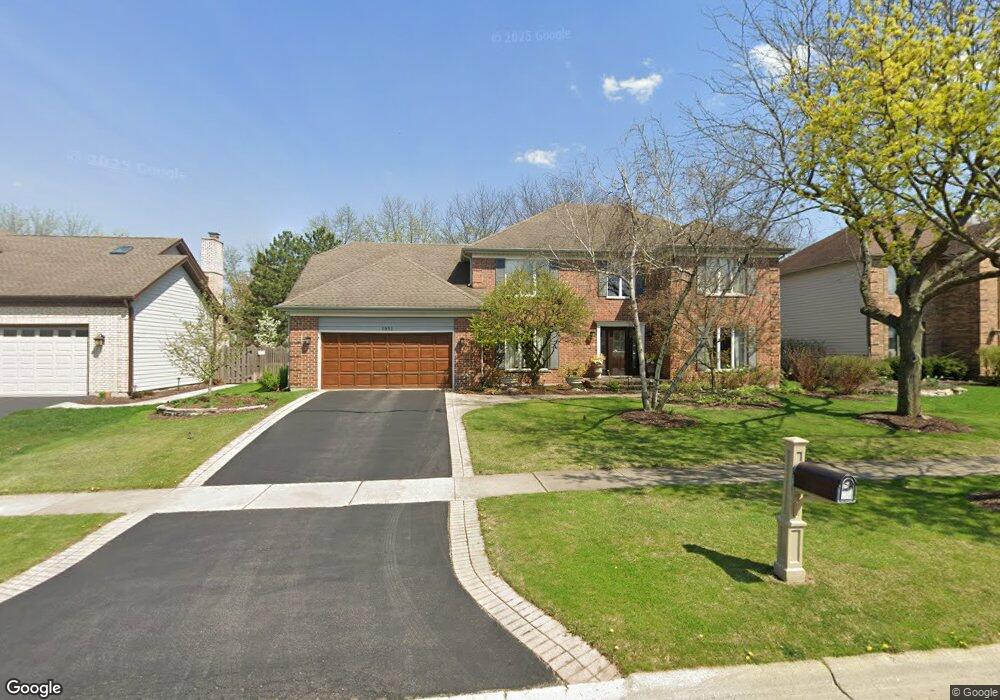
1951 Hampton Dr Wheaton, IL 60189
North Danada NeighborhoodEstimated Value: $808,776 - $980,000
4
Beds
3
Baths
3,245
Sq Ft
$285/Sq Ft
Est. Value
About This Home
This home is located at 1951 Hampton Dr, Wheaton, IL 60189 and is currently estimated at $923,694, approximately $284 per square foot. 1951 Hampton Dr is a home located in DuPage County with nearby schools including Madison Elementary School, Edison Middle School, and Wheaton Warrenville South High School.
Ownership History
Date
Name
Owned For
Owner Type
Purchase Details
Closed on
Dec 4, 1995
Sold by
Nelson Steven C and Nelson Barbara M
Bought by
English Brian P and English Annette L
Current Estimated Value
Home Financials for this Owner
Home Financials are based on the most recent Mortgage that was taken out on this home.
Original Mortgage
$195,000
Interest Rate
8.1%
Purchase Details
Closed on
Oct 29, 1993
Sold by
Epstein Dailey Kevin Richard and Epstein Dailey Lisa
Bought by
Nelson Steven C and Nelson Barbara M
Home Financials for this Owner
Home Financials are based on the most recent Mortgage that was taken out on this home.
Original Mortgage
$288,575
Interest Rate
4%
Create a Home Valuation Report for This Property
The Home Valuation Report is an in-depth analysis detailing your home's value as well as a comparison with similar homes in the area
Home Values in the Area
Average Home Value in this Area
Purchase History
| Date | Buyer | Sale Price | Title Company |
|---|---|---|---|
| English Brian P | $339,000 | -- | |
| Nelson Steven C | $338,833 | Attorneys Natl Title Network |
Source: Public Records
Mortgage History
| Date | Status | Borrower | Loan Amount |
|---|---|---|---|
| Previous Owner | English Brian P | $195,000 | |
| Previous Owner | Nelson Steven C | $288,575 |
Source: Public Records
Tax History
| Year | Tax Paid | Tax Assessment Tax Assessment Total Assessment is a certain percentage of the fair market value that is determined by local assessors to be the total taxable value of land and additions on the property. | Land | Improvement |
|---|---|---|---|---|
| 2024 | $14,178 | $227,970 | $51,767 | $176,203 |
| 2023 | $13,640 | $209,840 | $47,650 | $162,190 |
| 2022 | $13,318 | $198,310 | $45,030 | $153,280 |
| 2021 | $13,277 | $193,600 | $43,960 | $149,640 |
| 2020 | $13,238 | $191,800 | $43,550 | $148,250 |
| 2019 | $12,939 | $186,740 | $42,400 | $144,340 |
| 2018 | $13,672 | $194,760 | $71,120 | $123,640 |
| 2017 | $13,476 | $187,580 | $68,500 | $119,080 |
| 2016 | $13,305 | $180,080 | $65,760 | $114,320 |
| 2015 | $13,214 | $171,800 | $62,740 | $109,060 |
| 2014 | $13,265 | $169,600 | $64,340 | $105,260 |
| 2013 | $12,923 | $170,110 | $64,530 | $105,580 |
Source: Public Records
Map
Nearby Homes
- 30 Danada Dr
- 24 Winners Cup Cir Unit 3
- 121 Brighton Dr
- 141 Loretto Ct
- 76 Somerset Cir
- 110 E Farnham Ln
- 570 Riva Ct
- 371 W Arboretum Cir
- 1542 Castlewood Dr
- 1265 Windsor Dr
- 26W055 Cree Ln
- 1127 Hibbard Rd
- 1682 Monticello Ct Unit D
- 1230 Bunker Hill Ct Unit A
- 1135 Mount Vernon Ct Unit B
- 1675 Valley Forge Ct Unit A
- 1120 Mount Vernon Ct Unit C
- 2552 Weatherbee Ln
- 1219 Golf Ln
- 3S700 Delles Rd
- 1945 Hampton Dr
- 1961 Hampton Dr
- 1950 Hampton Dr
- 1967 Hampton Dr
- 1937 Hampton Dr
- 1962 Hampton Dr Unit 3
- 1944 Hampton Dr
- 1966 Hampton Dr
- 1927 Hampton Dr
- 1973 Hampton Dr
- 1938 Hampton Dr
- 1972 Hampton Dr
- 1963 Chatham Dr
- 1932 Hampton Dr
- 1979 Hampton Dr
- 1957 Chatham Dr
- 1923 Hampton Dr
- 2002 Hampton Dr
- 1969 Chatham Dr
- 1975 Chatham Dr
Your Personal Tour Guide
Ask me questions while you tour the home.