1951 Stanford Ave Saint Paul, MN 55105
Macalester-Groveland NeighborhoodEstimated Value: $515,280 - $604,000
3
Beds
2
Baths
1,751
Sq Ft
$311/Sq Ft
Est. Value
About This Home
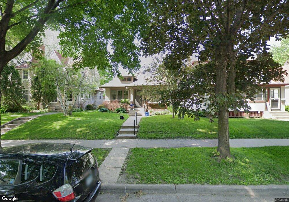
This home is located at 1951 Stanford Ave, Saint Paul, MN 55105 and is currently estimated at $544,320, approximately $310 per square foot. 1951 Stanford Ave is a home located in Ramsey County with nearby schools including Groveland Park Elementary School, Hidden River Middle School, and Central Senior High School.
Ownership History
Date
Name
Owned For
Owner Type
Purchase Details
Closed on
Aug 28, 2015
Sold by
Fox Thomas and Fox Elyse
Bought by
Gorham Geoffrey and Ihlan Amy J
Current Estimated Value
Home Financials for this Owner
Home Financials are based on the most recent Mortgage that was taken out on this home.
Original Mortgage
$272,960
Interest Rate
3.91%
Mortgage Type
New Conventional
Purchase Details
Closed on
Jun 30, 1999
Sold by
Whitcomb Martha K S and Whitcomb Joel C
Bought by
Paulson Gaylord P
Create a Home Valuation Report for This Property
The Home Valuation Report is an in-depth analysis detailing your home's value as well as a comparison with similar homes in the area
Home Values in the Area
Average Home Value in this Area
Purchase History
| Date | Buyer | Sale Price | Title Company |
|---|---|---|---|
| Gorham Geoffrey | $341,200 | Home Title | |
| Paulson Gaylord P | $153,000 | -- |
Source: Public Records
Mortgage History
| Date | Status | Borrower | Loan Amount |
|---|---|---|---|
| Previous Owner | Gorham Geoffrey | $272,960 |
Source: Public Records
Tax History Compared to Growth
Tax History
| Year | Tax Paid | Tax Assessment Tax Assessment Total Assessment is a certain percentage of the fair market value that is determined by local assessors to be the total taxable value of land and additions on the property. | Land | Improvement |
|---|---|---|---|---|
| 2025 | $6,814 | $497,000 | $134,600 | $362,400 |
| 2023 | $6,814 | $441,500 | $134,600 | $306,900 |
| 2022 | $6,476 | $434,400 | $134,600 | $299,800 |
| 2021 | $5,994 | $401,000 | $134,600 | $266,400 |
| 2020 | $6,270 | $385,900 | $134,600 | $251,300 |
| 2019 | $6,068 | $375,800 | $134,600 | $241,200 |
| 2018 | $5,608 | $360,300 | $134,600 | $225,700 |
| 2017 | $5,006 | $344,200 | $134,600 | $209,600 |
| 2016 | $4,822 | $0 | $0 | $0 |
| 2015 | $4,858 | $299,200 | $121,200 | $178,000 |
| 2014 | $3,996 | $0 | $0 | $0 |
Source: Public Records
Map
Nearby Homes
- 281 Cleveland Ave S
- 188 Cleveland Ave S
- 2129 Stanford Ave
- 1818 Juliet Ave
- 2133 Berkeley Ave
- 1926 Lincoln Ave
- 1797 James Ave
- 2009 Grand Ave
- 2047 Grand Ave
- 265 Mount Curve Blvd
- 2114 Randolph Ave
- 2056 Summit Ave
- 191 Vernon St
- 1917 Summit Ave Unit 2
- 313 Stonebridge Blvd
- 317 Stonebridge Blvd
- 2250 Princeton Ave
- 1688 James Ave
- 2248 Goodrich Ave
- 475 Mount Curve Blvd
- 1945 Stanford Ave
- 1953 Stanford Ave
- 1941 Stanford Ave
- 1957 Stanford Ave
- 1963 Stanford Ave
- 1950 Berkeley Ave
- 1946 Berkeley Ave
- 1954 Berkeley Ave
- 1965 Stanford Ave
- 1942 Berkeley Ave
- 1956 Berkeley Ave
- 1937 Stanford Ave
- 1950 Stanford Ave
- 1954 Stanford Ave
- 1946 Stanford Ave
- 1969 Stanford Ave
- 1956 Stanford Ave
- 1942 Stanford Ave
- 1964 Berkeley Ave
- 1960 Stanford Ave