Estimated Value: $280,963 - $387,000
4
Beds
3
Baths
2,112
Sq Ft
$149/Sq Ft
Est. Value
About This Home
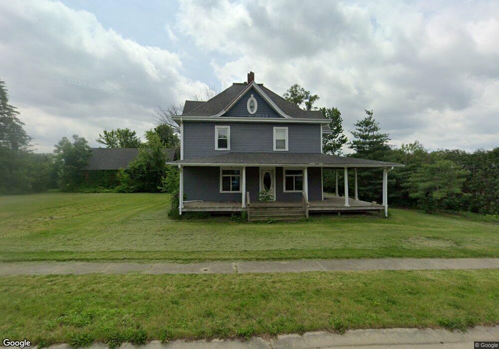
This home is located at 1960 Dows St, Ely, IA 52227 and is currently estimated at $314,741, approximately $149 per square foot. 1960 Dows St is a home located in Linn County with nearby schools including Prairie Heights Elementary School, Prairie Ridge Elementary School, and Prairie Crest Elementary School.
Ownership History
Date
Name
Owned For
Owner Type
Purchase Details
Closed on
May 29, 2024
Sold by
Malatek Paul M and Malatek Diane L
Bought by
City Of Ely Iowa
Current Estimated Value
Purchase Details
Closed on
Oct 9, 2007
Sold by
Gaddis Donald L and Gaddis Karen A
Bought by
Malatek Paul M and Malatek Diane L
Purchase Details
Closed on
Aug 14, 2000
Sold by
Gaddis Donald L and Gaddis Karen A
Bought by
Malatek Paul M and Malatek Diane L
Home Financials for this Owner
Home Financials are based on the most recent Mortgage that was taken out on this home.
Original Mortgage
$77,500
Interest Rate
6%
Purchase Details
Closed on
Feb 9, 1999
Sold by
Murphy Dennis L and Gaddis Murphy Diane L
Bought by
Gaddis Donald L and Gaddis Karen A
Create a Home Valuation Report for This Property
The Home Valuation Report is an in-depth analysis detailing your home's value as well as a comparison with similar homes in the area
Purchase History
| Date | Buyer | Sale Price | Title Company |
|---|---|---|---|
| City Of Ely Iowa | $300,000 | None Listed On Document | |
| City Of Ely Iowa | $300,000 | None Listed On Document | |
| Malatek Paul M | $93,500 | None Available | |
| Malatek Paul M | $94,000 | -- | |
| Gaddis Donald L | $103,433 | -- |
Source: Public Records
Mortgage History
| Date | Status | Borrower | Loan Amount |
|---|---|---|---|
| Previous Owner | Malatek Paul M | $77,500 |
Source: Public Records
Tax History
| Year | Tax Paid | Tax Assessment Tax Assessment Total Assessment is a certain percentage of the fair market value that is determined by local assessors to be the total taxable value of land and additions on the property. | Land | Improvement |
|---|---|---|---|---|
| 2025 | $3,656 | -- | -- | -- |
| 2024 | $3,228 | $222,400 | $42,600 | $179,800 |
| 2023 | $3,228 | $222,400 | $42,600 | $179,800 |
| 2022 | $4,156 | $167,000 | $42,600 | $124,400 |
| 2021 | $3,896 | $218,900 | $42,600 | $176,300 |
| 2020 | $3,896 | $194,900 | $42,600 | $152,300 |
| 2019 | $3,590 | $181,200 | $42,600 | $138,600 |
| 2018 | $3,268 | $181,200 | $42,600 | $138,600 |
| 2017 | $2,894 | $155,200 | $42,600 | $112,600 |
| 2016 | $2,428 | $136,400 | $42,600 | $93,800 |
| 2015 | $2,338 | $132,000 | $42,600 | $89,400 |
| 2014 | $2,184 | $132,000 | $42,600 | $89,400 |
| 2013 | $2,062 | $132,000 | $42,600 | $89,400 |
Source: Public Records
Map
Nearby Homes
- 1605 Ranmar Dr
- 1500 Main St Unit 208
- 1500 Main St Unit 207
- 1500 Main St Unit 206
- 1500 Main St
- 1500 Main St Unit 202
- 1500 Main St Unit 201
- 1500 Main St Unit 200
- 1500 Main St Unit 205
- 1500 Main St Unit 203
- 3215 Sunflower St
- 1750 Parkland Dr
- 1000 Switchgrass Ln
- 1255 Pacific St
- 1020 Linden Ln
- 3060 Sunflower St
- 1100 Switchgrass Ln
- 1110 Switchgrass Ln
- 1854 Wrigley St
- 1856 Wrigley St
Your Personal Tour Guide
Ask me questions while you tour the home.