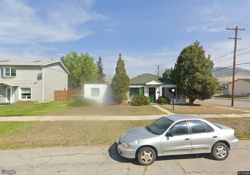
1961 Locust St Butte, MT 59701
Greeley NeighborhoodEstimated Value: $266,000 - $306,000
2
Beds
1
Bath
1,610
Sq Ft
$176/Sq Ft
Est. Value
About This Home
This home is located at 1961 Locust St, Butte, MT 59701 and is currently estimated at $283,512, approximately $176 per square foot. 1961 Locust St is a home located in Silver Bow County with nearby schools including Emerson School, East Middle School, and Butte High School.
Ownership History
Date
Name
Owned For
Owner Type
Purchase Details
Closed on
Jul 1, 2013
Sold by
Kaario Tammy Rae and Jackson Tammy Rae
Bought by
Kaario Tammy Rae
Current Estimated Value
Home Financials for this Owner
Home Financials are based on the most recent Mortgage that was taken out on this home.
Original Mortgage
$74,000
Outstanding Balance
$44,390
Interest Rate
0.15%
Estimated Equity
$239,122
Purchase Details
Closed on
Apr 21, 2011
Sold by
Bisch Thomas W
Bought by
Brennan Leona
Create a Home Valuation Report for This Property
The Home Valuation Report is an in-depth analysis detailing your home's value as well as a comparison with similar homes in the area
Home Values in the Area
Average Home Value in this Area
Purchase History
| Date | Buyer | Sale Price | Title Company |
|---|---|---|---|
| Kaario Tammy Rae | -- | -- | |
| Brennan Leona | -- | -- |
Source: Public Records
Mortgage History
| Date | Status | Borrower | Loan Amount |
|---|---|---|---|
| Open | Kaario Tammy Rae | $74,000 |
Source: Public Records
Tax History
| Year | Tax Paid | Tax Assessment Tax Assessment Total Assessment is a certain percentage of the fair market value that is determined by local assessors to be the total taxable value of land and additions on the property. | Land | Improvement |
|---|---|---|---|---|
| 2025 | $2,227 | $278,200 | $0 | $0 |
| 2024 | $2,795 | $254,300 | $0 | $0 |
| 2023 | $2,786 | $254,300 | $0 | $0 |
| 2022 | $2,185 | $144,600 | $0 | $0 |
| 2021 | $1,603 | $144,600 | $0 | $0 |
| 2020 | $2,240 | $139,300 | $0 | $0 |
| 2019 | $2,235 | $139,300 | $0 | $0 |
| 2018 | $1,903 | $113,900 | $0 | $0 |
| 2017 | $1,156 | $113,900 | $0 | $0 |
| 2016 | $1,696 | $101,800 | $0 | $0 |
| 2015 | $1,073 | $101,800 | $0 | $0 |
| 2014 | $1,714 | $57,770 | $0 | $0 |
Source: Public Records
Map
Nearby Homes
- 2108 Walnut St
- 2107 Grand Ave
- 200 Howard St
- 2211 Walnut St
- 200 Howard Ave
- 1705 Wall St
- 1671 Grand Ave
- 1920 Aberdeen St
- 1953 George St
- 1636 Harrison Ave
- 2401 Elm St
- 2318 Argyle St
- 1630 Phillips Ave
- 1801 Reynolds Ave
- 2422 Argyle St
- 1801 Wilson Ave
- 2400 Silver Bow
- 1639 Lowell Ave
- 1409 S Warren Ave
- 1875 Harrison Ave
- 1951 Locust St
- 1960 Silver Bow Blvd
- 1941 Locust St
- 1950 Silver Bow Blvd
- 1960 Locust St
- 2009 Locust St
- 1940 Silver Bow Blvd
- 1950 Locust St
- 1100 Carolina Ave
- 2017 Locust St
- 1930 Silver Bow Blvd
- 1921 Locust St
- 1930 Locust St
- 2012 Locust St
- 2021 Locust St
- 1920 Silver Bow Blvd
- 1961 Elm St
- 1951 Elm St
- 1920 Locust St
Your Personal Tour Guide
Ask me questions while you tour the home.