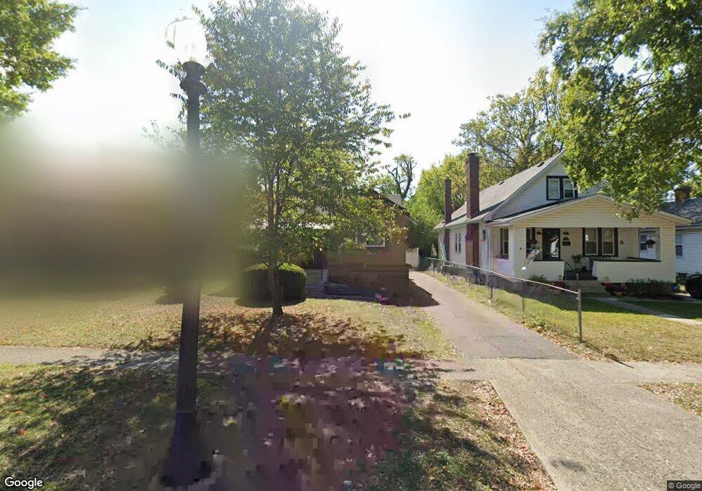
1967 Northcut Ave Cincinnati, OH 45237
Bond Hill NeighborhoodEstimated Value: $164,000 - $194,000
2
Beds
1
Bath
1,036
Sq Ft
$171/Sq Ft
Est. Value
About This Home
This home is located at 1967 Northcut Ave, Cincinnati, OH 45237 and is currently estimated at $176,839, approximately $170 per square foot. 1967 Northcut Ave is a home located in Hamilton County with nearby schools including Bond Hill Academy Elementary School, Shroder High School, and Clark Montessori High School.
Ownership History
Date
Name
Owned For
Owner Type
Purchase Details
Closed on
Apr 13, 2009
Sold by
Howard Melvina and Howard Melvina G
Bought by
Pearson John T and Pearson Pamela
Current Estimated Value
Create a Home Valuation Report for This Property
The Home Valuation Report is an in-depth analysis detailing your home's value as well as a comparison with similar homes in the area
Home Values in the Area
Average Home Value in this Area
Purchase History
| Date | Buyer | Sale Price | Title Company |
|---|---|---|---|
| Pearson John T | $30,000 | Attorney |
Source: Public Records
Tax History
| Year | Tax Paid | Tax Assessment Tax Assessment Total Assessment is a certain percentage of the fair market value that is determined by local assessors to be the total taxable value of land and additions on the property. | Land | Improvement |
|---|---|---|---|---|
| 2025 | $2,629 | $41,325 | $5,674 | $35,651 |
| 2023 | $2,630 | $41,325 | $5,674 | $35,651 |
| 2022 | $1,568 | $22,096 | $5,551 | $16,545 |
| 2021 | $1,538 | $22,096 | $5,551 | $16,545 |
| 2020 | $1,543 | $22,096 | $5,551 | $16,545 |
| 2019 | $1,584 | $20,650 | $5,187 | $15,463 |
| 2018 | $1,585 | $20,650 | $5,187 | $15,463 |
| 2017 | $1,886 | $25,536 | $5,187 | $20,349 |
| 2016 | $712 | $9,346 | $5,772 | $3,574 |
| 2015 | $638 | $9,346 | $5,772 | $3,574 |
| 2014 | $641 | $9,346 | $5,772 | $3,574 |
| 2013 | $731 | $10,501 | $6,486 | $4,015 |
Source: Public Records
Map
Nearby Homes
- 1966 Avonlea Ave
- 5314 Section Ave
- 1847 Andina Ave
- 2011 Dale Rd
- 5256 Warren Ave
- 5716 Section Ave
- 5405 Carthage Ave
- 5258 Hunter Ave
- 1832 Catalina Ave
- 5310 Globe Ave
- 5234 Hunter Ave
- 5104 Lillian Dr
- 1945 Lawn Ave
- 5203 Rolston Ave
- 5229 Globe Ave
- 2119 Cathedral Ave
- 1730 Dale Rd
- 5119 Warren Ave
- 5121 Rolston Ave
- 2106 Lawn Ave
- 1963 Northcut Ave
- 1971 Northcut Ave
- 1959 Northcut Ave
- 1959 Northcutt Ave
- 1973 Northcut Ave
- 1955 Northcut Ave
- 1970 Avonlea Ave
- 1962 Avonlea Ave
- 1951 Northcut Ave
- 1974 Avonlea Ave
- 1958 Avonlea Ave
- 1954 Avonlea Ave
- 1947 Northcut Ave
- 1956 Northcutt Ave
- 1966 Northcut Ave
- 1974 Northcutt Ave
- 1962 Northcut Ave
- 1970 Northcut Ave
- 1950 Avonlea Ave
- 1956 Northcut Ave
Your Personal Tour Guide
Ask me questions while you tour the home.