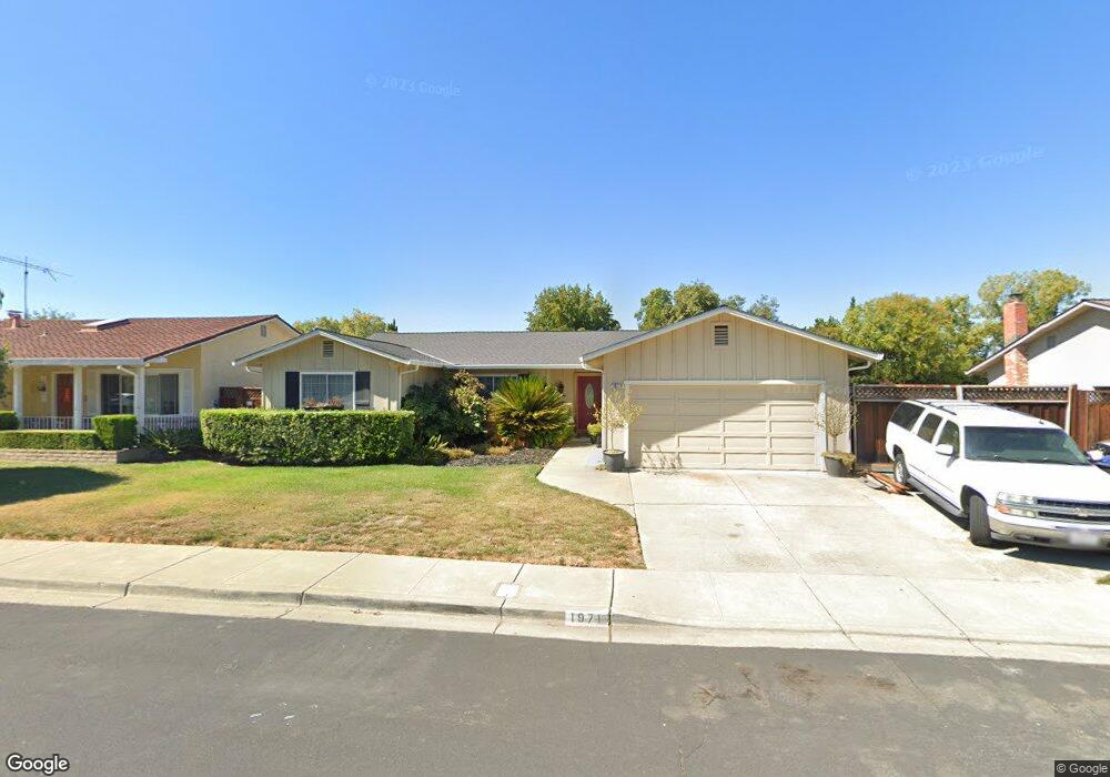
1971 Brooktree Way Pleasanton, CA 94566
Amador Valley NeighborhoodEstimated Value: $1,414,618 - $1,638,000
4
Beds
2
Baths
1,716
Sq Ft
$893/Sq Ft
Est. Value
About This Home
This home is located at 1971 Brooktree Way, Pleasanton, CA 94566 and is currently estimated at $1,532,155, approximately $892 per square foot. 1971 Brooktree Way is a home located in Alameda County with nearby schools including Alisal Elementary School, Harvest Park Middle School, and Amador Valley High School.
Ownership History
Date
Name
Owned For
Owner Type
Purchase Details
Closed on
May 28, 2003
Sold by
Barragan Lorenzo and Barragan Sonia D
Bought by
Barragan Derek and Barragan Linda
Current Estimated Value
Home Financials for this Owner
Home Financials are based on the most recent Mortgage that was taken out on this home.
Original Mortgage
$402,000
Interest Rate
7.8%
Mortgage Type
Purchase Money Mortgage
Purchase Details
Closed on
Jun 14, 2000
Sold by
Barragan Lorenzo and Barragan Sonia D
Bought by
Barragan Lorenzo and Barragan Sonia D
Create a Home Valuation Report for This Property
The Home Valuation Report is an in-depth analysis detailing your home's value as well as a comparison with similar homes in the area
Home Values in the Area
Average Home Value in this Area
Purchase History
| Date | Buyer | Sale Price | Title Company |
|---|---|---|---|
| Barragan Derek | $375,000 | First California Title Co | |
| Barragan Lorenzo | -- | -- |
Source: Public Records
Mortgage History
| Date | Status | Borrower | Loan Amount |
|---|---|---|---|
| Closed | Barragan Derek | $402,000 |
Source: Public Records
Tax History
| Year | Tax Paid | Tax Assessment Tax Assessment Total Assessment is a certain percentage of the fair market value that is determined by local assessors to be the total taxable value of land and additions on the property. | Land | Improvement |
|---|---|---|---|---|
| 2025 | $987 | $77,830 | $19,123 | $65,707 |
| 2024 | $987 | $76,168 | $18,749 | $64,419 |
| 2023 | $973 | $81,537 | $18,381 | $63,156 |
| 2022 | $922 | $72,939 | $18,021 | $61,918 |
| 2021 | $897 | $71,371 | $17,667 | $60,704 |
| 2020 | $885 | $77,568 | $17,486 | $60,082 |
| 2019 | $892 | $76,047 | $17,143 | $58,904 |
| 2018 | $873 | $74,556 | $16,807 | $57,749 |
| 2017 | $851 | $73,095 | $16,478 | $56,617 |
| 2016 | $779 | $71,662 | $16,155 | $55,507 |
| 2015 | $764 | $70,585 | $15,912 | $54,673 |
| 2014 | $775 | $69,202 | $15,600 | $53,602 |
Source: Public Records
Map
Nearby Homes
- 4178 Francisco St
- 4586 Gatetree Cir
- 4563 Gatetree Cir
- 4823 Pipit Ct
- 4214 Wells St
- 1135 Tiffany Ln
- 1874 Harvest Rd
- 4452 Del Valle Pkwy
- 1421 Calle Enrique
- 1681 Holly Cir
- 1558 Calle Enrique
- 297 Del Valle Ct
- 2128 Alexander Way
- 1747 Nursery Way
- 4073 Stanley Blvd
- 2229 Delucchi Dr
- 337 Trenton Cir
- 3653 Kamp Dr
- 3080 Casadero Ct
- 2058 Palmer Dr
- 1979 Brooktree Way
- 1963 Brooktree Way
- 1865 Rosetree Ct
- 1883 Rosetree Ct
- 1847 Rosetree Ct
- 1987 Brooktree Way
- 1955 Brooktree Way
- 1968 Brooktree Way
- 1976 Brooktree Way
- 1960 Brooktree Way
- 1895 Rosetree Ct
- 1829 Rosetree Ct
- 1941 Brooktree Way
- 1995 Brooktree Way
- 1952 Brooktree Way
- 1909 Brooktree Way
- 1811 Rosetree Ct
- 4354 Valley Ave Unit C7
- 4356 Valley Ave Unit D6
- 4352 Valley Ave Unit C8
Your Personal Tour Guide
Ask me questions while you tour the home.