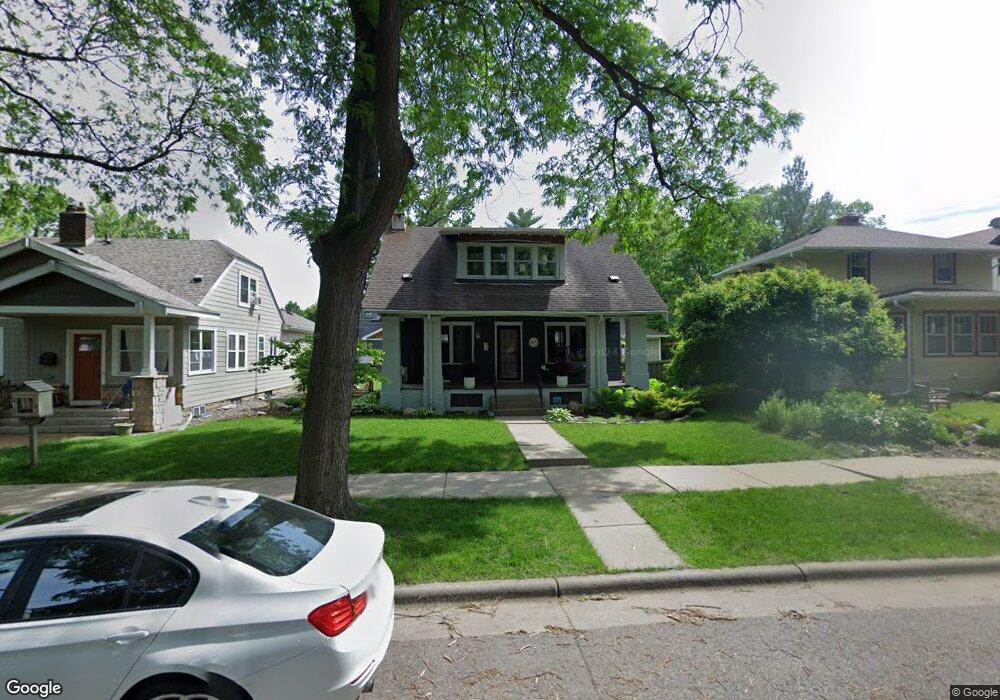
1972 Princeton Ave Saint Paul, MN 55105
Macalester-Groveland NeighborhoodEstimated Value: $369,000 - $464,923
2
Beds
1
Bath
980
Sq Ft
$431/Sq Ft
Est. Value
About This Home
This home is located at 1972 Princeton Ave, Saint Paul, MN 55105 and is currently estimated at $421,981, approximately $430 per square foot. 1972 Princeton Ave is a home located in Ramsey County with nearby schools including Groveland Park Elementary School, Hidden River Middle School, and Central Senior High School.
Ownership History
Date
Name
Owned For
Owner Type
Purchase Details
Closed on
Aug 8, 2014
Sold by
Graham Wesley T and Dickinson Stephanie A
Bought by
Claar Melissa K and Claar Jonathan A
Current Estimated Value
Home Financials for this Owner
Home Financials are based on the most recent Mortgage that was taken out on this home.
Original Mortgage
$242,250
Outstanding Balance
$184,646
Interest Rate
4.1%
Mortgage Type
New Conventional
Estimated Equity
$237,335
Purchase Details
Closed on
Dec 27, 1999
Sold by
Jensen Paul R and Jensen Heidi T Hess
Bought by
Malmberg Katherine L
Create a Home Valuation Report for This Property
The Home Valuation Report is an in-depth analysis detailing your home's value as well as a comparison with similar homes in the area
Home Values in the Area
Average Home Value in this Area
Purchase History
| Date | Buyer | Sale Price | Title Company |
|---|---|---|---|
| Claar Melissa K | $262,727 | Alliance Title Llc | |
| Malmberg Katherine L | $159,000 | -- |
Source: Public Records
Mortgage History
| Date | Status | Borrower | Loan Amount |
|---|---|---|---|
| Open | Claar Melissa K | $242,250 |
Source: Public Records
Tax History Compared to Growth
Tax History
| Year | Tax Paid | Tax Assessment Tax Assessment Total Assessment is a certain percentage of the fair market value that is determined by local assessors to be the total taxable value of land and additions on the property. | Land | Improvement |
|---|---|---|---|---|
| 2025 | $6,978 | $451,900 | $145,500 | $306,400 |
| 2023 | $6,978 | $452,400 | $145,500 | $306,900 |
| 2022 | $5,952 | $422,400 | $145,500 | $276,900 |
| 2021 | $5,716 | $370,500 | $145,500 | $225,000 |
| 2020 | $5,300 | $369,200 | $145,500 | $223,700 |
| 2019 | $5,086 | $321,800 | $145,500 | $176,300 |
| 2018 | $4,784 | $297,500 | $145,500 | $152,000 |
| 2017 | $3,938 | $297,500 | $145,500 | $152,000 |
| 2016 | $4,196 | $0 | $0 | $0 |
| 2015 | $4,486 | $250,700 | $121,300 | $129,400 |
| 2014 | $4,780 | $0 | $0 | $0 |
Source: Public Records
Map
Nearby Homes
- 188 Cleveland Ave S
- 1926 Lincoln Ave
- 281 Cleveland Ave S
- 2009 Grand Ave
- 2047 Grand Ave
- 2133 Berkeley Ave
- 2056 Summit Ave
- 2129 Stanford Ave
- 1917 Summit Ave Unit 2
- 1818 Juliet Ave
- 2248 Goodrich Ave
- 2250 Princeton Ave
- 191 Vernon St
- 1873 Ashland Ave
- 313 Stonebridge Blvd
- 317 Stonebridge Blvd
- 1920 Laurel Ave
- 1797 James Ave
- 2225 Summit Ave
- 196 Mississippi River Blvd S
- 1966 Princeton Ave
- 1978 Princeton Ave
- 1962 Princeton Ave
- 1984 Princeton Ave
- 1971 Sargent Ave
- 1990 Princeton Ave
- 1958 Princeton Ave
- 1975 Sargent Ave
- 1967 Sargent Ave
- 1983 Sargent Ave
- 1963 Sargent Ave
- 1971 Princeton Ave
- 1969 Princeton Ave
- 1977 Princeton Ave
- 1992 Princeton Ave
- 1954 Princeton Ave
- 1987 Sargent Ave
- 1959 Sargent Ave
- 1965 Princeton Ave
- 1981 Princeton Ave