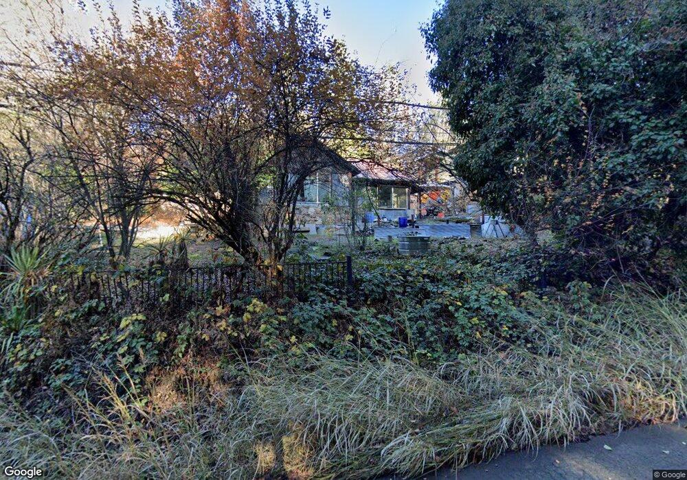
1975 Smith Flat Rd Placerville, CA 95667
Estimated Value: $314,870 - $403,000
2
Beds
1
Bath
1,046
Sq Ft
$345/Sq Ft
Est. Value
About This Home
This home is located at 1975 Smith Flat Rd, Placerville, CA 95667 and is currently estimated at $361,218, approximately $345 per square foot. 1975 Smith Flat Rd is a home located in El Dorado County with nearby schools including El Dorado High School, Country Day Montessori, and El Dorado Adventist School.
Ownership History
Date
Name
Owned For
Owner Type
Purchase Details
Closed on
Feb 1, 2024
Sold by
Byers Jason W and Byers Cari E
Bought by
Byers Family Trust and Byers
Current Estimated Value
Purchase Details
Closed on
Jul 23, 2015
Sold by
Byers Donald L and Byers Dorothy Carolyn
Bought by
Byers Jason W and Byers Cari E
Purchase Details
Closed on
Aug 5, 2005
Sold by
Byers Donald L and The Byers Family Trust
Bought by
Byers Donald L and Byers Dorothy Carolyn
Create a Home Valuation Report for This Property
The Home Valuation Report is an in-depth analysis detailing your home's value as well as a comparison with similar homes in the area
Home Values in the Area
Average Home Value in this Area
Purchase History
| Date | Buyer | Sale Price | Title Company |
|---|---|---|---|
| Byers Family Trust | -- | None Listed On Document | |
| Byers Jason W | -- | None Available | |
| Byers Donald L | -- | -- |
Source: Public Records
Tax History
| Year | Tax Paid | Tax Assessment Tax Assessment Total Assessment is a certain percentage of the fair market value that is determined by local assessors to be the total taxable value of land and additions on the property. | Land | Improvement |
|---|---|---|---|---|
| 2025 | $442 | $38,717 | $5,494 | $33,223 |
| 2024 | $442 | $37,959 | $5,387 | $32,572 |
| 2023 | $437 | $37,216 | $5,282 | $31,934 |
| 2022 | $432 | $36,487 | $5,179 | $31,308 |
| 2021 | $427 | $35,773 | $5,078 | $30,695 |
| 2020 | $421 | $35,407 | $5,026 | $30,381 |
| 2019 | $417 | $34,714 | $4,928 | $29,786 |
| 2018 | $405 | $34,034 | $4,832 | $29,202 |
| 2017 | $400 | $33,368 | $4,738 | $28,630 |
| 2016 | $394 | $32,715 | $4,646 | $28,069 |
| 2015 | $378 | $32,226 | $4,577 | $27,649 |
| 2014 | $378 | $31,597 | $4,489 | $27,108 |
Source: Public Records
Map
Nearby Homes
- 1818 Smith Flat Rd
- 3353 Airport Rd
- 1810 Country Club Dr
- 1822 Country Club Dr
- 2970 Texas Hill Rd
- 3020 Newtown Rd Unit C
- 3020 Newtown Rd Unit 31
- 1635 Country Club Dr
- 2900 Parkway Dr Unit 12
- 2900 Parkway Dr Unit 2
- 2360 Union Ridge Rd
- 2399 Kingsgate Rd
- 3930 Cedar Ravine Rd
- 3550 Eskaton Dr
- 3621 Paydirt Dr
- 2655 Mona Dr
- 3341 Newtown Rd
- 9425 Mosquito Rd
- 1302 Nicks Ln
- 2977 Mosquito Rd
- 21 Smith Flat Rd
- 1970 Smith Flat Rd
- 1988 Smith Flat Rd
- 1950 Smith Flat Rd
- 2940 Centennial Ct
- 1889 Point View Dr
- 1895 Point View Dr
- 2900 Seven Springs Rd
- 1873 Point View Dr
- 1890 Point View Dr
- 1855 Point View Dr
- 1940 Smith Flat Rd
- 1870 Point View Dr
- 2948 Centennial Ct
- 1866 Point View Dr
- 1864 Point View Dr
- 1855 Cardinal Dr Unit AF
- 1934 Smith Flat Rd
- 1850 Point View Dr
- 1839 Point View Dr
Your Personal Tour Guide
Ask me questions while you tour the home.