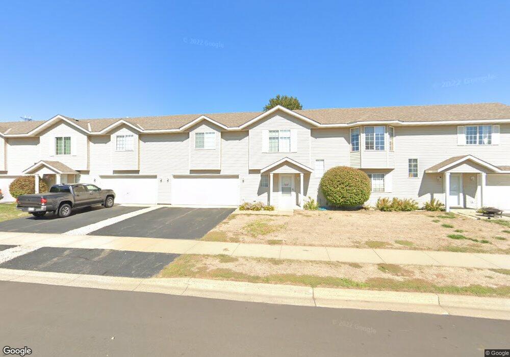
1977 Downing Ave Shakopee, MN 55379
Estimated Value: $231,000 - $254,000
2
Beds
2
Baths
1,256
Sq Ft
$194/Sq Ft
Est. Value
About This Home
This home is located at 1977 Downing Ave, Shakopee, MN 55379 and is currently estimated at $243,964, approximately $194 per square foot. 1977 Downing Ave is a home located in Scott County with nearby schools including Sun Path Elementary School, Shakopee West Middle School, and Shakopee Senior High School.
Ownership History
Date
Name
Owned For
Owner Type
Purchase Details
Closed on
May 25, 2018
Sold by
Barnard Eldon L and Barnard Muriel A
Bought by
Eroman Matthew Michael and Eroman Tira Leigh
Current Estimated Value
Home Financials for this Owner
Home Financials are based on the most recent Mortgage that was taken out on this home.
Original Mortgage
$162,960
Outstanding Balance
$140,636
Interest Rate
4.5%
Mortgage Type
New Conventional
Estimated Equity
$103,328
Purchase Details
Closed on
Jun 27, 2007
Sold by
Weckman Melissa A
Bought by
Barnard Eldon L and Barnard Muriel A
Purchase Details
Closed on
Oct 29, 2004
Sold by
Bremer Bruce E and Bremer Sarah L
Bought by
Weckman Melissa A
Purchase Details
Closed on
Oct 20, 2000
Sold by
Mw Johnson Construction
Bought by
Bremer Bruce E and Bremer Sarah L
Create a Home Valuation Report for This Property
The Home Valuation Report is an in-depth analysis detailing your home's value as well as a comparison with similar homes in the area
Home Values in the Area
Average Home Value in this Area
Purchase History
| Date | Buyer | Sale Price | Title Company |
|---|---|---|---|
| Eroman Matthew Michael | $168,000 | Trademark Title Services | |
| Barnard Eldon L | $149,500 | -- | |
| Weckman Melissa A | $165,000 | -- | |
| Bremer Bruce E | $124,199 | -- |
Source: Public Records
Mortgage History
| Date | Status | Borrower | Loan Amount |
|---|---|---|---|
| Open | Eroman Matthew Michael | $162,960 |
Source: Public Records
Tax History Compared to Growth
Tax History
| Year | Tax Paid | Tax Assessment Tax Assessment Total Assessment is a certain percentage of the fair market value that is determined by local assessors to be the total taxable value of land and additions on the property. | Land | Improvement |
|---|---|---|---|---|
| 2025 | $2,152 | $235,600 | $76,100 | $159,500 |
| 2024 | $2,232 | $225,000 | $72,400 | $152,600 |
| 2023 | $2,284 | $221,600 | $71,000 | $150,600 |
| 2022 | $2,116 | $223,300 | $72,700 | $150,600 |
| 2021 | $1,862 | $182,600 | $57,000 | $125,600 |
| 2020 | $1,916 | $178,800 | $52,500 | $126,300 |
| 2019 | $1,754 | $164,900 | $44,400 | $120,500 |
| 2018 | $1,804 | $0 | $0 | $0 |
| 2016 | $1,670 | $0 | $0 | $0 |
| 2014 | -- | $0 | $0 | $0 |
Source: Public Records
Map
Nearby Homes
- 1844 Mockingbird Ave Unit 1102
- 1820 Mockingbird Ave
- 1552 Dublin Ct
- 2471 Tyrone Dr
- 2447 Tyrone Dr
- 2399 Tyrone Dr
- 2263 Tyrone Dr
- 1511 England Way
- 2388 Vierling Dr E
- 2006 Tyrone Dr
- Lewis Plan at Summerland Place - Landmark Collection
- 2795 Downing Ave
- Vanderbilt Plan at Summerland Place - Landmark Collection
- Sinclair Plan at Summerland Place - Landmark Collection
- 1624 Philipp Way
- Nokomis Plan at Summerland Place - The Tradition Collection
- Gregorian Plan at Summerland Place - The Tradition Collection
- 1542 Philipp Way
- Pryor Plan at Summerland Place - The Tradition Collection
- Mille Lacs Plan at Summerland Place - The Tradition Collection
- 1961 Downing Ave
- 1993 Downing Ave
- 1945 Downing Ave
- 1995 Brittany Ct
- 1929 Downing Ave
- 1999 Brittany Ct
- 1964 Downing Ave
- 1948 Downing Ave
- 2003 Brittany Ct
- 1932 Downing Ave
- 1999 Downing Ave
- 1994 Brittany Ct
- 1998 Brittany Ct
- 2002 Brittany Ct
- 2002 Downing Ave
- 1916 Downing Ave
- 1897 Downing Ave
- 2007 Brittany Ct
- 2006 Brittany Ct
- 2014 Downing Ave