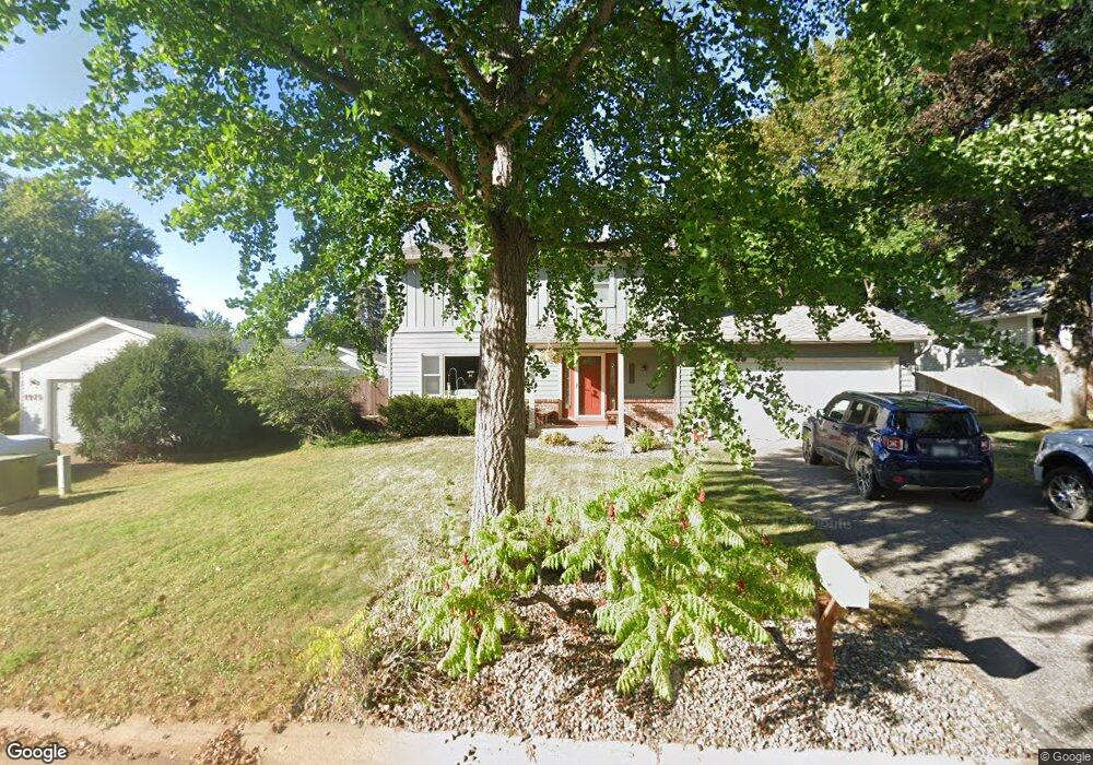
1981 1981 Warbler-Lane- St. Paul, MN 55119
Battle Creek NeighborhoodEstimated Value: $338,000 - $382,000
4
Beds
3
Baths
1,160
Sq Ft
$316/Sq Ft
Est. Value
About This Home
This home is located at 1981 1981 Warbler-Lane-, St. Paul, MN 55119 and is currently estimated at $366,526, approximately $315 per square foot. 1981 1981 Warbler-Lane- is a home located in Ramsey County with nearby schools including Battle Creek Elementary School, Battle Creek Middle School, and Harding Senior High School.
Ownership History
Date
Name
Owned For
Owner Type
Purchase Details
Closed on
Nov 8, 2013
Sold by
Seifert Shawn W and Seifert Kimberly
Bought by
Moynihan Ronald and Moynihan Cynthia J
Current Estimated Value
Home Financials for this Owner
Home Financials are based on the most recent Mortgage that was taken out on this home.
Original Mortgage
$155,600
Interest Rate
4.31%
Mortgage Type
New Conventional
Create a Home Valuation Report for This Property
The Home Valuation Report is an in-depth analysis detailing your home's value as well as a comparison with similar homes in the area
Home Values in the Area
Average Home Value in this Area
Purchase History
| Date | Buyer | Sale Price | Title Company |
|---|---|---|---|
| Moynihan Ronald | $200,393 | Stewart Title Of Minnesota |
Source: Public Records
Mortgage History
| Date | Status | Borrower | Loan Amount |
|---|---|---|---|
| Previous Owner | Moynihan Ronald | $155,600 |
Source: Public Records
Tax History Compared to Growth
Tax History
| Year | Tax Paid | Tax Assessment Tax Assessment Total Assessment is a certain percentage of the fair market value that is determined by local assessors to be the total taxable value of land and additions on the property. | Land | Improvement |
|---|---|---|---|---|
| 2025 | $5,446 | $359,600 | $39,500 | $320,100 |
| 2023 | $5,446 | $355,500 | $39,500 | $316,000 |
| 2022 | $4,440 | $338,000 | $39,500 | $298,500 |
| 2021 | $4,038 | $282,700 | $39,500 | $243,200 |
| 2020 | $4,126 | $267,700 | $39,500 | $228,200 |
| 2019 | $4,148 | $255,900 | $39,500 | $216,400 |
| 2018 | $3,736 | $253,400 | $39,500 | $213,900 |
| 2017 | $3,270 | $236,900 | $34,800 | $202,100 |
| 2016 | $3,334 | $0 | $0 | $0 |
| 2015 | $3,110 | $213,300 | $34,800 | $178,500 |
| 2014 | $3,176 | $0 | $0 | $0 |
Source: Public Records
Map
Nearby Homes
- 1935 Warbler Ln
- 138 Ruth St N Unit 9
- 1989 N Park Dr
- 2059 Parkside Dr Unit 29
- 2069 Parkside Dr Unit G2
- 2063 N Park Dr Unit 6
- 125 Battle Creek Place
- 136 White Bear Ave N
- 49 Battle Creek Place
- 125 Mcknight Rd N Unit K
- 465 Ruth St N
- 1821 Wilson Ave
- 2138 3rd St E
- 2169 Glenridge Ave
- 1935 Fremont Ave E
- 2243 Edgebrook Ave
- 1964 4th St E
- 2250 Edgebrook Ave
- 237 Sigurd St
- 2243 3rd St E
- 1981 Warbler Ln
- 1975 Warbler Ln
- 1989 Warbler Ln
- 184 Valleyside Dr
- 182 Valleyside Dr
- 1982 Warbler Ln
- 186 Valleyside Dr
- 1976 Warbler Ln
- 178 Valleyside Dr
- 1993 Warbler Ln
- 1990 Warbler Ln
- 1963 Warbler Ln
- 1970 Warbler Ln
- 188 Valleyside Dr
- 1999 Warbler Ln
- 174 Valleyside Dr
- 1994 Warbler Ln
- 1962 Warbler Ln
- 1957 Warbler Ln
- 192 Valleyside Dr