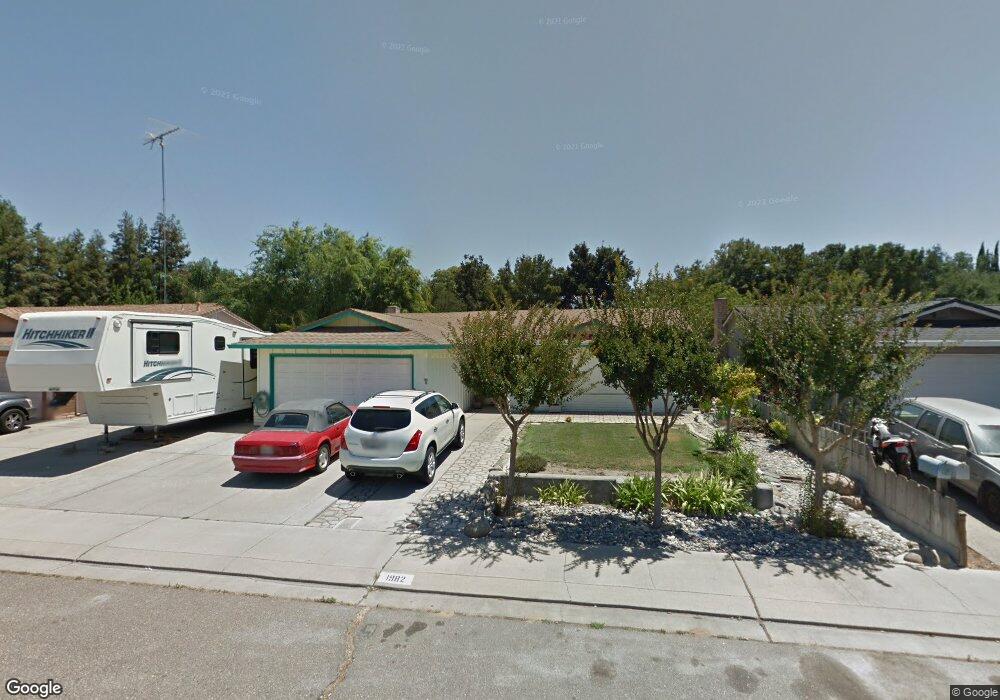
1982 Forest Ln Manteca, CA 95336
Downtown Manteca NeighborhoodEstimated Value: $446,589 - $473,000
3
Beds
2
Baths
1,245
Sq Ft
$370/Sq Ft
Est. Value
About This Home
This home is located at 1982 Forest Ln, Manteca, CA 95336 and is currently estimated at $460,397, approximately $369 per square foot. 1982 Forest Ln is a home located in San Joaquin County with nearby schools including Neil Hafley Elementary School and East Union High School.
Ownership History
Date
Name
Owned For
Owner Type
Purchase Details
Closed on
Dec 26, 2022
Sold by
Loredo Isidoro and Loredo Shirley
Bought by
Isidoro And Shirley Loredo Trust
Current Estimated Value
Purchase Details
Closed on
Sep 16, 2002
Sold by
Loredo Isidoro and Loredo Shirley
Bought by
Loredo Isidoro and Loredo Shirley
Home Financials for this Owner
Home Financials are based on the most recent Mortgage that was taken out on this home.
Original Mortgage
$126,900
Interest Rate
6.24%
Purchase Details
Closed on
Apr 12, 1994
Sold by
South San Joaquin Irrigation District
Bought by
Loredo Iridoro and Loredo Shirley
Create a Home Valuation Report for This Property
The Home Valuation Report is an in-depth analysis detailing your home's value as well as a comparison with similar homes in the area
Home Values in the Area
Average Home Value in this Area
Purchase History
| Date | Buyer | Sale Price | Title Company |
|---|---|---|---|
| Isidoro And Shirley Loredo Trust | -- | -- | |
| Loredo Isidoro | -- | Chicago Title Co | |
| Loredo Iridoro | -- | Old Republic Title Co |
Source: Public Records
Mortgage History
| Date | Status | Borrower | Loan Amount |
|---|---|---|---|
| Previous Owner | Loredo Isidoro | $126,900 |
Source: Public Records
Tax History
| Year | Tax Paid | Tax Assessment Tax Assessment Total Assessment is a certain percentage of the fair market value that is determined by local assessors to be the total taxable value of land and additions on the property. | Land | Improvement |
|---|---|---|---|---|
| 2025 | $2,389 | $220,508 | $117,219 | $103,289 |
| 2024 | $2,320 | $216,185 | $114,921 | $101,264 |
| 2023 | $2,291 | $211,947 | $112,668 | $99,279 |
| 2022 | $2,255 | $207,792 | $110,459 | $97,333 |
| 2021 | $2,229 | $203,719 | $108,294 | $95,425 |
| 2020 | $2,138 | $201,631 | $107,184 | $94,447 |
| 2019 | $2,109 | $197,679 | $105,083 | $92,596 |
| 2018 | $2,080 | $193,804 | $103,023 | $90,781 |
| 2017 | $2,048 | $190,004 | $101,003 | $89,001 |
| 2016 | $1,997 | $186,279 | $99,023 | $87,256 |
| 2014 | $1,855 | $179,887 | $95,625 | $84,262 |
Source: Public Records
Map
Nearby Homes
- 2016 Westboro Ln
- 1648 Olivewood Ave
- 6288 E Lathrop Rd
- 403 Curtwood Ct
- 1859 Elmwood Ln
- 1059 Harvest Mill Dr
- 1414 Pajaro Ave Unit 41
- 1460 Ridgecrest Dr
- 11097 S Union Rd
- 1110 Clearwater Creek Blvd
- 1293 Northgate Dr
- 976 Glen Abbey Dr
- 1296 Spruce Ln Unit 44
- 1479 Santini Ave
- 2558 Edgebrook Ln
- 1040 Birch Run Way
- 1350 Laurel Dr
- 1266 Wimbledon Way
- 2379 Pepper Tree Ln
- 2224 Bellchase Dr
- 1994 Forest Ln
- 1974 Forest Ln
- 2006 Forest Ln
- 1962 Forest Ln
- 1977 Forest Ln
- 1989 Forest Ln
- 2001 Forest Ln
- 2024 Forest Ln
- 1950 Forest Ln
- 2011 Westboro Ln
- 751 Cheshire Ct
- 2015 Forest Ln
- 2023 Westboro Ln
- 738 Cheshire Ct
- 678 Carlisle Way
- 2040 Forest Ln
- 1936 Forest Ln
- 2035 Westboro Ln
- 2000 Manchester Ln
- 2029 Forest Ln
Your Personal Tour Guide
Ask me questions while you tour the home.