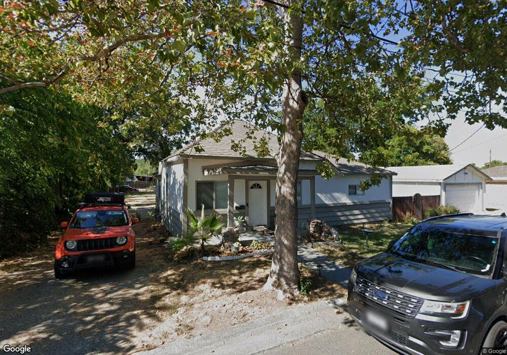
1982 Taft Ave Unit 1 Corning, CA 96021
Estimated Value: $183,000 - $266,000
About This Home
This home is located at 1982 Taft Ave Unit 1, Corning, CA 96021 and is currently estimated at $228,133, approximately $196 per square foot. 1982 Taft Ave Unit 1 is a home located in Tehama County with nearby schools including West Street Elementary School, Maywood Middle School, and Corning High School.
Ownership History
We collect this data history from publicly available records. To have your information removed, we recommend requesting removal directly through your county’s website.
Purchase Details
Purchase Details
Purchase Details
Home Financials for this Owner
Home Financials are based on the most recent Mortgage that was taken out on this home.Purchase Details
Home Financials for this Owner
Home Financials are based on the most recent Mortgage that was taken out on this home.Purchase Details
Purchase Details
Home Financials for this Owner
Home Financials are based on the most recent Mortgage that was taken out on this home.Purchase Details
Home Financials for this Owner
Home Financials are based on the most recent Mortgage that was taken out on this home.Purchase Details
Home Financials for this Owner
Home Financials are based on the most recent Mortgage that was taken out on this home.Purchase History
We collect this data history from publicly available records. To have your information removed, we recommend requesting removal directly through your county’s website.
| Date | Buyer | Sale Price | Title Company |
|---|---|---|---|
| $68,000 | Servicelink | ||
| $84,824 | Accommodation | ||
| $120,000 | First American Title Ins Co | ||
| -- | First American Title Ins Co | ||
| $113,445 | First American Title Ins Co | ||
| -- | Chicago Title Co | ||
| -- | -- | ||
| $86,500 | Northern California Title Co |
Mortgage History
We collect this data history from publicly available records. To have your information removed, we recommend requesting removal directly through your county’s website.
| Date | Status | Borrower | Loan Amount |
|---|---|---|---|
| Previous Owner | $123,600 | ||
| Previous Owner | $108,750 | ||
| Previous Owner | $77,850 |
Tax History
We collect this data history from publicly available records. To have your information removed, we recommend requesting removal directly through your county’s website.
| Year | Tax Paid | Tax Assessment Tax Assessment Total Assessment is a certain percentage of the fair market value that is determined by local assessors to be the total taxable value of land and additions on the property. | Land | Improvement |
|---|---|---|---|---|
| 2025 | $868 | $83,722 | $24,622 | $59,100 |
| 2023 | $852 | $80,473 | $23,667 | $56,806 |
| 2022 | $840 | $78,896 | $23,203 | $55,693 |
| 2021 | $809 | $77,350 | $22,749 | $54,601 |
| 2020 | $817 | $76,558 | $22,516 | $54,042 |
| 2019 | $784 | $75,058 | $22,075 | $52,983 |
| 2018 | $785 | $73,588 | $21,643 | $51,945 |
| 2017 | $780 | $72,146 | $21,219 | $50,927 |
| 2016 | $727 | $70,732 | $20,803 | $49,929 |
| 2015 | -- | $69,671 | $20,491 | $49,180 |
| 2014 | $711 | $68,307 | $20,090 | $48,217 |
Map
- 2018 Donnovan Ave
- 0 Toomes Ave Unit SN25272183
- 0 Toomes Ave Unit SN24222817
- 0 Toomes Ave Unit SN25176211
- 2059 Blossom Ave
- 2067 Blossom Ave
- 1414 Marin St
- 818 6th St
- 1162 5th Ave
- 2008 North St
- 1220 5th Ave
- 0 Carona Ave
- 1209 Marin St
- 1075 99w
- 233 Rio Verde Ct
- 1121 Marin St
- 243 Edith Ave
- 0 Houghton Ave Unit 324045531
- 0 Hwy 99 W Unit SN26028885
- 0 Hwy 99 W Unit SN26134655
- 1982 Taft Ave
- 1948 Taft Ave
- 1958 Taft Ave
- 909 Toomes Ave
- XXX Toomes Ave
- 4178 Toomes Ave
- 1983 Taft Ave
- 1973 Taft Ave
- 1928 Grant Ave
- 907 Toomes Ave
- 1916 Grant Ave
- 1045 Toomes Ave
- 1014 Toomes Ave
- 1914 Grant Ave
- 982 Toomes Ave
- 1910 Grant Ave
- 1042 Toomes Ave
- 1931 Mckinley Ave
- 1927 Mckinley Ave
- 1940 Taft Ave
Ask me questions while you tour the home.