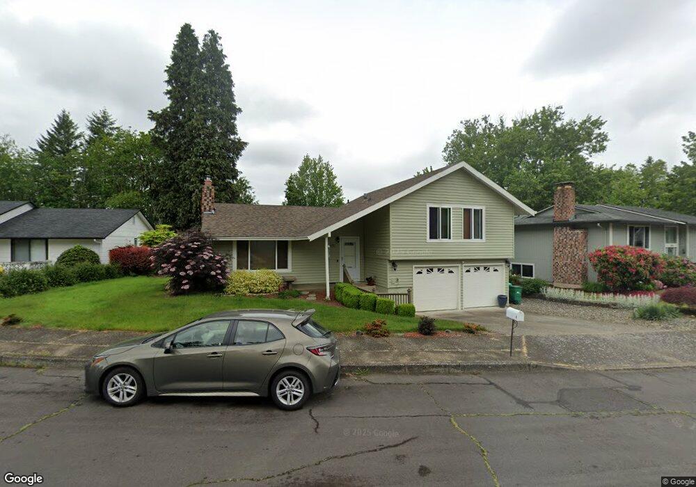
1985 SW Mawrcrest Ct Gresham, OR 97080
Southwest Gresham NeighborhoodEstimated Value: $452,000 - $489,000
About This Home
This home is located at 1985 SW Mawrcrest Ct, Gresham, OR 97080 and is currently estimated at $464,958, approximately $357 per square foot. 1985 SW Mawrcrest Ct is a home located in Multnomah County with nearby schools including Hollydale Elementary School, Dexter McCarty Middle School, and Gresham High School.
Ownership History
We collect this data history from publicly available records. To have your information removed, we recommend requesting removal directly through your county’s website.
Purchase Details
Home Financials for this Owner
Home Financials are based on the most recent Mortgage that was taken out on this home.Home Values in the Area
Average Home Value in this Area
Purchase History
We collect this data history from publicly available records. To have your information removed, we recommend requesting removal directly through your county’s website.
| Date | Buyer | Sale Price | Title Company |
|---|---|---|---|
| $10,000 | Transnation Title Insurance |
Mortgage History
We collect this data history from publicly available records. To have your information removed, we recommend requesting removal directly through your county’s website.
| Date | Status | Borrower | Loan Amount |
|---|---|---|---|
| Closed | $67,667 |
Tax History
We collect this data history from publicly available records. To have your information removed, we recommend requesting removal directly through your county’s website.
| Year | Tax Paid | Tax Assessment Tax Assessment Total Assessment is a certain percentage of the fair market value that is determined by local assessors to be the total taxable value of land and additions on the property. | Land | Improvement |
|---|---|---|---|---|
| 2025 | $4,835 | $237,600 | -- | -- |
| 2024 | $4,628 | $230,680 | -- | -- |
| 2023 | $4,217 | $223,970 | $0 | $0 |
| 2022 | $4,099 | $217,450 | $0 | $0 |
| 2021 | $3,996 | $211,120 | $0 | $0 |
| 2020 | $3,760 | $204,980 | $0 | $0 |
| 2019 | $3,661 | $199,010 | $0 | $0 |
| 2018 | $3,491 | $193,220 | $0 | $0 |
| 2017 | $3,350 | $187,600 | $0 | $0 |
| 2016 | $2,953 | $182,140 | $0 | $0 |
| 2015 | $2,890 | $176,840 | $0 | $0 |
| 2014 | $2,819 | $171,690 | $0 | $0 |
Map
- 2650 SW 22nd Ct
- 2530 SW 23rd St
- 1702 SW Mawrcrest Ave
- 2182 SW Brixton Place
- 2188 SW Binford Lake Pkwy
- 2500 SW 15th St
- 2791 SW Myers Dr
- 1944 SW 20th Ct
- 2331 SW 27th Dr
- 1479 SW Willowbrook Ct
- 2638 SW Sandlewood Ave
- 2959 SW Emerald Ave
- 2715 SW 31st St
- 1962 SW 27th Dr
- 3600 SW Brittany Dr
- 2607 SW Pleasant View Dr
- 1450 SW 26th Ct
- 1488 SW 17th Ct
- 1488 SW 17th Ct Unit N
- 1363 SW Binford Lake Pkwy
- 1965 SW Mawrcrest Ct
- 1935 SW Mawrcrest Ct
- 1994 SW Myers Place
- 1962 SW Mawrcrest Ct
- 1915 SW Mawrcrest Ct
- 1995 SW Mawrcrest Ct
- 1972 SW Myers Place
- 1932 SW Mawrcrest Ct
- 1987 SW Myers Place
- 2012 SW Mawrcrest Ct
- 1922 SW Mawrcrest Ct
- 1905 SW Mawrcrest Ct
- 1895 SW Mawrcrest Ave
- 2401 SW 20th St
- 2005 SW Mawrcrest Ct
- 1960 SW Myers Place
- 2392 SW Binford Lake Pkwy
- 2022 SW Mawrcrest Ct
- 2372 SW Binford Lake Pkwy
- 2015 SW Mawrcrest Ct
Ask me questions while you tour the home.