Estimated Value: $347,000 - $359,184
3
Beds
2
Baths
1,840
Sq Ft
$192/Sq Ft
Est. Value
About This Home
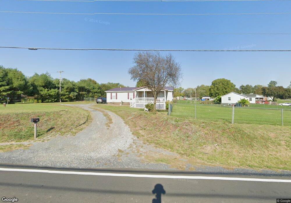
This home is located at 1985 Us Highway 340 N Unit 340N, Luray, VA 22835 and is currently estimated at $353,092, approximately $191 per square foot. 1985 Us Highway 340 N Unit 340N is a home located in Page County with nearby schools including Mt. Carmel Christian Academy.
Ownership History
Date
Name
Owned For
Owner Type
Purchase Details
Closed on
Oct 30, 2019
Sold by
Robert Yandow
Bought by
Strickler Shannon O
Current Estimated Value
Purchase Details
Closed on
Nov 3, 2016
Sold by
Franklin Elliott
Bought by
Yandow Robert and Yandow Margaret
Home Financials for this Owner
Home Financials are based on the most recent Mortgage that was taken out on this home.
Original Mortgage
$132,554
Interest Rate
3.37%
Mortgage Type
FHA
Purchase Details
Closed on
Aug 17, 2012
Purchase Details
Closed on
Apr 16, 2012
Create a Home Valuation Report for This Property
The Home Valuation Report is an in-depth analysis detailing your home's value as well as a comparison with similar homes in the area
Home Values in the Area
Average Home Value in this Area
Purchase History
| Date | Buyer | Sale Price | Title Company |
|---|---|---|---|
| Strickler Shannon O | $185,000 | -- | |
| Yandow Robert | $135,000 | -- | |
| -- | $116,000 | -- | |
| -- | $174,800 | -- |
Source: Public Records
Mortgage History
| Date | Status | Borrower | Loan Amount |
|---|---|---|---|
| Previous Owner | Yandow Robert | $132,554 | |
| Closed | Yandow Robert | $132,554 |
Source: Public Records
Tax History Compared to Growth
Tax History
| Year | Tax Paid | Tax Assessment Tax Assessment Total Assessment is a certain percentage of the fair market value that is determined by local assessors to be the total taxable value of land and additions on the property. | Land | Improvement |
|---|---|---|---|---|
| 2025 | $1,396 | $191,200 | $40,000 | $151,200 |
| 2024 | $1,396 | $191,200 | $40,000 | $151,200 |
| 2023 | $1,396 | $191,200 | $40,000 | $151,200 |
| 2022 | $1,396 | $191,200 | $40,000 | $151,200 |
| 2021 | $1,396 | $191,200 | $40,000 | $151,200 |
| 2020 | $1,345 | $184,200 | $35,000 | $149,200 |
| 2019 | $1,345 | $184,200 | $35,000 | $149,200 |
| 2018 | $1,289 | $184,200 | $35,000 | $149,200 |
| 2017 | $1,216 | $184,200 | $35,000 | $149,200 |
| 2016 | $1,216 | $184,200 | $35,000 | $149,200 |
| 2015 | $1,200 | $187,500 | $30,000 | $157,500 |
| 2014 | $1,200 | $187,500 | $30,000 | $157,500 |
Source: Public Records
Map
Nearby Homes
- 4 Cottage Dr
- 0 Cottage Dr
- 1050 Almond Dr
- 50 Cottage Dr
- 100 Cottage Dr
- 480 Mont View Ln
- 15 Mont View Ln
- 201 Woodland Ave
- 0 Collins Ave Unit VAPA2003268
- 34 Oflinn St
- 26 O Flinn St
- 26 Oflinn St
- 900 River Lodge Rd
- 0 None Unit 660498
- 220 Mechanic St
- 422 Mechanic St
- 125 N Lee St
- 0 Independence Dr
- 0 Atkins Dr Unit VAPA2001686
- 115 E Page St
- 1985 Us Highway 340 N
- 1985 U S Hwy 340n
- 1969 Us Highway 340 N
- 151 Sandy Hook Rd
- 275 Sandy Hook Rd
- 1913 Us Highway 340 N
- 1909 Us Highway 340 N
- 295 Sandy Hook Rd
- 323 Sandy Hook Rd
- 351 Sandy Hook Rd
- 385 Sandy Hook Rd
- 2134 Us Highway 340 N
- 2134 Us Highway 340 N
- 2138 Us Hwy
- 1919 Us Highway 340 N
- 2138 Us Highway 340 N
- 2138 Us Highway 340 N
- 409 Sandy Hook Rd
- 2144 Us Highway 340 N
- 431 Sandy Hook Rd