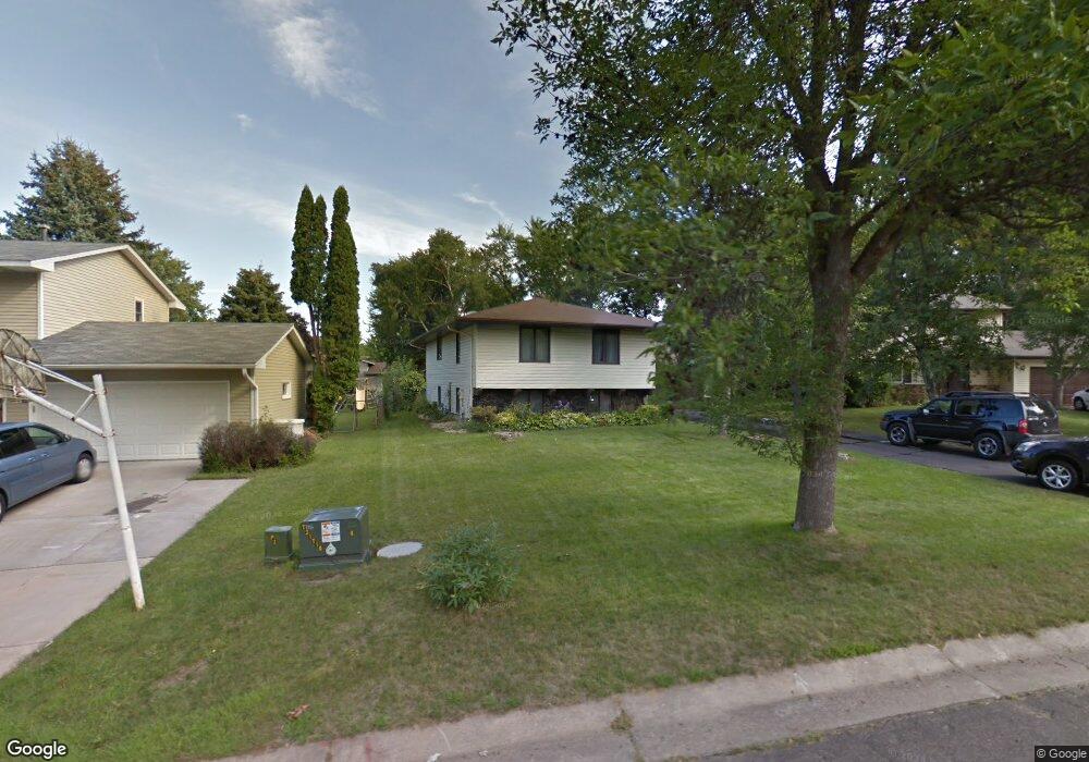
1989 Foxridge Rd Saint Paul, MN 55119
Battle Creek NeighborhoodEstimated Value: $346,567 - $386,000
5
Beds
2
Baths
1,142
Sq Ft
$321/Sq Ft
Est. Value
About This Home
This home is located at 1989 Foxridge Rd, Saint Paul, MN 55119 and is currently estimated at $366,142, approximately $320 per square foot. 1989 Foxridge Rd is a home located in Ramsey County with nearby schools including Battle Creek Elementary School, Battle Creek Middle School, and Harding Senior High School.
Ownership History
Date
Name
Owned For
Owner Type
Purchase Details
Closed on
Jun 15, 2017
Sold by
Alfa Adhanom W and Gemil Seva P
Bought by
Madigan Patrick J and Madigan Barbara J
Current Estimated Value
Home Financials for this Owner
Home Financials are based on the most recent Mortgage that was taken out on this home.
Original Mortgage
$200,000
Outstanding Balance
$166,358
Interest Rate
4.02%
Mortgage Type
New Conventional
Estimated Equity
$199,784
Create a Home Valuation Report for This Property
The Home Valuation Report is an in-depth analysis detailing your home's value as well as a comparison with similar homes in the area
Home Values in the Area
Average Home Value in this Area
Purchase History
| Date | Buyer | Sale Price | Title Company |
|---|---|---|---|
| Madigan Patrick J | $259,000 | None Available |
Source: Public Records
Mortgage History
| Date | Status | Borrower | Loan Amount |
|---|---|---|---|
| Open | Madigan Patrick J | $200,000 |
Source: Public Records
Tax History Compared to Growth
Tax History
| Year | Tax Paid | Tax Assessment Tax Assessment Total Assessment is a certain percentage of the fair market value that is determined by local assessors to be the total taxable value of land and additions on the property. | Land | Improvement |
|---|---|---|---|---|
| 2025 | $5,320 | $339,300 | $40,000 | $299,300 |
| 2023 | $5,320 | $342,400 | $40,000 | $302,400 |
| 2022 | $4,718 | $327,100 | $40,000 | $287,100 |
| 2021 | $4,346 | $274,500 | $40,000 | $234,500 |
| 2020 | $4,452 | $260,300 | $40,000 | $220,300 |
| 2019 | $4,442 | $247,400 | $40,000 | $207,400 |
| 2018 | $3,352 | $256,800 | $40,000 | $216,800 |
| 2017 | $3,272 | $203,800 | $35,300 | $168,500 |
| 2016 | $3,136 | $0 | $0 | $0 |
| 2015 | $3,054 | $175,600 | $35,300 | $140,300 |
| 2014 | $2,906 | $0 | $0 | $0 |
Source: Public Records
Map
Nearby Homes
- 1989 N Park Dr
- 138 Ruth St N Unit 9
- 1935 Warbler Ln
- 2059 Parkside Dr Unit 29
- 2069 Parkside Dr Unit G2
- 2063 N Park Dr Unit 6
- 125 Battle Creek Place
- 136 White Bear Ave N
- 49 Battle Creek Place
- 125 Mcknight Rd N Unit K
- 465 Ruth St N
- 1821 Wilson Ave
- 2169 Glenridge Ave
- 2243 Edgebrook Ave
- 2250 Edgebrook Ave
- 2138 3rd St E
- 1935 Fremont Ave E
- 237 Sigurd St
- 1964 4th St E
- 2243 3rd St E
- 1983 Foxridge Rd
- 1993 Foxridge Rd
- 1990 Warbler Ln
- 1982 Warbler Ln
- 1975 Foxridge Rd
- 1997 Foxridge Rd
- 1976 Warbler Ln
- 1994 Warbler Ln
- 1984 Foxridge Rd
- 1990 Foxridge Rd
- 1967 Foxridge Rd
- 1976 Foxridge Rd
- 1970 Warbler Ln
- 1998 Foxridge Rd
- 145 Ruth St N
- 135 Ruth St N
- 1999 Warbler Ln
- 155 Ruth St N
- 155 155 Ruth-Street-n
- 1968 Foxridge Rd