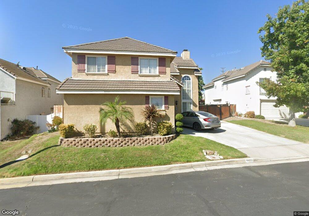
1991 Briar Path Trail Upland, CA 91784
Estimated Value: $790,931 - $975,000
4
Beds
3
Baths
1,951
Sq Ft
$454/Sq Ft
Est. Value
About This Home
This home is located at 1991 Briar Path Trail, Upland, CA 91784 and is currently estimated at $886,233, approximately $454 per square foot. 1991 Briar Path Trail is a home located in San Bernardino County with nearby schools including Pepper Tree Elementary, Pioneer Junior High School, and Upland High School.
Ownership History
Date
Name
Owned For
Owner Type
Purchase Details
Closed on
Oct 26, 2011
Sold by
Waite Yvonne R
Bought by
Morales Roer and Morales Lutgarda
Current Estimated Value
Home Financials for this Owner
Home Financials are based on the most recent Mortgage that was taken out on this home.
Original Mortgage
$287,850
Interest Rate
4.4%
Mortgage Type
FHA
Purchase Details
Closed on
Mar 23, 2005
Sold by
Thompson Timothy M and Thompson Michele L
Bought by
Waite Yvonne R
Home Financials for this Owner
Home Financials are based on the most recent Mortgage that was taken out on this home.
Original Mortgage
$424,150
Interest Rate
6.95%
Mortgage Type
Purchase Money Mortgage
Purchase Details
Closed on
Nov 3, 1994
Sold by
Emc Mtg Corp
Bought by
Thompson Timothy M and Thompson Michele L
Home Financials for this Owner
Home Financials are based on the most recent Mortgage that was taken out on this home.
Original Mortgage
$163,300
Interest Rate
6%
Purchase Details
Closed on
Feb 15, 1994
Sold by
Serrano Reconveyance Company
Bought by
Emc Mtg Corp
Create a Home Valuation Report for This Property
The Home Valuation Report is an in-depth analysis detailing your home's value as well as a comparison with similar homes in the area
Home Values in the Area
Average Home Value in this Area
Purchase History
| Date | Buyer | Sale Price | Title Company |
|---|---|---|---|
| Morales Roer | $300,000 | Ticor Title | |
| Waite Yvonne R | $499,000 | Investors Title Co San Bern | |
| Thompson Timothy M | $172,000 | Fidelity National Title Ins | |
| Emc Mtg Corp | $134,100 | Chicago Title Company |
Source: Public Records
Mortgage History
| Date | Status | Borrower | Loan Amount |
|---|---|---|---|
| Previous Owner | Morales Roer | $287,850 | |
| Previous Owner | Waite Yvonne R | $424,150 | |
| Previous Owner | Thompson Timothy M | $163,300 |
Source: Public Records
Tax History
| Year | Tax Paid | Tax Assessment Tax Assessment Total Assessment is a certain percentage of the fair market value that is determined by local assessors to be the total taxable value of land and additions on the property. | Land | Improvement |
|---|---|---|---|---|
| 2025 | $4,175 | $376,817 | $131,886 | $244,931 |
| 2024 | $4,041 | $369,428 | $129,300 | $240,128 |
| 2023 | $3,978 | $362,185 | $126,765 | $235,420 |
| 2022 | $3,891 | $355,083 | $124,279 | $230,804 |
| 2021 | $3,884 | $348,120 | $121,842 | $226,278 |
| 2020 | $3,778 | $344,551 | $120,593 | $223,958 |
| 2019 | $3,764 | $337,795 | $118,228 | $219,567 |
| 2018 | $3,672 | $331,172 | $115,910 | $215,262 |
| 2017 | $3,565 | $324,678 | $113,637 | $211,041 |
| 2016 | $5,190 | $318,312 | $111,409 | $206,903 |
| 2015 | $5,122 | $313,531 | $109,736 | $203,795 |
| 2014 | $3,199 | $307,389 | $107,586 | $199,803 |
Source: Public Records
Map
Nearby Homes
- 1243 Jacaranda Place
- 1328 Sunrise Cir S
- 1393 Sunrise Cir S
- 1214 Miller Ct
- 2166 Malati Cir
- 2183 Paris Cir
- 1931 Eloise Way
- 1798 Wilson Ave
- 907 Pineridge St
- 1238 Fairway Cir
- 2252 Verbena Ave
- 1234 Fairway Cir
- 2257 Poppy Ave
- 1279 Moss St
- 1739 Orangewood Ave
- 2326 Fairfield Way
- 779 Coral Tree Way
- 1435 Lookout Ct
- 937 Emerson St
- 1640 Lakewood Ave
- 1995 Briar Trail
- 1995 Briar Path Trail
- 1985 Briar Trail
- 1985 Briar Path Trail
- 1981 Briar Path Trail
- 1990 Shady Brook Way
- 1999 Briar Trail
- 1999 Briar Path Trail
- 1994 Shady Brook Way
- 1984 Shady Brook Way
- 1998 Shady Brook Way
- 1990 Briar Path Trail
- 1984 Briar Path Trail
- 1994 Briar Path Trail
- 1979 Briar Trail
- 1979 Briar Path Trail
- 1980 Shady Brook Way
- 1998 Briar Path Trail
- 1980 Briar Path Trail
- 1978 Shady Brook Way
Your Personal Tour Guide
Ask me questions while you tour the home.