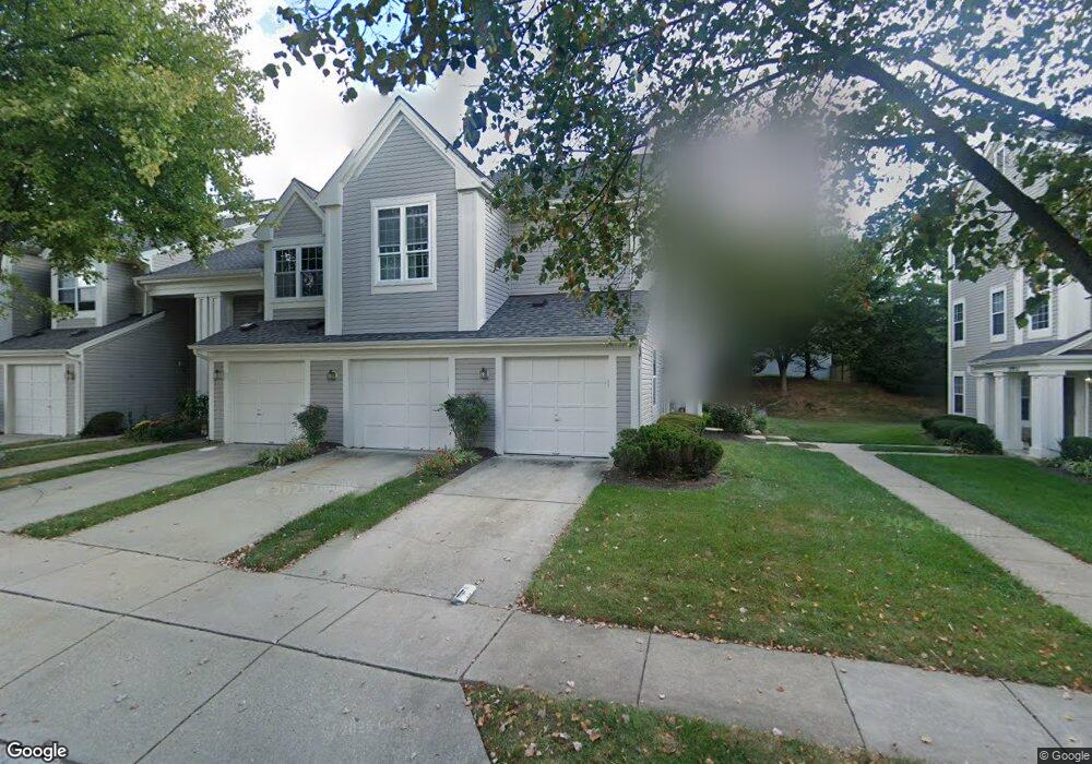
19955 Dunstable Cir Germantown, MD 20876
Estimated Value: $336,169 - $345,000
2
Beds
2
Baths
1,242
Sq Ft
$273/Sq Ft
Est. Value
About This Home
This home is located at 19955 Dunstable Cir, Germantown, MD 20876 and is currently estimated at $339,542, approximately $273 per square foot. 19955 Dunstable Cir is a home located in Montgomery County with nearby schools including South Lake Elementary School, Neelsville Middle, and Watkins Mill High School.
Ownership History
Date
Name
Owned For
Owner Type
Purchase Details
Closed on
Sep 26, 2011
Sold by
Armstrong Robert
Bought by
Brown Aranda M
Current Estimated Value
Home Financials for this Owner
Home Financials are based on the most recent Mortgage that was taken out on this home.
Original Mortgage
$162,766
Outstanding Balance
$111,547
Interest Rate
4.2%
Mortgage Type
FHA
Estimated Equity
$227,995
Purchase Details
Closed on
Mar 28, 2001
Sold by
Aijo Scott P
Bought by
Donovan William
Create a Home Valuation Report for This Property
The Home Valuation Report is an in-depth analysis detailing your home's value as well as a comparison with similar homes in the area
Home Values in the Area
Average Home Value in this Area
Purchase History
| Date | Buyer | Sale Price | Title Company |
|---|---|---|---|
| Brown Aranda M | $167,000 | Old Republic National Title | |
| Donovan William | $123,500 | -- |
Source: Public Records
Mortgage History
| Date | Status | Borrower | Loan Amount |
|---|---|---|---|
| Open | Brown Aranda M | $162,766 |
Source: Public Records
Tax History Compared to Growth
Tax History
| Year | Tax Paid | Tax Assessment Tax Assessment Total Assessment is a certain percentage of the fair market value that is determined by local assessors to be the total taxable value of land and additions on the property. | Land | Improvement |
|---|---|---|---|---|
| 2025 | $3,218 | $273,333 | -- | -- |
| 2024 | $3,218 | $246,667 | $0 | $0 |
| 2023 | $2,009 | $220,000 | $66,000 | $154,000 |
| 2022 | $1,719 | $213,333 | $0 | $0 |
| 2021 | $1,888 | $206,667 | $0 | $0 |
| 2020 | $1,791 | $200,000 | $60,000 | $140,000 |
| 2019 | $3,483 | $196,667 | $0 | $0 |
| 2018 | $1,700 | $193,333 | $0 | $0 |
| 2017 | $1,746 | $190,000 | $0 | $0 |
| 2016 | -- | $190,000 | $0 | $0 |
| 2015 | $2,300 | $190,000 | $0 | $0 |
| 2014 | $2,300 | $200,000 | $0 | $0 |
Source: Public Records
Map
Nearby Homes
- 19932 Dunstable Cir
- 11116 Cedarbluff Ln
- 19810 Madrigal Dr
- 19922 Gateshead Cir
- 19970 Appledowre Cir
- 19900 Appledowre Cir
- 11303 Appledowre Way
- 20172 Locustdale Dr
- 11418 Appledowre Way
- 20113 Locustdale Dr
- 11407 Stoney Point Place
- 11427 Hawks Ridge Terrace
- 11406 Locustdale Terrace
- 11417 Appledowre Way
- 19323 Moon Ridge Dr
- 19540 Scenery Dr
- 11421 Flowerton Place
- 11524 Brundidge Terrace
- 11409 Berland Place
- 20415 Cabana Dr
- 19959 Dunstable Cir
- 19957 Dunstable Cir
- 19965 Dunstable Cir
- 19961 Dunstable Cir
- 19963 Dunstable Cir
- 19949 Dunstable Cir
- 19953 Dunstable Cir
- 19951 Dunstable Cir
- 19943 Dunstable Cir
- 19947 Dunstable Cir
- 19945 Dunstable Cir
- 19948 Dunstable Cir
- 19952 Dunstable Cir
- 19950 Dunstable Cir
- 19954 Dunstable Cir
- 19956 Dunstable Cir
- 19958 Dunstable Cir
- 19969 Dunstable Cir
- 19967 Dunstable Cir
- 19971 Dunstable Cir