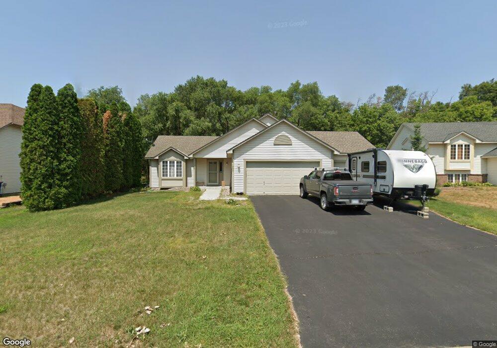
1999 Mathias Rd Shakopee, MN 55379
Estimated Value: $449,119 - $477,000
4
Beds
2
Baths
1,404
Sq Ft
$326/Sq Ft
Est. Value
About This Home
This home is located at 1999 Mathias Rd, Shakopee, MN 55379 and is currently estimated at $458,280, approximately $326 per square foot. 1999 Mathias Rd is a home located in Scott County with nearby schools including Sun Path Elementary School, Shakopee West Middle School, and Shakopee Senior High School.
Ownership History
Date
Name
Owned For
Owner Type
Purchase Details
Closed on
Apr 8, 2022
Sold by
Harig John C and Harig Joan C
Bought by
Harig John C and Harig Joan C
Current Estimated Value
Purchase Details
Closed on
Aug 19, 2004
Sold by
Sirva Relocation Llc
Bought by
Harig John C and Harig John C
Purchase Details
Closed on
Jun 12, 2003
Sold by
Nonyak Andrey and Nonyak Olga
Bought by
Webb Elizabeth L and Webb Robert H
Purchase Details
Closed on
May 3, 2000
Sold by
U S Home Corp
Bought by
Nonyak Andrey and Nonyak Olga
Create a Home Valuation Report for This Property
The Home Valuation Report is an in-depth analysis detailing your home's value as well as a comparison with similar homes in the area
Home Values in the Area
Average Home Value in this Area
Purchase History
| Date | Buyer | Sale Price | Title Company |
|---|---|---|---|
| Harig John C | -- | None Listed On Document | |
| Harig John C | $299,000 | -- | |
| Sirva Relocation Llc | $299,000 | -- | |
| Webb Elizabeth L | $267,000 | -- | |
| Nonyak Andrey | $184,735 | -- |
Source: Public Records
Tax History Compared to Growth
Tax History
| Year | Tax Paid | Tax Assessment Tax Assessment Total Assessment is a certain percentage of the fair market value that is determined by local assessors to be the total taxable value of land and additions on the property. | Land | Improvement |
|---|---|---|---|---|
| 2025 | $4,332 | $414,100 | $156,500 | $257,600 |
| 2024 | $4,206 | $417,900 | $156,500 | $261,400 |
| 2023 | $4,456 | $393,700 | $142,500 | $251,200 |
| 2022 | $4,096 | $408,700 | $161,900 | $246,800 |
| 2021 | $3,652 | $327,400 | $128,100 | $199,300 |
| 2020 | $3,980 | $319,700 | $122,900 | $196,800 |
| 2019 | $3,736 | $306,800 | $109,200 | $197,600 |
| 2018 | $4,084 | $0 | $0 | $0 |
| 2016 | $3,978 | $0 | $0 | $0 |
| 2014 | -- | $0 | $0 | $0 |
Source: Public Records
Map
Nearby Homes
- 2052 Wilhelm Ct
- 1844 Mockingbird Ave Unit 1102
- 1820 Mockingbird Ave
- 2777 Pampas Ct
- 1552 Dublin Ct
- 2518 Green Ash Ave
- 2529 Green Ash Ave
- 1895 Omega Dr
- Berkley Plan at Arbor Bluff - Venture Collection
- 2551 Aspen Ct
- Clark Plan at Arbor Bluff - Venture Collection
- 2548 Aspen Ct
- Itasca Plan at Arbor Bluff - Landmark Collection
- Sequoia Plan at Arbor Bluff - Venture Collection
- Markham Plan at Arbor Bluff - Venture Collection
- 2340 Rock Elm Rd
- Lewis Plan at Arbor Bluff - Landmark Collection
- McKinley Plan at Arbor Bluff - Landmark Collection
- 2584 Aspen Ct
- 2606 Green Ash Ave
- 1977 Mathias Rd
- 2021 Mathias Rd
- 2022 Groveland Way
- 1955 Mathias Rd
- 2012 Groveland Way
- 2043 Mathias Rd
- 2042 Groveland Way
- 1982 Groveland Way
- 2008 Mathias Rd
- 1933 Mathias Rd
- 1911 Mooers Ave
- 1962 Groveland Way
- 2054 Saint Francis Ave
- 2030 Mathias Rd
- 2044 Saint Francis Ave
- 1964 Mathias Rd
- 2014 Saint Francis Ave
- 1895 Mooers Ave
- 1942 Groveland Way
- 2052 Mathias Rd