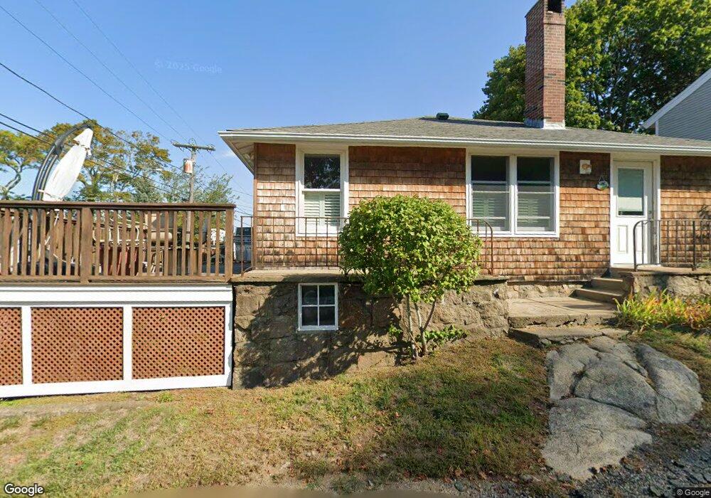
2 Orchard Way Gloucester, MA 01930
Riverview NeighborhoodEstimated Value: $510,000 - $621,051
1
Bed
1
Bath
840
Sq Ft
$669/Sq Ft
Est. Value
About This Home
This home is located at 2 Orchard Way, Gloucester, MA 01930 and is currently estimated at $562,263, approximately $669 per square foot. 2 Orchard Way is a home located in Essex County with nearby schools including Beeman Memorial, Ralph B O'maley Middle School, and Gloucester High School.
Ownership History
Date
Name
Owned For
Owner Type
Purchase Details
Closed on
Apr 28, 2016
Sold by
Sinclair-Murray Kristin F
Bought by
Sinclair-Murray Kristin F and Murray Matthew B
Current Estimated Value
Purchase Details
Closed on
Jan 4, 2001
Sold by
Lane Florence M
Bought by
Sinclair Kristin F
Create a Home Valuation Report for This Property
The Home Valuation Report is an in-depth analysis detailing your home's value as well as a comparison with similar homes in the area
Home Values in the Area
Average Home Value in this Area
Purchase History
| Date | Buyer | Sale Price | Title Company |
|---|---|---|---|
| Sinclair-Murray Kristin F | -- | -- | |
| Sinclair Kristin F | $160,000 | -- |
Source: Public Records
Mortgage History
| Date | Status | Borrower | Loan Amount |
|---|---|---|---|
| Previous Owner | Sinclair Kristin F | $64,000 | |
| Previous Owner | Sinclair Kristin F | $166,500 | |
| Previous Owner | Sinclair Kristin F | $20,000 |
Source: Public Records
Tax History
| Year | Tax Paid | Tax Assessment Tax Assessment Total Assessment is a certain percentage of the fair market value that is determined by local assessors to be the total taxable value of land and additions on the property. | Land | Improvement |
|---|---|---|---|---|
| 2025 | $5,275 | $542,700 | $277,100 | $265,600 |
| 2024 | $5,112 | $525,400 | $263,900 | $261,500 |
| 2023 | $5,100 | $481,600 | $235,600 | $246,000 |
| 2022 | $4,303 | $366,800 | $158,900 | $207,900 |
| 2021 | $4,307 | $346,200 | $144,400 | $201,800 |
| 2020 | $4,005 | $324,800 | $144,400 | $180,400 |
| 2019 | $3,961 | $312,100 | $144,400 | $167,700 |
| 2018 | $3,895 | $301,200 | $144,400 | $156,800 |
| 2017 | $3,793 | $287,600 | $137,600 | $150,000 |
| 2016 | $3,608 | $265,100 | $138,000 | $127,100 |
| 2015 | $3,567 | $261,300 | $138,000 | $123,300 |
Source: Public Records
Map
Nearby Homes
- 2 Breezy Point Rd
- 13 Honeysuckle Rd
- 3 Deacon Farm Ln
- 672 Washington St
- 31 Echo Ave
- 167 Atlantic St
- 178 Atlantic St
- 226 Atlantic St
- 136 Leonard St
- 3 Rockland St
- 13 Mystic Ave
- 8 Mystic Ave
- 6 Monroe Ct
- 98 Maplewood Ave
- 9 Cleveland Place
- 12 Arthur St
- 40 Sargent St
- 4 Ciaramitaro Ct
- 15 Harvard St
- 19 Trask St Unit 2
- 127 Wheeler St
- 4 Orchard Way
- 128A Wheeler St
- 125 Wheeler St
- 131 Wheeler St
- 3 Orchard Way
- 131A Wheeler St
- 6 Orchard Way
- 128 Wheeler St
- 6 Shore Hill Rd
- 5 Wheelers Point Rd
- 132 Wheeler St
- 126 Wheeler St
- 7 Orchard Way
- 132 1/2 Wheeler St
- 124 Wheeler St
- 8 Orchard Way
- 137 Wheeler St
- 6 Wheelers Point Rd
- 7 Wheelers Point Rd
Your Personal Tour Guide
Ask me questions while you tour the home.