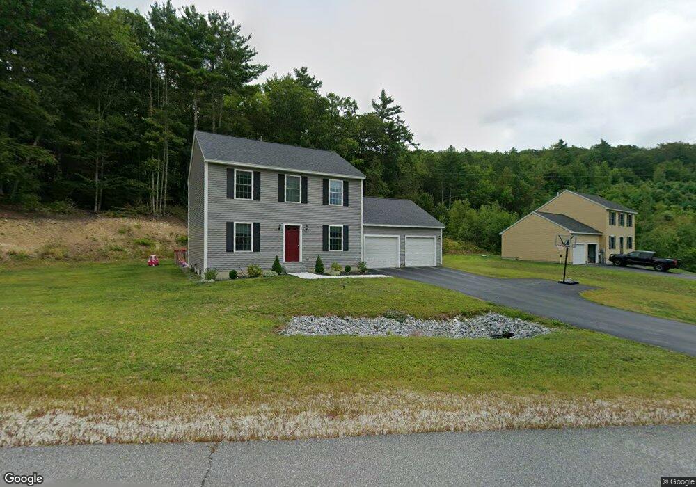
2 Richfield Way Wilton, NH 03086
Estimated Value: $457,000 - $519,000
3
Beds
2
Baths
1,560
Sq Ft
$314/Sq Ft
Est. Value
About This Home
This home is located at 2 Richfield Way, Wilton, NH 03086 and is currently estimated at $490,571, approximately $314 per square foot. 2 Richfield Way is a home with nearby schools including Florence Rideout Elementary School, Wilton-Lyndeborough Cooperative Middle School, and Wilton-Lyndeborough Cooperative High School.
Ownership History
Date
Name
Owned For
Owner Type
Purchase Details
Closed on
Sep 28, 2018
Sold by
Buchanan Constructio C
Bought by
Powers Nathan T and Powers Tiffany M
Current Estimated Value
Home Financials for this Owner
Home Financials are based on the most recent Mortgage that was taken out on this home.
Original Mortgage
$220,684
Outstanding Balance
$189,244
Interest Rate
3.75%
Mortgage Type
Adjustable Rate Mortgage/ARM
Estimated Equity
$301,327
Create a Home Valuation Report for This Property
The Home Valuation Report is an in-depth analysis detailing your home's value as well as a comparison with similar homes in the area
Home Values in the Area
Average Home Value in this Area
Purchase History
| Date | Buyer | Sale Price | Title Company |
|---|---|---|---|
| Powers Nathan T | $275,866 | -- |
Source: Public Records
Mortgage History
| Date | Status | Borrower | Loan Amount |
|---|---|---|---|
| Open | Powers Nathan T | $220,684 |
Source: Public Records
Tax History Compared to Growth
Tax History
| Year | Tax Paid | Tax Assessment Tax Assessment Total Assessment is a certain percentage of the fair market value that is determined by local assessors to be the total taxable value of land and additions on the property. | Land | Improvement |
|---|---|---|---|---|
| 2024 | $8,662 | $348,300 | $113,900 | $234,400 |
| 2023 | $7,732 | $348,300 | $113,900 | $234,400 |
| 2022 | $7,196 | $348,300 | $113,900 | $234,400 |
| 2021 | $7,069 | $367,800 | $113,900 | $253,900 |
| 2020 | $6,533 | $222,300 | $56,100 | $166,200 |
| 2019 | $6,456 | $222,300 | $56,100 | $166,200 |
| 2018 | $1,642 | $57,100 | $56,100 | $1,000 |
| 2017 | $1,551 | $57,100 | $56,100 | $1,000 |
| 2016 | $1,504 | $57,100 | $56,100 | $1,000 |
| 2015 | $1,760 | $66,800 | $63,700 | $3,100 |
| 2014 | $1,723 | $66,800 | $63,700 | $3,100 |
| 2013 | $976 | $37,500 | $37,500 | $0 |
Source: Public Records
Map
Nearby Homes
- 18 Richfield Way
- 81 Abbot Hill Acres
- 88 McGettigan Rd Unit 88-6-1
- F-88-10 Aria Hill Dr
- F-88-11 Aria Hill Dr
- 27 Island St
- F-88-12 Aria Hill Dr
- Lot F-88-9 Aria Hill Dr
- F-88-7 Aria Hill Dr
- 10 Mill St
- F/88-5 McGettigan Rd
- F/88-4 McGettigan Rd
- 8 Maple St
- 134 Falcon Ridge Rd Unit 23
- Lots 4 & 7 Gibbons & Robbins Rd
- 30 Holden Ln
- 0 Marden Rd
- 59 Goldsmith Rd
- 119 Boynton Hill Rd
- 60 Goldsmith Rd
- 6 Richfield Way
- 1 Richfield Way
- 46 Proctor Rd
- 8 Richfield Way
- 54 Proctor Rd
- 59 Proctor Rd
- 10 Richfield Way
- 39 Proctor Rd
- 9 Richfield Way
- 36 Proctor Rd
- 12 Richfield Way
- 181 Abbot Hill Rd
- 11 Richfield Way
- 171 Abbot Hill Rd
- 60 Proctor Rd
- 14 Richfield Way
- 13 Richfield Way
- 4 Greene St
- 24 Proctor Rd
- 58 Proctor Rd