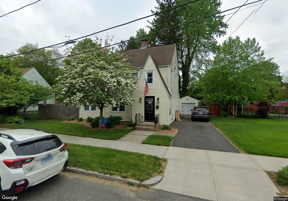
20 Ashbrook St Springfield, MA 01118
East Forest Park NeighborhoodEstimated Value: $317,000 - $344,000
3
Beds
2
Baths
1,836
Sq Ft
$181/Sq Ft
Est. Value
About This Home
This home is located at 20 Ashbrook St, Springfield, MA 01118 and is currently estimated at $332,445, approximately $181 per square foot. 20 Ashbrook St is a home located in Hampden County with nearby schools including Mary A. Dryden Veterans Memorial School, M Marcus Kiley Middle, and Springfield High School of Science and Technology.
Ownership History
Date
Name
Owned For
Owner Type
Purchase Details
Closed on
Sep 30, 2019
Sold by
Duffy Richard E and Duffy Ann M
Bought by
Duffy Robert W and Mahoney Rachael M
Current Estimated Value
Home Financials for this Owner
Home Financials are based on the most recent Mortgage that was taken out on this home.
Original Mortgage
$179,450
Outstanding Balance
$156,512
Interest Rate
3.5%
Mortgage Type
New Conventional
Estimated Equity
$175,933
Purchase Details
Closed on
May 17, 2012
Sold by
Duffy Ann M
Bought by
Duffy Richard E and Duffy Ann M
Purchase Details
Closed on
Apr 26, 2011
Sold by
Coughlin Maryrose and Duffy Ann M
Bought by
Duffy Ann M and Taft Joan T
Create a Home Valuation Report for This Property
The Home Valuation Report is an in-depth analysis detailing your home's value as well as a comparison with similar homes in the area
Home Values in the Area
Average Home Value in this Area
Purchase History
| Date | Buyer | Sale Price | Title Company |
|---|---|---|---|
| Duffy Robert W | $185,000 | -- | |
| Duffy Robert W | $185,000 | -- | |
| Duffy Richard E | -- | -- | |
| Duffy Ann M | $50,000 | -- | |
| Duffy Richard E | -- | -- | |
| Duffy Ann M | $50,000 | -- | |
| Duffy Ann M | -- | -- | |
| Duffy Ann M | -- | -- | |
| Duffy Ann M | -- | -- |
Source: Public Records
Mortgage History
| Date | Status | Borrower | Loan Amount |
|---|---|---|---|
| Open | Duffy Robert W | $179,450 | |
| Closed | Duffy Robert W | $179,450 | |
| Previous Owner | Duffy Ann M | $5,000 |
Source: Public Records
Tax History
| Year | Tax Paid | Tax Assessment Tax Assessment Total Assessment is a certain percentage of the fair market value that is determined by local assessors to be the total taxable value of land and additions on the property. | Land | Improvement |
|---|---|---|---|---|
| 2025 | $4,663 | $297,400 | $46,500 | $250,900 |
| 2024 | $4,304 | $268,000 | $46,500 | $221,500 |
| 2023 | $4,020 | $235,800 | $44,300 | $191,500 |
| 2022 | $4,282 | $227,500 | $44,300 | $183,200 |
| 2021 | $4,046 | $214,100 | $40,200 | $173,900 |
| 2020 | $3,804 | $194,800 | $40,200 | $154,600 |
| 2019 | $3,727 | $189,400 | $40,200 | $149,200 |
| 2018 | $3,376 | $182,100 | $40,200 | $141,900 |
| 2017 | $3,376 | $171,700 | $40,200 | $131,500 |
| 2016 | $3,334 | $169,600 | $40,200 | $129,400 |
| 2015 | $3,387 | $172,200 | $40,200 | $132,000 |
Source: Public Records
Map
Nearby Homes
- 7 Ashbrook St
- 75 Gillette Cir
- 170 Plumtree Rd
- 134 Eddywood St
- 79 Roosevelt Ave
- 47 Hartford Terrace
- 118 Pilgrim Rd
- 384 Abbott St
- 509 Plumtree Rd
- 29 Eddywood St
- 1088 Sumner Ave
- 37 Chesterfield Ave
- 13 Bither St
- 54 S Shore Dr
- 55 Mandalay Rd
- 39 Balfour Dr
- 34 Castle St
- 236 Pondview Dr
- 647 Plumtree Rd
- 119 Powell Ave
- 14 Ashbrook St
- 32 Ashbrook St
- 8 Ashbrook St
- 290 Plumtree Rd
- 19 Ashbrook St
- 15 Audborn St
- 239 Roosevelt Ave
- 25 Ashbrook St
- 11 Ashbrook St
- 245 Roosevelt Ave
- 4 Ashbrook St
- 233 Roosevelt Ave
- 251 Roosevelt Ave
- 33 Ashbrook St
- 284 Plumtree Rd
- 40 Ashbrook St
- 12 Oregon St
- 20 Oregon St
- 257 Roosevelt Ave
- 280 Plumtree Rd
Your Personal Tour Guide
Ask me questions while you tour the home.