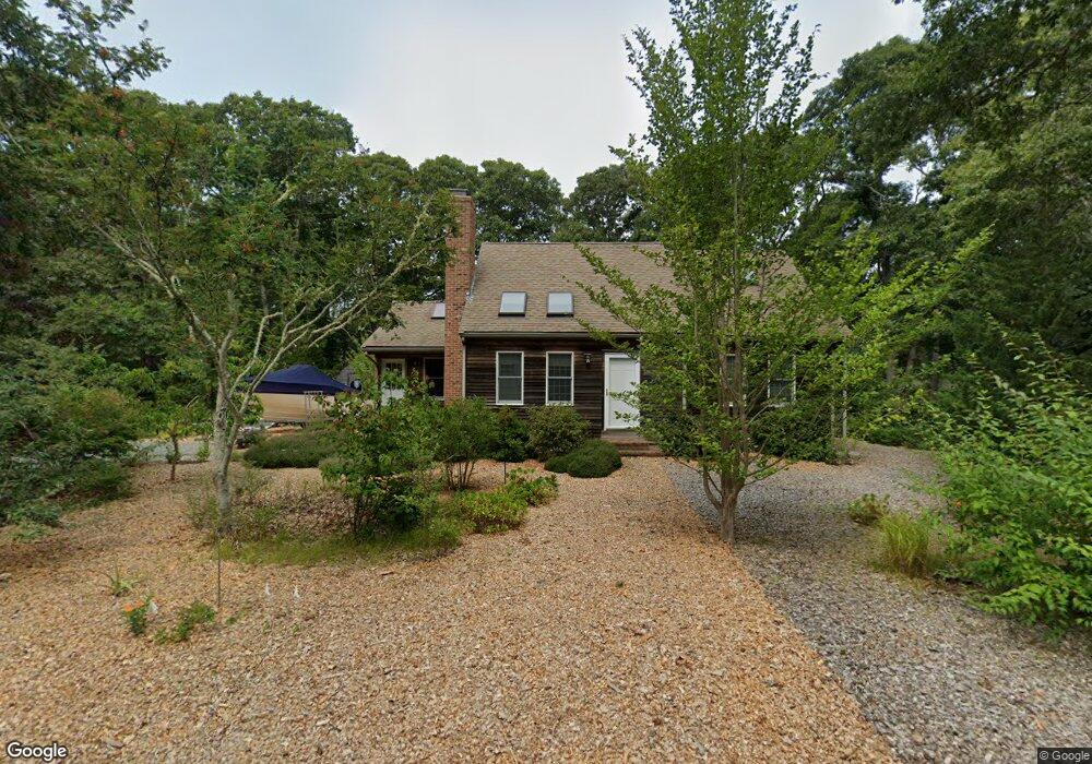
20 Lighthouse Ln Eastham, MA 02642
Estimated Value: $818,000 - $992,000
4
Beds
2
Baths
1,821
Sq Ft
$492/Sq Ft
Est. Value
About This Home
This home is located at 20 Lighthouse Ln, Eastham, MA 02642 and is currently estimated at $895,121, approximately $491 per square foot. 20 Lighthouse Ln is a home located in Barnstable County with nearby schools including Eastham Elementary School, Nauset Regional Middle School, and Nauset Regional High School.
Ownership History
Date
Name
Owned For
Owner Type
Purchase Details
Closed on
Aug 30, 2024
Sold by
Shames Spencer L and Shames Dennis Patricia
Bought by
20 Lighthouse Lane T and Shames
Current Estimated Value
Purchase Details
Closed on
Dec 29, 1994
Sold by
Toscano Anthony and Toscano Theresa
Bought by
Shames Spencer L
Create a Home Valuation Report for This Property
The Home Valuation Report is an in-depth analysis detailing your home's value as well as a comparison with similar homes in the area
Home Values in the Area
Average Home Value in this Area
Purchase History
| Date | Buyer | Sale Price | Title Company |
|---|---|---|---|
| 20 Lighthouse Lane T | -- | None Available | |
| 20 Lighthouse Lane T | -- | None Available | |
| Shames Spencer L | $48,000 | -- | |
| Shames Spencer L | $48,000 | -- |
Source: Public Records
Mortgage History
| Date | Status | Borrower | Loan Amount |
|---|---|---|---|
| Previous Owner | Shames Spencer L | $95,000 | |
| Previous Owner | Shames Spencer L | $99,000 | |
| Previous Owner | Shames Spencer L | $101,000 | |
| Previous Owner | Shames Spencer L | $101,000 |
Source: Public Records
Tax History
| Year | Tax Paid | Tax Assessment Tax Assessment Total Assessment is a certain percentage of the fair market value that is determined by local assessors to be the total taxable value of land and additions on the property. | Land | Improvement |
|---|---|---|---|---|
| 2025 | $5,745 | $745,200 | $264,400 | $480,800 |
| 2024 | $5,072 | $723,600 | $256,700 | $466,900 |
| 2023 | $4,701 | $649,300 | $237,700 | $411,600 |
| 2022 | $4,341 | $506,000 | $212,200 | $293,800 |
| 2021 | $4,251 | $463,100 | $192,900 | $270,200 |
| 2020 | $3,922 | $449,800 | $196,900 | $252,900 |
| 2019 | $3,628 | $439,700 | $191,100 | $248,600 |
| 2018 | $3,566 | $427,100 | $185,600 | $241,500 |
| 2017 | $3,329 | $421,400 | $181,900 | $239,500 |
| 2016 | $3,093 | $415,700 | $181,900 | $233,800 |
| 2015 | $2,898 | $408,100 | $178,400 | $229,700 |
Source: Public Records
Map
Nearby Homes
- 255 Epanow Rd
- 20 Oak Rd
- 18 Jay Dee Ln
- 35 Wiley Ln
- 255 Massasoit Rd
- 5470 State Hwy
- 82 Old Orchard Rd
- 10 Bradford Ln
- 300 School House Rd
- 70 Deerfield Ln
- 100 Gigi Ln
- 245 Nauset Light Beach Rd
- 245 Nauset Light Rd Unit R
- 495 Aspinet Rd
- 50 Surrey Dr
- 115 Wamsutta Rd
- 157 Brownell Rd
- 3098 State Hwy
- 80 Quason Dr
- 49 Village Ln
- 2045 Nauset Rd
- 10 Lighthouse Ln
- 3 Lighthouse Ln
- 30 Lighthouse Ln
- 5 Lighthouse Ln
- 80 Captain Penniman Rd
- 100 Captain Penniman Rd
- 2055 Nauset Rd
- 40 Lighthouse Ln
- 2115 Nauset Rd
- 30 Queen Anne Dr
- 110 Captain Penniman Rd
- 115 Capt Penniman Rd
- 50 Lighthouse Ln
- 1915 Nauset Rd
- 2145 Nauset Rd
- 20 Kiahs Way
- 130 Capt Penniman
- 35 Queen Anne Dr
- 15 Lighthouse Ln
Your Personal Tour Guide
Ask me questions while you tour the home.