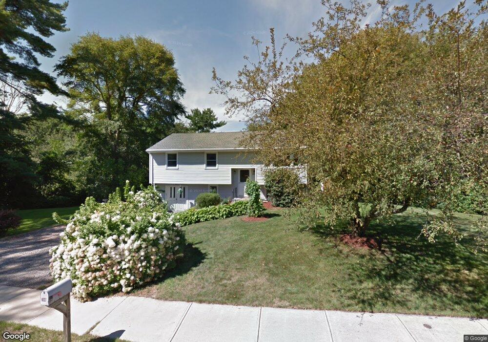
200 Crossfield Rd Franklin, MA 02038
Estimated Value: $534,000 - $575,000
3
Beds
1
Bath
1,028
Sq Ft
$538/Sq Ft
Est. Value
About This Home
This home is located at 200 Crossfield Rd, Franklin, MA 02038 and is currently estimated at $552,712, approximately $537 per square foot. 200 Crossfield Rd is a home located in Norfolk County with nearby schools including Oak Street Elementary School, Horace Mann Middle School, and Franklin High School.
Ownership History
Date
Name
Owned For
Owner Type
Purchase Details
Closed on
Aug 23, 2010
Sold by
Barbour David and Barbour Susan M
Bought by
Barbour Susan M and Matte Philip
Current Estimated Value
Purchase Details
Closed on
Sep 30, 2004
Sold by
Abney Catherine L and Abney Robert C
Bought by
Abney Catherine L and Barbour David
Create a Home Valuation Report for This Property
The Home Valuation Report is an in-depth analysis detailing your home's value as well as a comparison with similar homes in the area
Purchase History
| Date | Buyer | Sale Price | Title Company |
|---|---|---|---|
| Barbour Susan M | -- | -- | |
| Abney Catherine L | -- | -- |
Source: Public Records
Tax History Compared to Growth
Tax History
| Year | Tax Paid | Tax Assessment Tax Assessment Total Assessment is a certain percentage of the fair market value that is determined by local assessors to be the total taxable value of land and additions on the property. | Land | Improvement |
|---|---|---|---|---|
| 2025 | $6,243 | $537,300 | $328,000 | $209,300 |
| 2024 | $6,115 | $518,700 | $328,000 | $190,700 |
| 2023 | $5,982 | $475,500 | $284,800 | $190,700 |
| 2022 | $5,388 | $383,500 | $215,800 | $167,700 |
| 2021 | $5,409 | $369,200 | $239,800 | $129,400 |
| 2020 | $5,034 | $346,900 | $224,000 | $122,900 |
| 2019 | $4,970 | $339,000 | $216,000 | $123,000 |
| 2018 | $4,719 | $322,100 | $212,100 | $110,000 |
| 2017 | $4,494 | $308,200 | $198,200 | $110,000 |
| 2016 | $4,286 | $295,600 | $200,900 | $94,700 |
| 2015 | $4,311 | $290,500 | $195,800 | $94,700 |
| 2014 | $3,849 | $266,400 | $171,700 | $94,700 |
Source: Public Records
Map
Nearby Homes
- 201 Crossfield Rd
- 8 Riverstone Way
- 276 Pond St
- 25 Brookview Rd
- 38 Conlyn Ave
- 834-836 W Central St
- 1801 Franklin Crossing Rd Unit 1801
- 2211 Franklin Crossing Rd Unit 2211
- 605 Franklin Crossing Rd
- 134 Highwood Dr
- 57 Raymond St Unit 2
- 41 Kimberlee Ave
- 151 Stone Ridge Rd
- 17 Pine St
- 14 Pleasant St Unit B
- 120 Union St Unit 1
- 17 Longhill Rd
- 204 Lincoln St
- 374-378 Union St
- 7 Howard Place
- 208 Crossfield Rd
- 196 Crossfield Rd
- 197 Crossfield Rd
- 209 Crossfield Rd
- 216 Crossfield Rd
- 195 Crossfield Rd
- 217 Crossfield Rd
- 224 Crossfield Rd
- 192 Crossfield Rd
- 236 Pond St
- 224 Pond St
- 238 Pond St
- 225 Crossfield Rd
- 193 Crossfield Rd
- 503 White Ave
- 517 White Ave
- 190 Crossfield Rd
- 222 Pond St
- 191 Crossfield Rd
- 220 Pond St